

Method for testing road damage based on post-disaster high-resolution remote sensing image
A high-resolution, remote sensing image technology, applied in the direction of measuring devices, electromagnetic wave re-radiation, radio wave measurement systems, etc., can solve problems that cannot meet the needs of rapid detection and evaluation of road damage, improve accuracy, reduce labor The effect of the degree of intervention
- Summary
- Abstract
- Description
- Claims
- Application Information
AI Technical Summary
Problems solved by technology
Method used
Image

Examples
Embodiment Construction
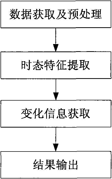
[0022] Attached below figure 2 The present invention is described in further detail:
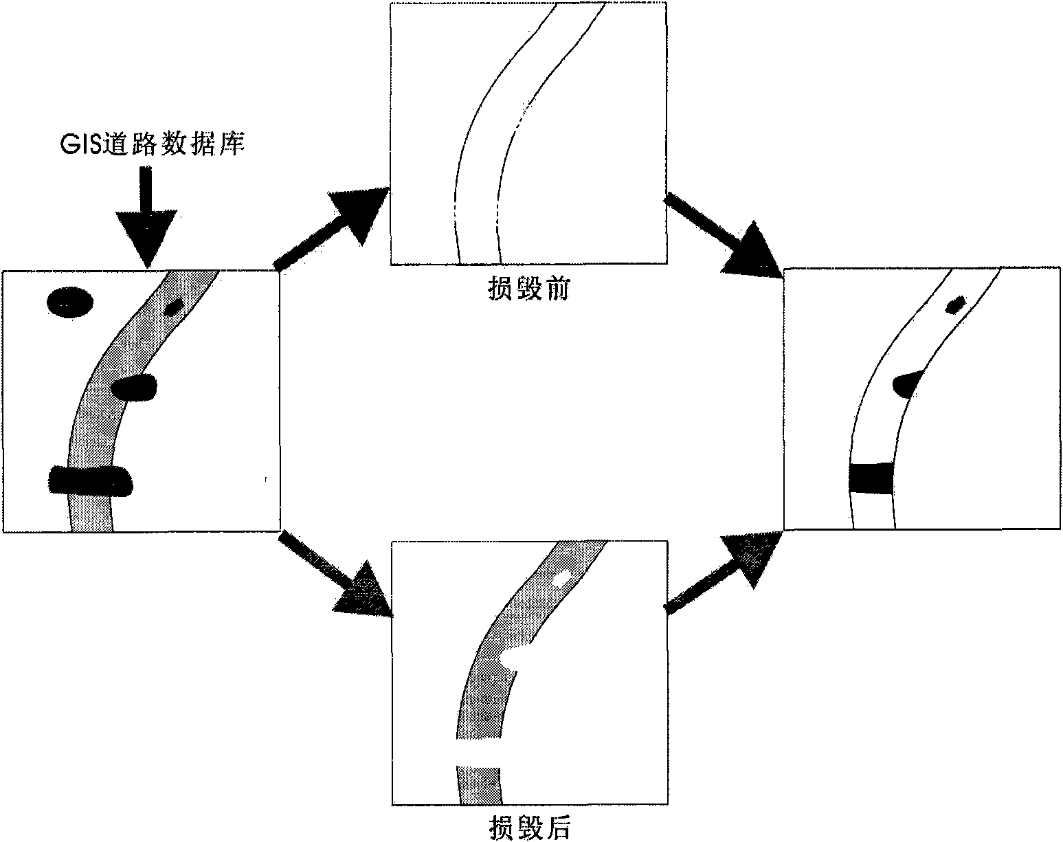
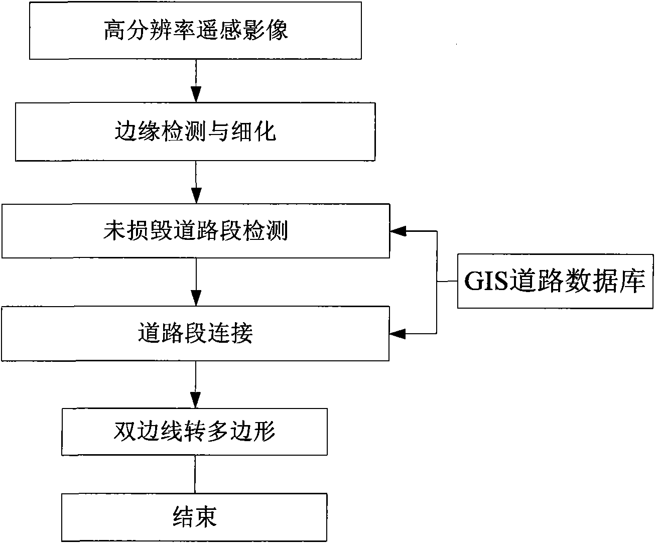
[0023] The first step: Preprocessing the high-resolution remote sensing images after road damage, specifically, using Gaussian filtering to remove image noise, using histogram stretching to adjust image gray contrast, etc.; and in order to use GIS road data to guide image processing, The image data to be processed is spatially registered with the data of the GIS road database.
[0024] The second step: road coverage extraction before road damage occurs. In the post-disaster high-resolution images, the undamaged road edge retains the morphological features of the road before the damage, and the GIS basic road data provides information such as the centerline, width, and road grade of the road before the damage. Therefore, the coverage can be obtained by detecting and connecting the undamaged road edges in the image to extract the complete bilateral lines of the road before the damage.
[0...
PUM
 Abstract
Description
Claims
Application Information