Method for monitoring roadbed subsidence of express way by InSAR
A technology for highways and road surfaces. It is used in measurement devices, radio wave measurement systems, and radio wave reflection/re-radiation. It can solve the problems of high manpower and material resources, stability of benchmarking points, and cannot give the trend of changes in the entire region. And other issues
- Summary
- Abstract
- Description
- Claims
- Application Information
AI Technical Summary
Problems solved by technology
Method used
Image
Examples
Embodiment 1
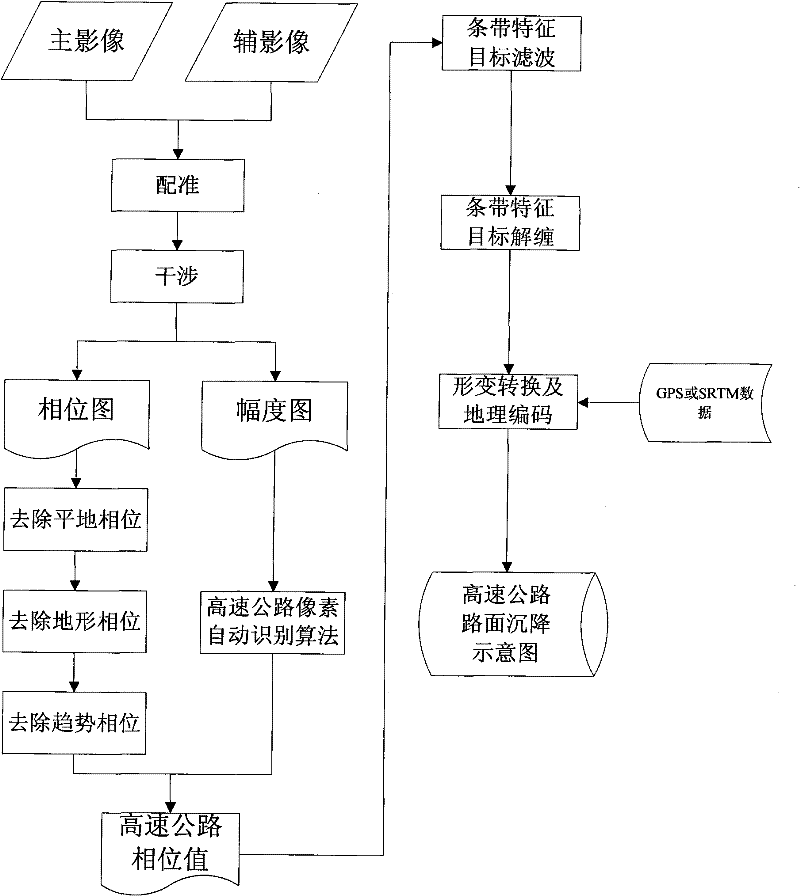
[0050] The specific embodiment of the present invention comprises the following steps:
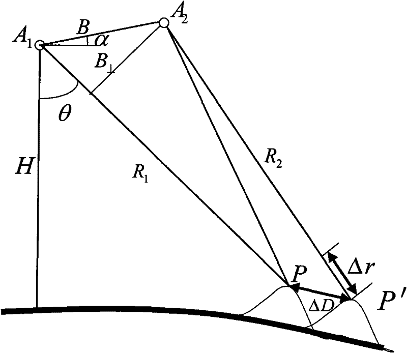
[0051] (1) Data selection and preprocessing. Customize the SAR raw image according to the coordinate range of the monitoring area. The following factors should be considered when selecting the SAR image: sensor characteristics (including wavelength, bandwidth, SNR, orbit and repetition period, etc.), data availability, time and space baseline, ground characteristics and atmosphere etc. Then preprocess the selected raw images and convert them into single-view complex images (SLC).
[0052] (2) Primary and secondary SAR image registration. The accuracy of SAR image registration directly affects the subsequent processing and the quality of the final result. To generate high-quality interference fringe images, the registration accuracy should be better than 0.2 pixels. Generally, satellite orbit information is used for coarse registration first, so that the registration accuracy can reach b...
PUM
 Abstract
Description
Claims
Application Information
 - R&D
- Intellectual Property
- Life Sciences
- Materials
- Tech Scout
- Unparalleled Data Quality
- Higher Quality Content
- 60% Fewer Hallucinations
Browse by: Latest US Patents, China's latest patents, Technical Efficacy Thesaurus, Application Domain, Technology Topic, Popular Technical Reports.
© 2025 PatSnap. All rights reserved.Legal|Privacy policy|Modern Slavery Act Transparency Statement|Sitemap|About US| Contact US: help@patsnap.com


