Method and system for realizing terminal track playback in network geographic information system
A geographic information system and trajectory playback technology, applied in the field of satellite positioning and navigation, can solve the problems of large network traffic and long time required, and achieve the effect of small transmission data and short transmission time
- Summary
- Abstract
- Description
- Claims
- Application Information
AI Technical Summary
Problems solved by technology
Method used
Image
Examples
Embodiment Construction
[0043] Embodiments of the present invention will be further described below in conjunction with the accompanying drawings.
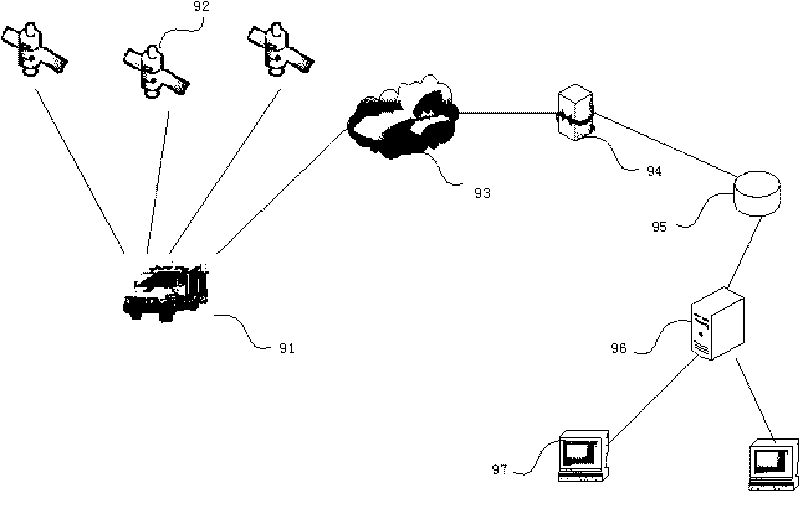
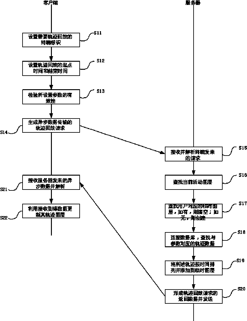
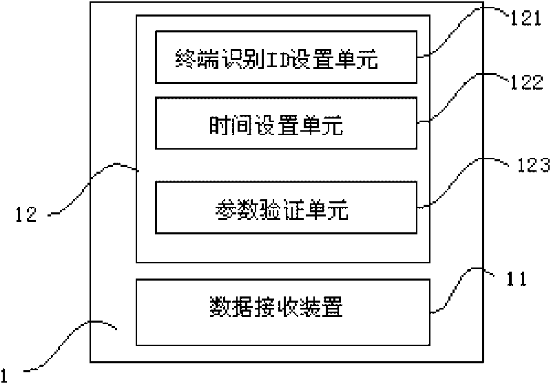
[0044] Such as figure 1 As shown, in the method and system embodiment for realizing terminal track playback in the WebGIS system of the present invention, its system structure is not different from the system structure in the prior art. In this embodiment, it is different from the prior art The most important thing is that the server and the client communicate and update the data (that is, realize the terminal track playback) in different ways, as well as the corresponding structures that must be possessed in order to realize the track playback method. exist figure 1 Among them, GPS terminal 91, satellite 92, GPRS or CDMA wireless network 93, GIS gateway 94, GIS database 95, GIS server 96 and client 97 installed on the electric emergency repair vehicle are included, wherein terminal 91 is installed on the vehicle, and with the vehicle Mobile, which rec...
PUM
 Abstract
Description
Claims
Application Information
 - R&D
- Intellectual Property
- Life Sciences
- Materials
- Tech Scout
- Unparalleled Data Quality
- Higher Quality Content
- 60% Fewer Hallucinations
Browse by: Latest US Patents, China's latest patents, Technical Efficacy Thesaurus, Application Domain, Technology Topic, Popular Technical Reports.
© 2025 PatSnap. All rights reserved.Legal|Privacy policy|Modern Slavery Act Transparency Statement|Sitemap|About US| Contact US: help@patsnap.com


