

Geographic information guide method and system based on augment reality
A geographic information guidance and augmented reality technology, applied in the field of information processing, can solve problems such as map display is not intuitive enough, detailed geographic information guidance lacks means of expression, etc., and achieve the effect of convenient virtual advertising
- Summary
- Abstract
- Description
- Claims
- Application Information
AI Technical Summary
Problems solved by technology
Method used
Image

Examples
Embodiment Construction
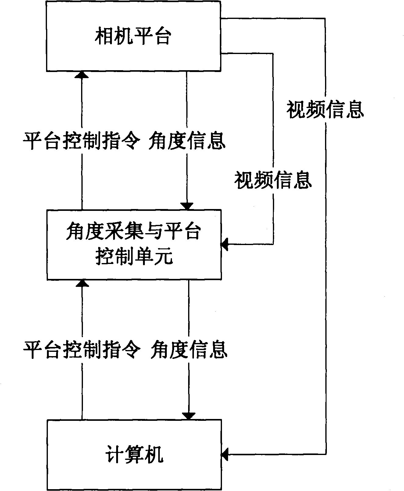
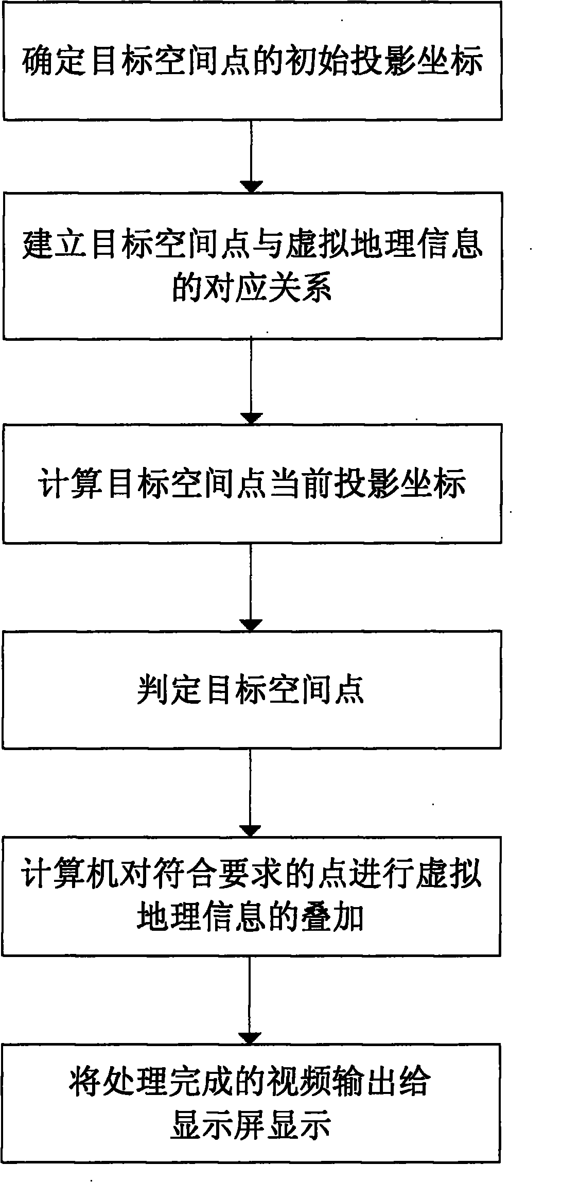
[0044] refer to figure 1 , the system of the present invention is mainly composed of a camera platform, an angle acquisition and platform control unit and a computer. in:
[0045] The camera platform is composed of a camera, a pan-tilt and two absolute photoelectric encoders. The camera is placed on a fixed pan-tilt with a fixed optical center. It can rotate from 0° to 360° and pitch to plus or minus 90°. The camera transmits the collected real-time video data to the computer and the angle acquisition and platform control unit, and two absolute photoelectric code discs provide the rotation angle and pitch angle of the camera respectively.
[0046] The angle acquisition and platform control unit is composed of a single-chip microcomputer, a serial port and a synchronization signal separation chip. The synchronization signal separation chip separates the frame synchronization signal from the video information and transmits it to the single-chip microcomputer. The single-chip mi...
PUM
 Abstract
Description
Claims
Application Information