Radar detection method for occurrence of geological structure surface

A technology of geological structure and detection method, applied in the field of geological exploration, can solve problems such as wrong prediction or detection results, large detection errors, etc., and achieve the effect of avoiding large deviations and improving accuracy and precision

Active Publication Date: 2011-04-13
ZHEJIANG HUADONG ENG SAFETY TECH +2
View PDF4 Cites 14 Cited by
  • Summary
  • Abstract
  • Description
  • Claims
  • Application Information

AI Technical Summary

Problems solved by technology

The spatial position of the structural surface determined according to the apparent strike or apparent inclination angle will be quite differen

Method used


Image

  • Radar detection method for occurrence of geological structure surface
  • Radar detection method for occurrence of geological structure surface
  • Radar detection method for occurrence of geological structure surface

Examples


Embodiment Construction
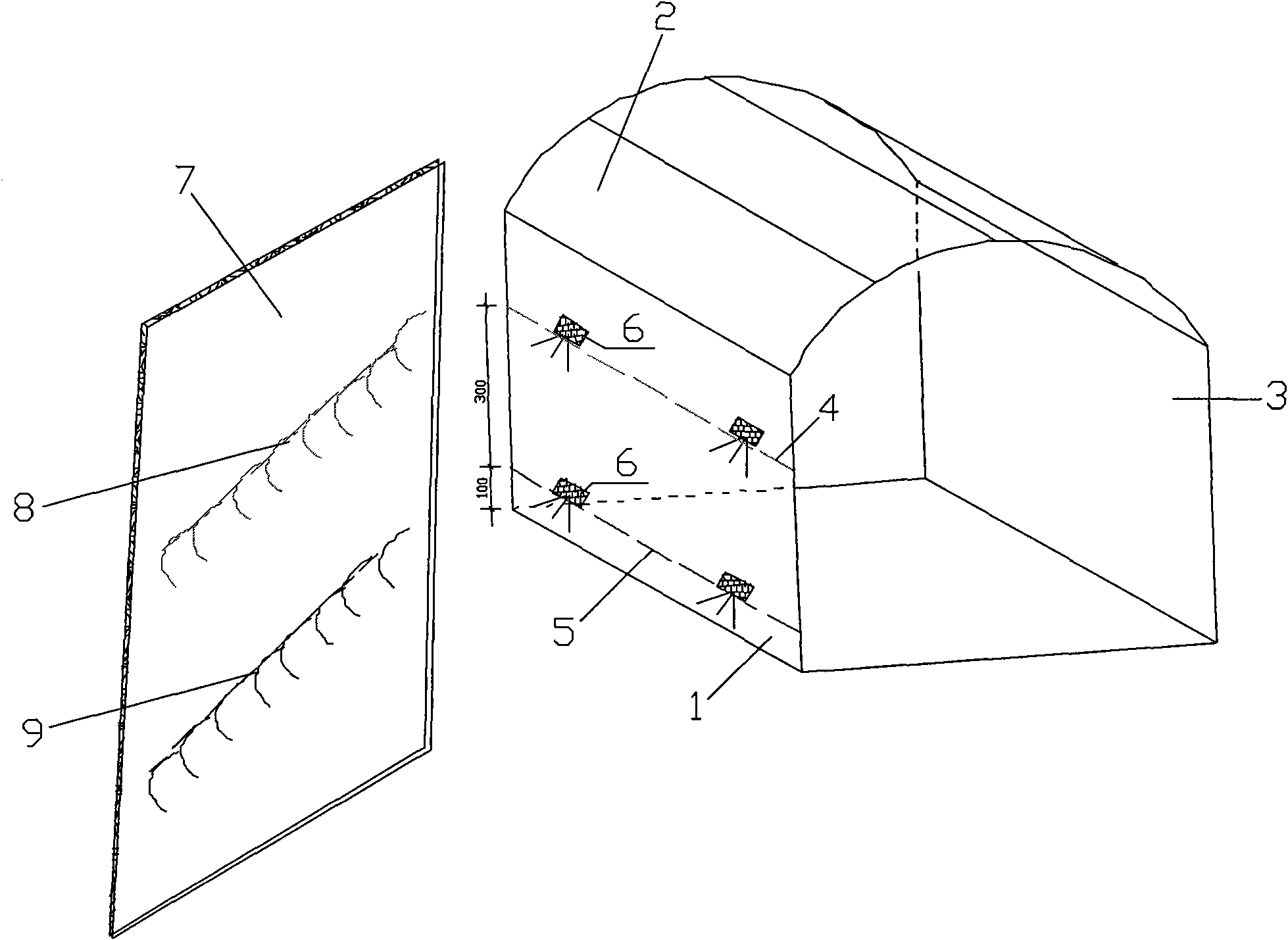
[0021] The design idea of ​​the present invention is: arrange the radar survey lines at different positions or elevations, extract the radar reflection wave event of the same structural surface reflected by each survey line after the survey, according to the spatial position of the survey line and the radar reflection wave event The relative distance of the structural surface is solved by spatial geometric principles and numerical fitting to solve the real occurrence of the structural surface, and then determine the spatial position of the structural surface.

[0022] It works as follows:

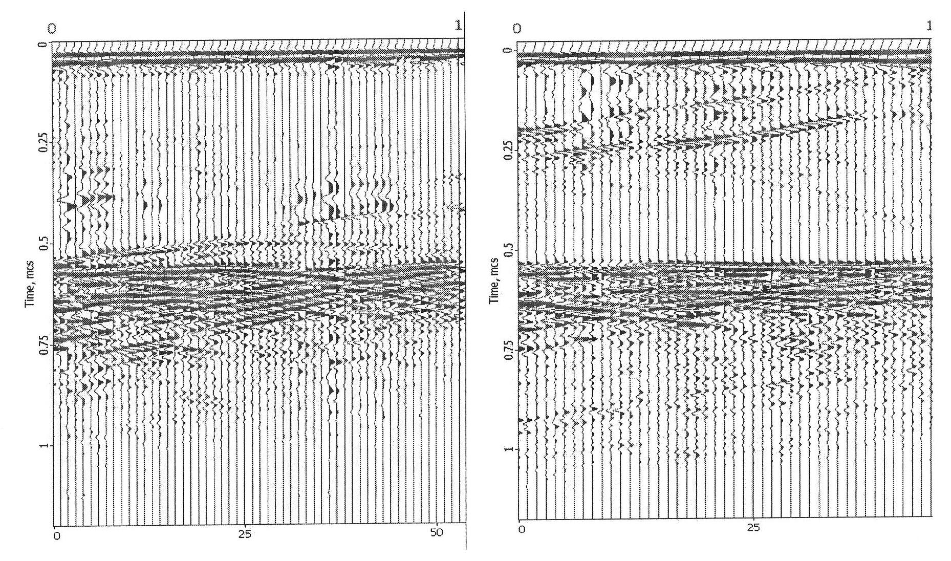
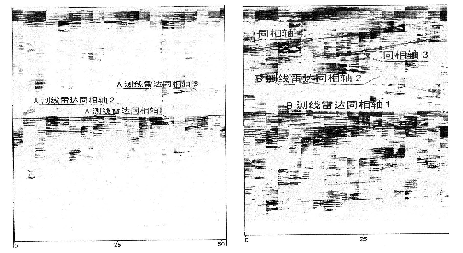
[0023] The radar reflection wave events of radar survey lines at different positions or elevations, that is, the connection line of the extreme values ​​(commonly known as peaks or troughs) of the same reflected wave phase on the radar record, reflect different parts of the structural surface. According to the principle of space geometry, The equation of the structural surface can be writte...


PUM


Abstract

The invention relates to a radar detection method for the occurrence of a geological structure surface. The technical problem to be solved is to provide a method for enhancing the advanced geological forecast of a ground penetrating radar or the detection correctness and accuracy of a geological radar and avoid large error caused by visual direction or virtual inclination. The technical scheme for solving the problem comprises the following steps of: arranging at least two radar survey lines for a detection target structure surface; testing along the survey lines by using the ground penetrating radar; analyzing and processing data acquired by testing and performing time depth conversion so as to form a radar image; finding out each radar reflected wave event of the same geological structure surface; resolving an equation of the structure surface according to the directions of the survey lines, distance and a reflecting interface depth detected by each residual distance test point; and determining the spatial position of the structure surface according to the true occurrence of the structure surface. The method can be applied to the advanced geological forecast and geological detection of tunnels.

Description

technical field [0001] The invention relates to geological exploration, in particular to a radar detection method for the occurrence of geological structure planes. It is suitable for geological advance prediction and geological exploration of tunnels (roads). Background technique [0002] Geological structural plane is a general term for planar geological bodies, such as faults, joint surfaces, lithological interfaces, etc. Occurrence indicates the spatial geometric state of rock mass structural planes, including three elements of strike, dip and dip. [0003] Radar detection technology has been widely used in tunnel (cave) geological advance prediction or geological detection, mainly for prediction or detection of geological structural planes and target geological bodies (detection objects with a certain scale, such as karst, ore deposits). According to the principle of electromagnetic wave specular reflection, the occurrence of the non-steep structural surface (structure...

Claims


Application Information

Patent Timeline
IPC IPC(8): G01S13/89
Inventor 陈文华单治钢周春宏孟繁兴
Owner ZHEJIANG HUADONG ENG SAFETY TECH
Why Eureka
Try Eureka