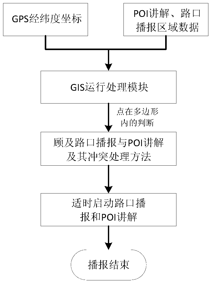
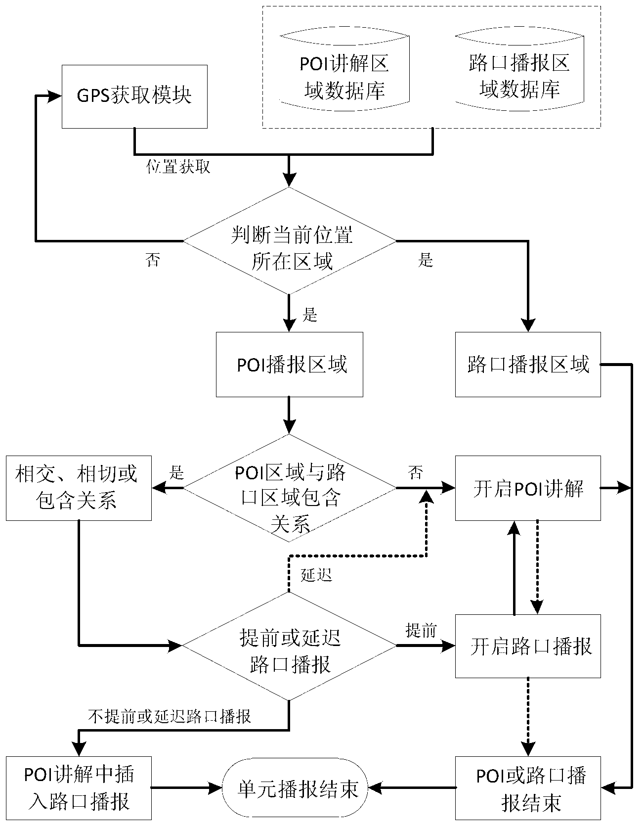
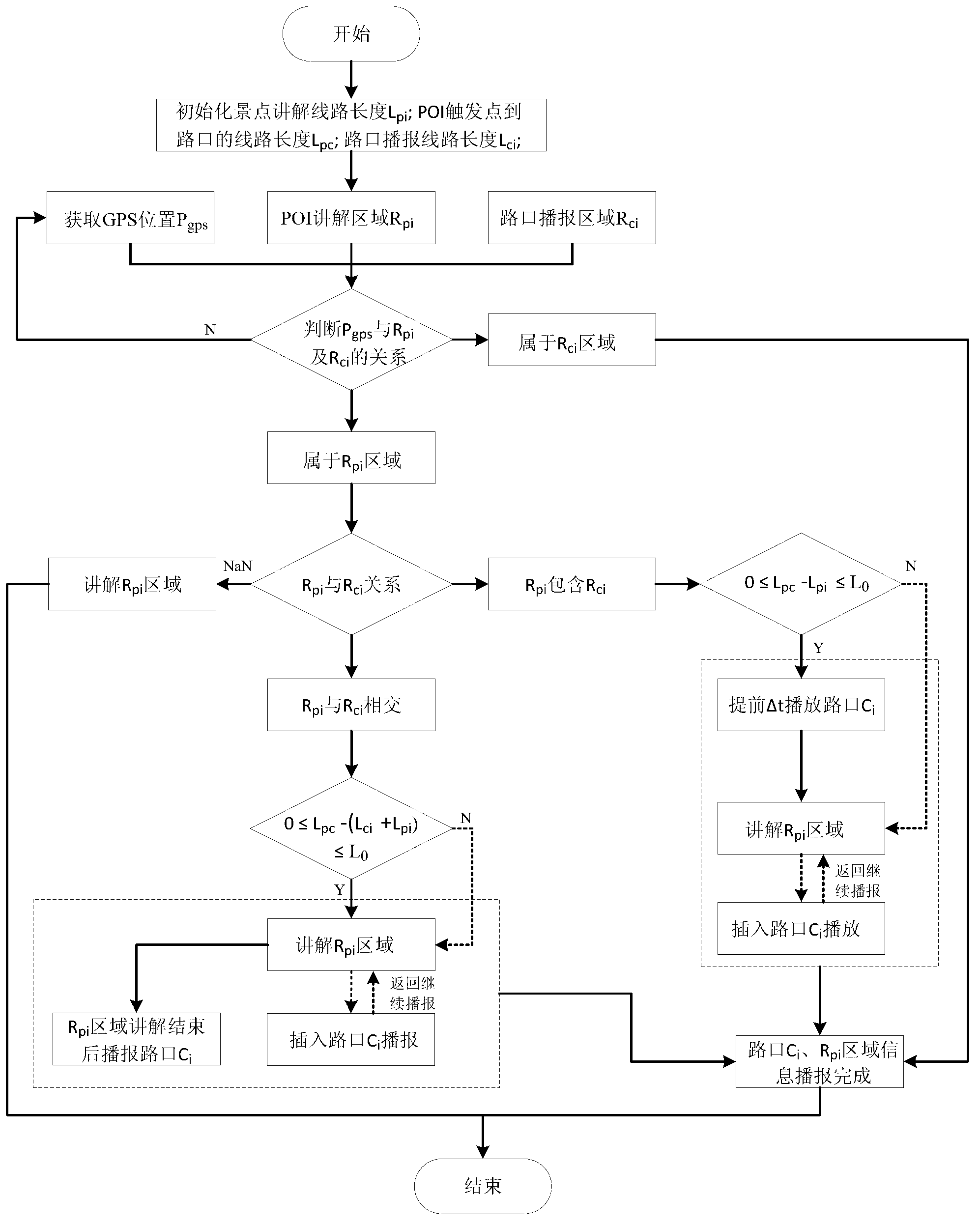
Mobile navigation method for simultaneously attending to intersection broadcasting and point of interest (POI) explanation
A line and path technology, applied in the direction of location-based services, instruments, data processing applications, etc., can solve the problem of no real-time guidance function, excluding real-time explanation function, etc.
- Summary
- Abstract
- Description
- Claims
- Application Information
AI Technical Summary
Problems solved by technology
Method used
Image
Examples
Embodiment
[0050] The basic requirements of the mobile device in this example: WindowsMobile6.0 / 6.1 / 6.5 operating system; 480×800 pixels (or 240×320 pixels) resolution; single-core CPU frequency higher than 528MHz; memory not less than 512MB ROM+256MB RAM; support MicroSD Card expansion storage, USB v2.0 and GPS navigation functions.
[0051] The GPS location acquisition module is provided by the GPS chip that comes with the mobile device. The geographic information system (GIS) module is based on the secondary development of ESRI’s ArcGISMobile10 software. It directly drives the GPS chip device through related interfaces to obtain information such as the current longitude and latitude location. The output of the synthesized speech in the speech output module uses the speech synthesis engine ejTTS6.0 and its interface of Jietong Huasheng Company, and the speech output based on audio broadcast uses the Interop.WMPLib.dll file provided by Microsoft for mobile devices. carry out.
[0052] Attac...
PUM
 Abstract
Description
Claims
Application Information
 - R&D
- Intellectual Property
- Life Sciences
- Materials
- Tech Scout
- Unparalleled Data Quality
- Higher Quality Content
- 60% Fewer Hallucinations
Browse by: Latest US Patents, China's latest patents, Technical Efficacy Thesaurus, Application Domain, Technology Topic, Popular Technical Reports.
© 2025 PatSnap. All rights reserved.Legal|Privacy policy|Modern Slavery Act Transparency Statement|Sitemap|About US| Contact US: help@patsnap.com


