Remote Sensing Dynamic Monitoring Method of Soil Erosion Based on Modified Universal Soil Erosion Equation
A dynamic monitoring and remote sensing technology, applied in special data processing applications, instruments, electrical digital data processing, etc., can solve the problems of unobjective soil erosion, inability to obtain large-scale soil erosion information, and difficult data acquisition.
- Summary
- Abstract
- Description
- Claims
- Application Information
AI Technical Summary
Problems solved by technology
Method used
Image
Examples
Embodiment Construction
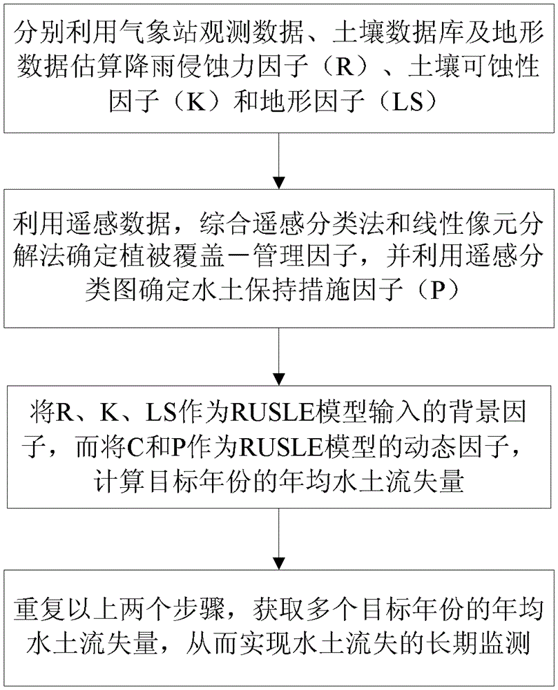
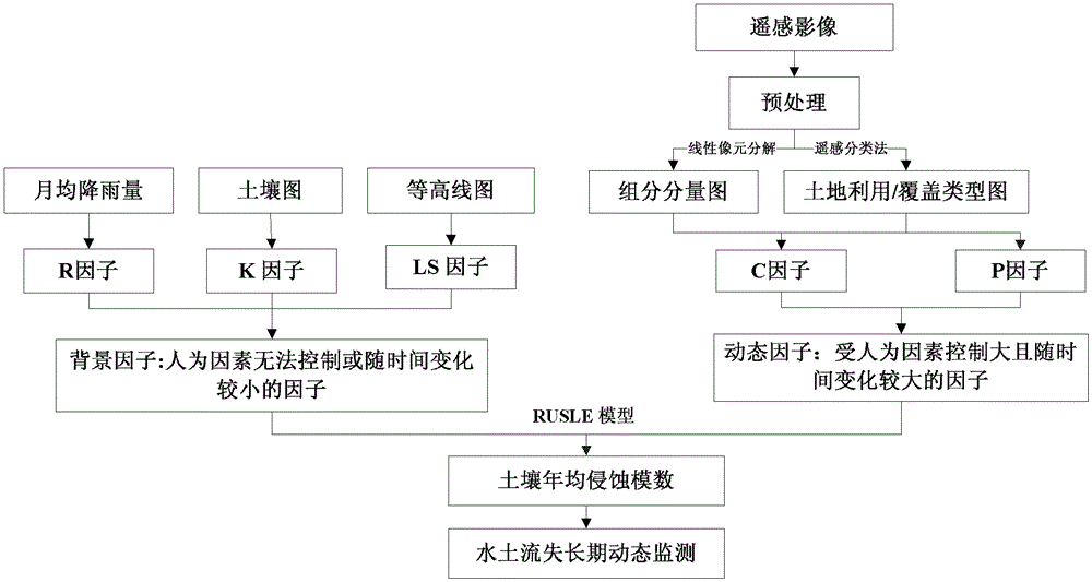
[0058] Such as figure 1 and figure 2 As shown, the implementation steps of the soil erosion remote sensing dynamic monitoring method based on the modified universal soil erosion equation in this embodiment are as follows:
[0059] 1) Obtain the monthly rainfall data during the specified period of the area to be monitored, and perform spatial regression calculation on the monthly rainfall data and the three-dimensional coordinates of altitude, longitude and latitude to obtain the rainfall erosivity factor (R);
[0060] The soil erodibility factor (K) is calculated according to the soil organic carbon content and soil particle distribution in the large-scale soil spatial database of the area to be monitored;
[0061] The terrain factor (LS) is calculated according to the digital terrain model data of the area to be monitored;
[0062] 2) Obtain the remote sensing image of the area to be monitored; divide the land use / cover category according to the remote sensing image to obt...
PUM
 Abstract
Description
Claims
Application Information
 - R&D
- Intellectual Property
- Life Sciences
- Materials
- Tech Scout
- Unparalleled Data Quality
- Higher Quality Content
- 60% Fewer Hallucinations
Browse by: Latest US Patents, China's latest patents, Technical Efficacy Thesaurus, Application Domain, Technology Topic, Popular Technical Reports.
© 2025 PatSnap. All rights reserved.Legal|Privacy policy|Modern Slavery Act Transparency Statement|Sitemap|About US| Contact US: help@patsnap.com


