

Control method of geosynchronous earth orbit (GEO) synthetic aperture radar (SAR) for covering all over China
A technology of synthetic aperture radar and geosynchronous orbit, which is applied in the direction of feedback control, radio wave reflection/re-radiation, and measurement devices. It can solve the problem that GEOSAR cannot cover the entire territory of China, improve coverage characteristics, and reduce energy consumption. , Easy engineering effect
- Summary
- Abstract
- Description
- Claims
- Application Information
AI Technical Summary
Problems solved by technology
Method used
Image

Examples
Embodiment Construction
[0026] The method of the present invention will be further described in detail below in conjunction with the accompanying drawings and embodiments.
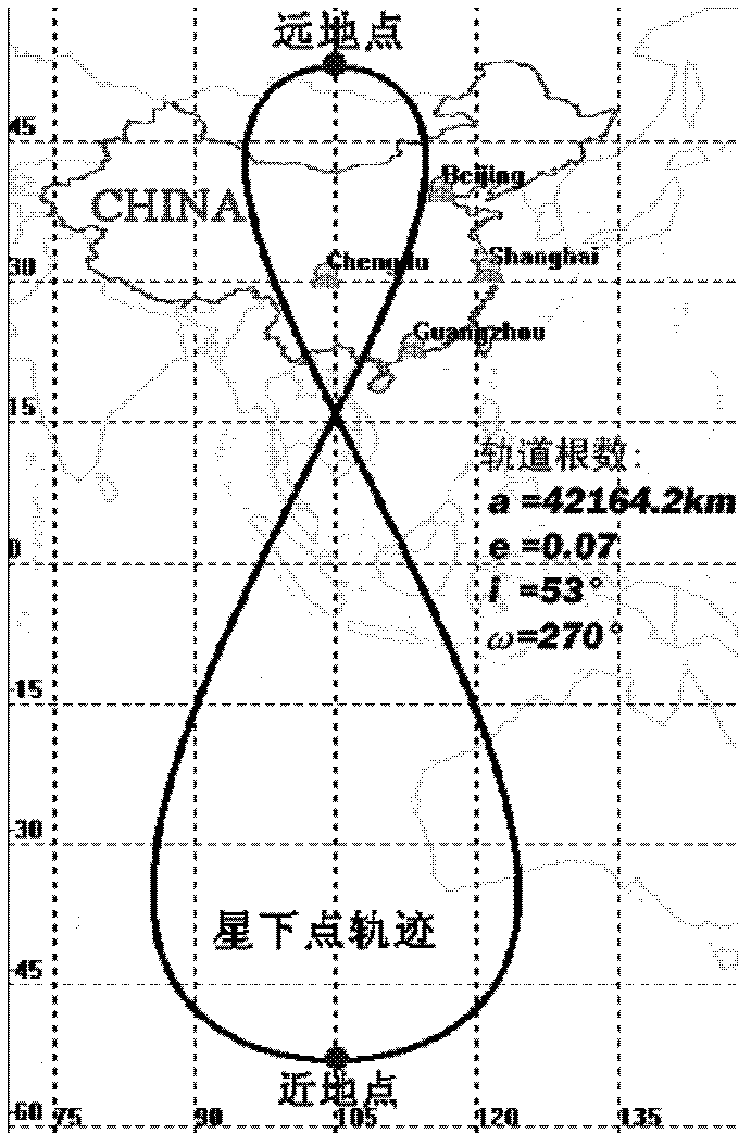
[0027] In this embodiment, the satellite where the SAR is located operates on a geosynchronous orbit (GEO) with a small eccentricity, and its sub-satellite track is located in the middle of my country. The average orbital parameters are as follows: the semi-major axis is 42164.2Km; the orbital inclination is 53°; the eccentricity is 0.07 ; The depression angle of perigee is 270°; the longitude of intersection point is 105°. Such as figure 1 shown.
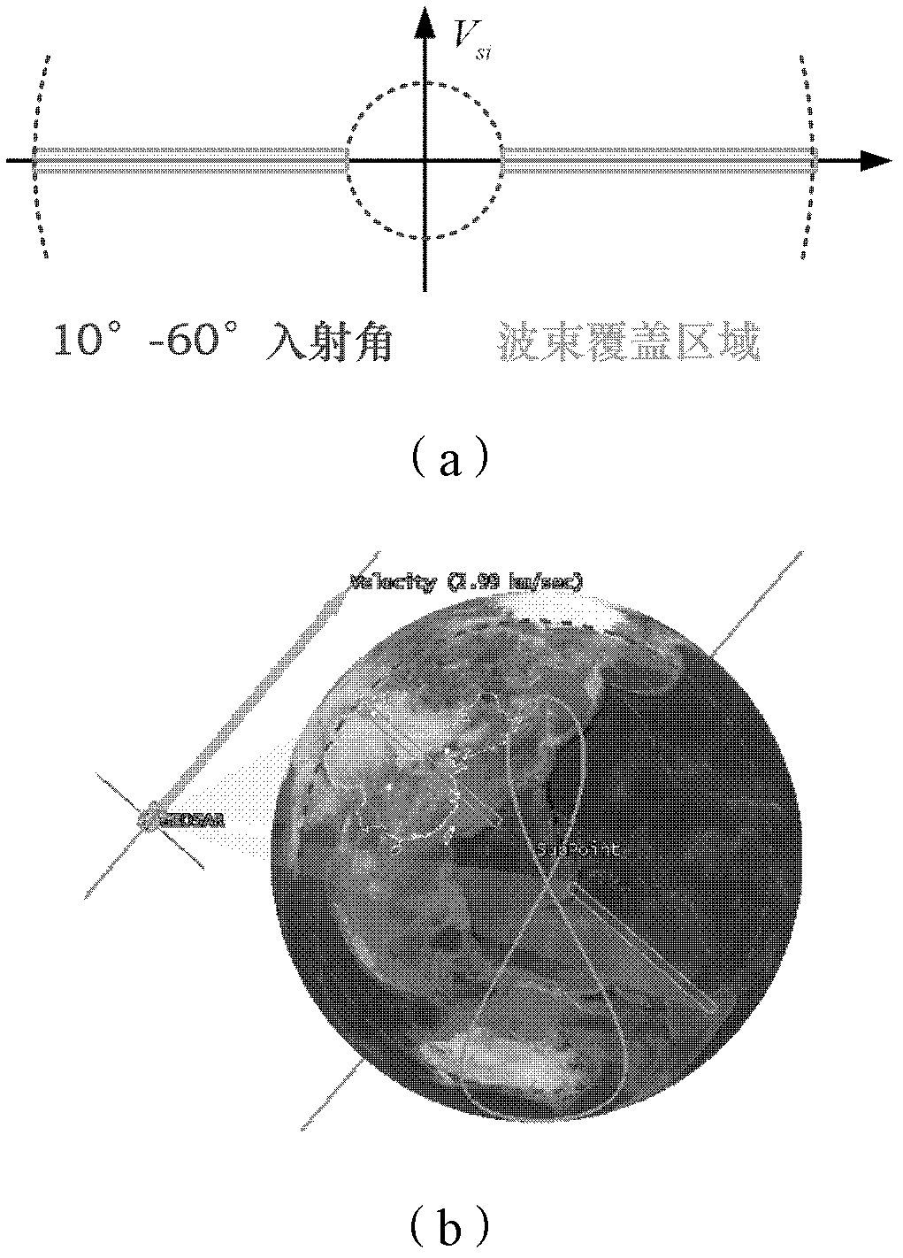
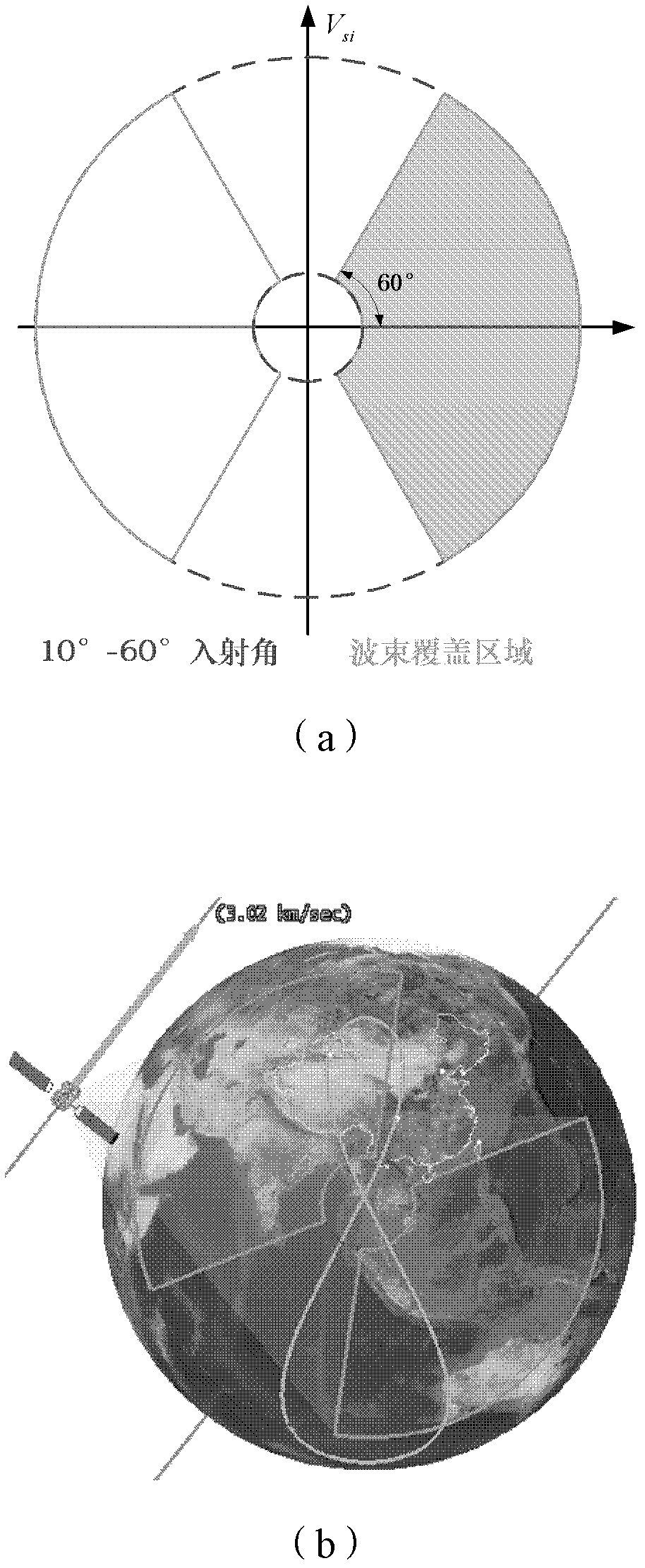
[0028] The whole territory coverage of China by the satellite is completed by adopting the control method of the geosynchronous orbit synthetic aperture radar covering the whole territory of China described in the present invention. Among them, the simulation of the beam coverage area, the calculation of geometric parameters and revisit time are carried out with the help of STK (Sat...
PUM
 Abstract
Description
Claims
Application Information