
Real-time three-dimensional visualization method of large-scale scene city building based on spatial cognition

A technology of spatial cognition and large scenes, applied in the field of spatial information, can solve the problems of increased data volume, reduced transmission and display efficiency, and inability to effectively improve the speed of visualization

Inactive Publication Date: 2012-09-12
BEIJING NORMAL UNIVERSITY
View PDF2 Cites 34 Cited by
  • Summary
  • Abstract
  • Description
  • Claims
  • Application Information

AI Technical Summary

Problems solved by technology

Applying the traditional method to simplify a single building model sequentially cannot effectively improve the speed of visualization, so the research on building model simplification mainly focuses on the merging and synthesis of adjacent buildings
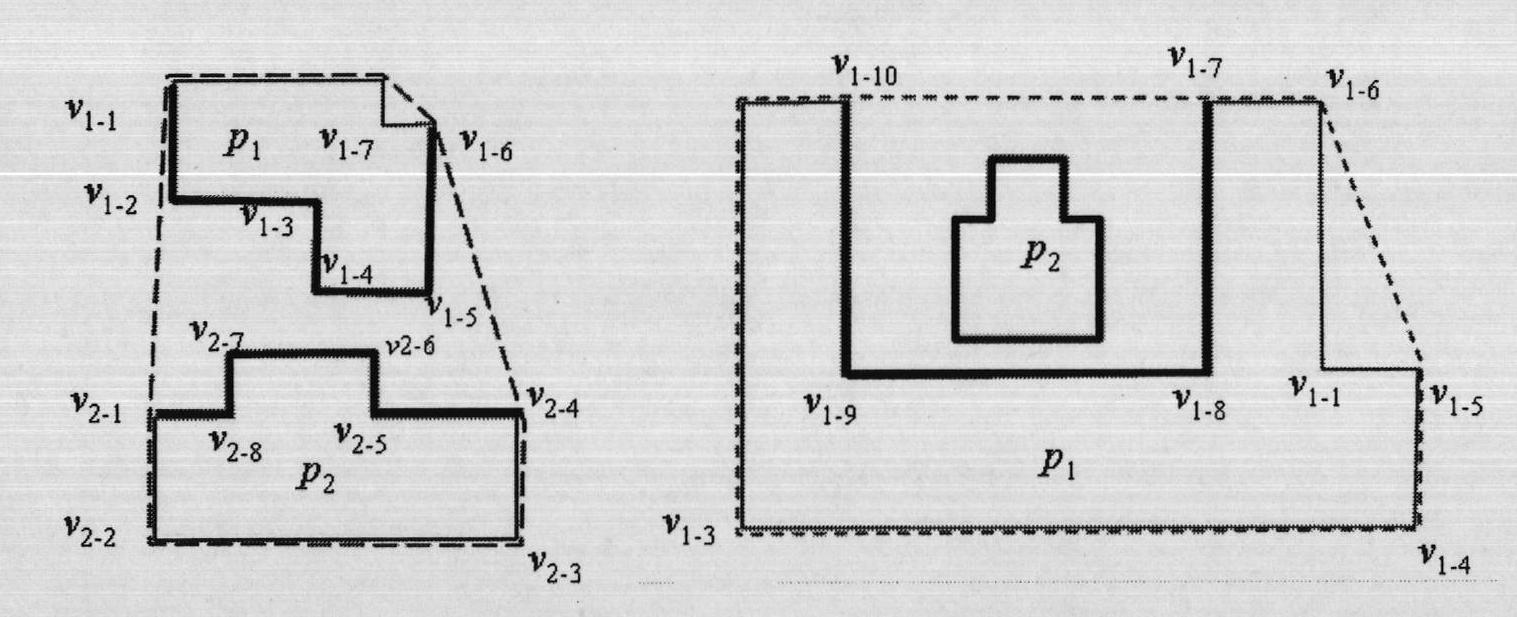
A very important part of the research on map synthesis is the synthesis of buildings, but two-dimensional map synthesis usually introduces new vertices, and the introduction of new vertices will inevitably increase the amount of data. Will cause reduction in transmission and display efficiency

Method used


Image

  • Real-time three-dimensional visualization method of large-scale scene city building based on spatial cognition
  • Real-time three-dimensional visualization method of large-scale scene city building based on spatial cognition
  • Real-time three-dimensional visualization method of large-scale scene city building based on spatial cognition

Examples


Embodiment 1

[0154] The implementation was carried out on a computer with 3.00GHz Intel(R) Pentium(R) 4 CPU, 2GB RAM, ATI mobility radeon X300 graphics card.

[0155] Firstly, the clustering results using proximity distance and Euclidean distance are compared. Figure 5 (a) is the original building polygon, which contains 37 buildings, and the depth of the compressed layers is expected to be int(lg(37) / 1.5); Figure 5 (b), (c), and (d) are the clustering results when the proximity distance is used as the clustering criterion, and the degree of merging gradually increases in turn; Figure 5 (e), (f), and (g) are simplified results using Euclidean distance as the distance factor. It can be seen from the comparison that the present invention adopts the proximity distance, better takes into account the direction of the building group and the similarity between buildings, and better preserves the road information.

[0156] Aiming at the efficiency of architectural simplification, the present ...


PUM


Abstract

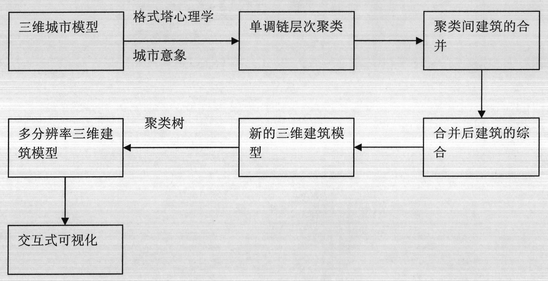
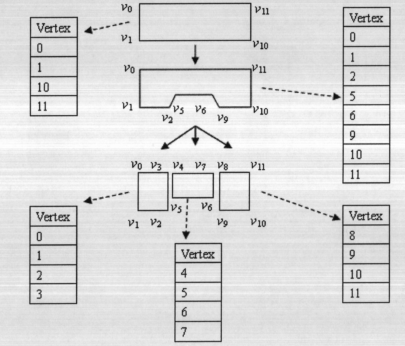
The invention relates to a real-time three-dimensional visualization method of a large-scale scene city building based on spatial cognition. The method is based on a gestalt psychology and a city image theory. A single chain clustering method is used to cluster large-scale building models. Delaunay triangulation and broken line simplification methods are used to rapidly combine and simplify a classification result so as to establish a multiple-level of detail model of the city building and realize interactive three-dimensional visualization of the large-cene and high-density city building. The method provided in the invention accords with principles of approach, similarity, syntropy and the like in the gestalt theory and simultaneously essential factors, such as a city road, a boundary, a landmark city image and the like, can be maintained.

Description

1. Technical field [0001] The invention relates to a method for real-time three-dimensional visualization of large-scene urban buildings based on spatial cognition, and belongs to the field of spatial information technology. 2. Background technology [0002] In the 3D digital city, the architectural model, as an important embodiment of the city's characteristics, is its most important component. On the premise of maintaining a certain spatial geometric accuracy, visually expressing the architectural entities of large scenes, so that it meets people's visual habits, conforms to people's objective impression of the city, and helps people obtain urban spatial information accurately and quickly. Important research content in the field of cognition and computer vision. In order to speed up the visualization of large scenes and high-density urban buildings and realize real-time interactive operation, it is necessary to simplify the building model and establish a level of detail m...

Claims


Application Information

Patent Timeline
IPC IPC(8): G06T17/00G06T15/00
Inventor 张立强张良杨玲王臻
Owner BEIJING NORMAL UNIVERSITY
Learn More