Beidou navigation satellite system (COMPASS)/global position system (GPS) dual-system four-satellite positioning method

A technology of a GPS system and a positioning method, which is applied in the field of global satellite navigation and positioning, and can solve problems such as difficult integration.

Active Publication Date: 2012-10-10
BEIHANG UNIV
View PDF7 Cites 8 Cited by
  • Summary
  • Abstract
  • Description
  • Claims
  • Application Information

AI Technical Summary

Problems solved by technology

Such methods require additional equipment and are not easy to integrate

Method used


Image

  • Beidou navigation satellite system (COMPASS)/global position system (GPS) dual-system four-satellite positioning method
  • Beidou navigation satellite system (COMPASS)/global position system (GPS) dual-system four-satellite positioning method
  • Beidou navigation satellite system (COMPASS)/global position system (GPS) dual-system four-satellite positioning method

Examples


Embodiment Construction

[0052] Specific embodiments of the present invention will be described below in conjunction with the accompanying drawings.

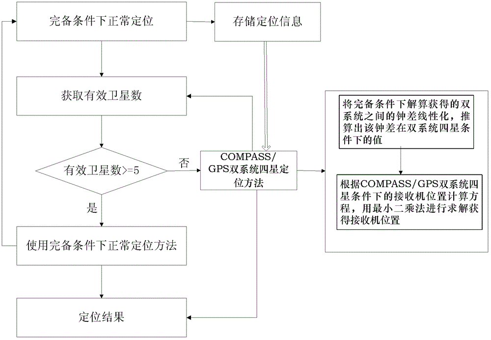
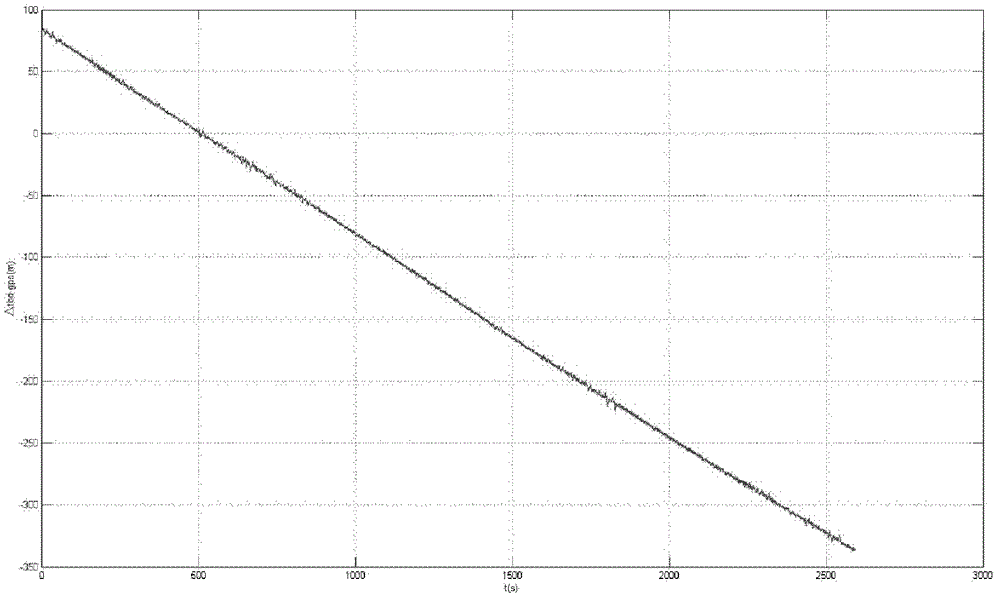
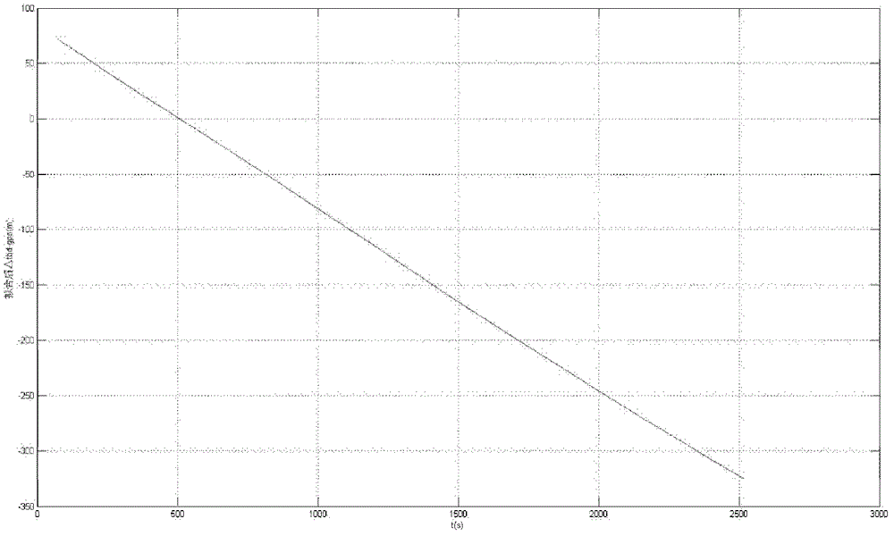
[0053] The invention provides a COMPASS / GPS dual-system four-satellite positioning method, which uses the information stored under the condition of complete dual-system satellite signals, and can still complete positioning when the satellite signal is temporarily missing. The technical solution is that when the number of visible satellites of the dual system is only 4, the positioning information obtained during normal positioning under the condition of complete satellite signals is used to calculate the relationship between the clock difference of the two systems, combined with the visible satellites, to maintain positioning in a short time .

[0054] The present invention provides a COMPASS / GPS dual-system four-star positioning method, such as figure 1 As shown, it specifically includes the following steps:

[0055] Step 1: Perform normal positionin...


PUM


Abstract

The invention provides a Beidou navigation satellite system (COMPASS)/global position system (GPS) dual-system four-satellite positioning method and belongs to the field of global satellite navigation positioning. The method comprises the following steps of: 1, normally positioning under complete dual-system satellite signal conditions, and storing the positioning information; 2, executing the COMPASS/GPS dual-system four-satellite positioning method when four satellites in dual systems are visible, calculating delta tBD-GPS according to the stored information, and linearizing the tBD-GPS; and 3, executing a positioning method under the complete conditions when more than five satellites are visible. By the method, the problem that a dual-system satellite navigation receiver cannot realizepositioning temporarily in cities because the satellite signals are blocked by flyovers or high-rise buildings is effectively solved, the positioning precision is high under the dual-system four-satellite conditions, the positioning precision level under the complete conditions can be kept within 60 seconds upon appearance of four satellites, other instruments and equipment are not required, an electronic map is not required, and the method is easy to implement and low in calculation amount.

Description

technical field [0001] The invention relates to a COMPASS / GPS dual-system four-star positioning method, which belongs to the field of global satellite navigation and positioning. Background technique [0002] With the rapid development of aerospace technology, communication technology, and computer technology, the development of satellite navigation systems is also changing rapidly, which has produced great economic and social benefits in scientific research, national economy, and national defense construction. played an increasingly important role. The construction of satellite navigation system has risen to become an important national strategic issue. At present, my country is actively building a GNSS (Global Navigation Satellite System, referred to as GNSS) with independent intellectual property rights - Beidou Satellite Navigation System (COMPASS). [0003] The COMPASS system is the English name of the Beidou satellite navigation system and the general name of China's...

Claims


Application Information

Patent Timeline
Patent Type & Authority Applications(China)
IPC IPC(8): G01S19/42
Inventor 张晓林侯冰唐艳
Owner BEIHANG UNIV
Why Eureka
Try Eureka