

Method and device for processing unmanned plane optical remote sensing image data
A technology for remote sensing image and data processing, which is applied in measurement devices, meteorology, scientific instruments, etc., to achieve the effects of high precision, simple operation and strong practicability
- Summary
- Abstract
- Description
- Claims
- Application Information
AI Technical Summary
Problems solved by technology
Method used
Image

Examples
Embodiment Construction
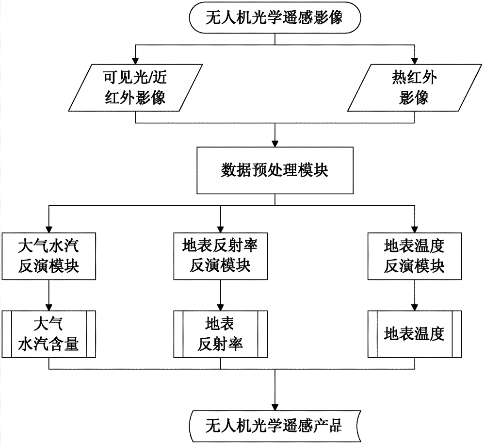
[0045] The UAV optical remote sensing image data processing method provided by the present invention includes: a data preprocessing module, an atmospheric water vapor inversion module, a surface reflectivity inversion module, and a surface temperature inversion module.
[0046] 1. Data preprocessing module
[0047] (1) Relative radiation calibration
[0048] Relative radiation calibration is to adjust the response value of each detector element, eliminate the influence of offset value, adjust the output value of each detector element to the same reference, so that each detector element produces the same output for the same input value:
[0049] Y=(X-μ i )σ r / σ i +μ r (1)
[0050] In the formula, X and Y are the gray value of the image before and after transformation; μ i is the average value of the image gray value in column i; σ i is the standard deviation of the gray value of the i-th column image; μ r is the average value of the gray value of the entire image;...
PUM
 Abstract
Description
Claims
Application Information