Method for building high-spatial resolution NDVI (normalized difference vegetation index) time series data

A high-spatial-resolution, time-series technology, applied in the field of building high-spatial-resolution NDVI time-series data, can solve the problems of continuous monitoring difficulty, time blind spots, and inability to obtain vegetation changes, etc.

Inactive Publication Date: 2012-12-19
BEIJING NORMAL UNIVERSITY
View PDF2 Cites 14 Cited by
  • Summary
  • Abstract
  • Description
  • Claims
  • Application Information

AI Technical Summary

Problems solved by technology

The spatial resolution of TM NDVI data is relatively high, and its detection accuracy for ground vegetation is much better than that of MODIS NDVI data. It is difficult to continuously monitor a specific area, and it is impossible to obtain vegetation changes within a precise time range. For example, there...

Method used


Image

  • Method for building high-spatial resolution NDVI (normalized difference vegetation index) time series data
  • Method for building high-spatial resolution NDVI (normalized difference vegetation index) time series data
  • Method for building high-spatial resolution NDVI (normalized difference vegetation index) time series data

Examples


Embodiment 1

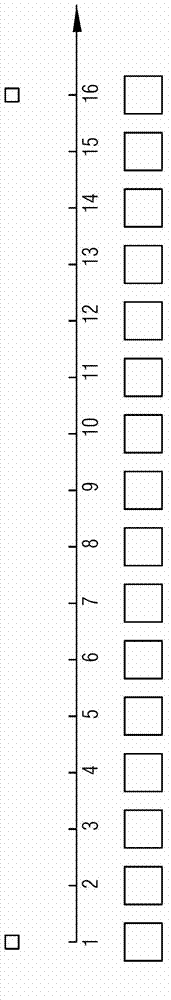
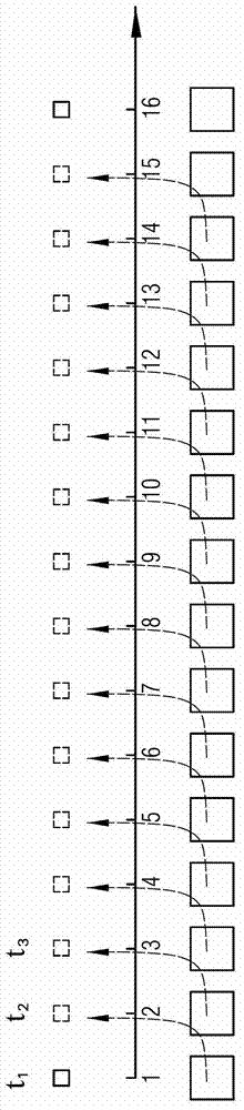
[0039] refer to figure 2 , which is shown in the figure 1 Based on the schematic diagram of predicting the corresponding TM NDVI data based on the MODIS NDVI data, the dotted line shows the predicted TM NDVI data.

[0040] Since the satellites that acquire TM NDVI data and MODIS NDVI data have similar orbital parameters and satellite transit time intervals of less than 30 minutes, it can be assumed theoretically that, in terms of time series, TM NDVI data and MODIS NDVI data are in a short period of time. can be assumed to vary linearly.

[0041] That is to say, figure 2 In the TM NDVI data above the time axis, the NDVI value of the TM pixel of the adjacent "picture" is assumed to change linearly with time, because the MODIS NDVI data below the time axis and the TM NDVI data are from satellite orbit to transit time Therefore, it can also be inferred that in the MODIS NDVI data below the time axis, the NDVI values ​​​​of the MODIS pixels of adjacent "pictures" also change ...

Embodiment 2

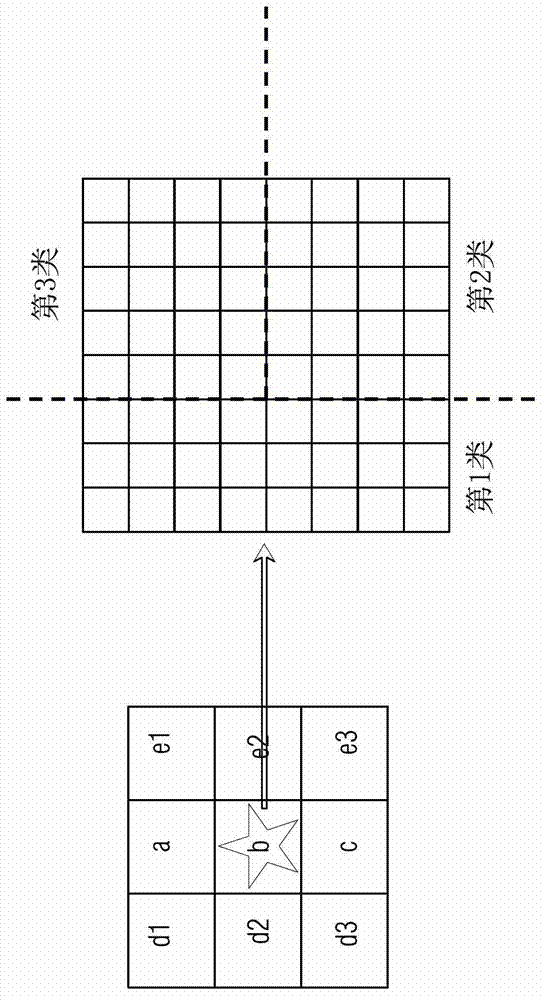
[0070] The method for constructing high spatial resolution NDVI time series data according to the present invention will be further described below with a specific example. Such as image 3 As shown in , it shows a schematic diagram of the corresponding relationship between MODIS pixels and TM pixels.

[0071] see image 3 , where the left side of the figure represents a 3*3 MODIS pixel, each small square represents a MODIS pixel, and there are 9 MODIS pixels in total. The right side of the figure shows the enlarged image of the MODIS pixel (target MODIS pixel) marked with a star on the left, which is filled according to the TM pixel scale, that is, each small square on the right represents the corresponding A TM pixel. It should be noted that since the spatial resolution of MODIS pixels is 250m*250m, and the spatial resolution of TM pixels is 30m*30m, in order to facilitate later calculations, MODIS pixels are resampled to 240m*240m, so each MODIS pixel is equal to 8 *8=6...


PUM


Abstract

The invention discloses a method for building high-spatial resolution NDVI (normalized difference vegetation index) time series data. The high-spatial resolution NDVI time series data is predicted and built according to low-spatial resolution MODIS (moderate-resolution imaging spectroradiometer) pixels in known MODIS NDVI data and high-spatial resolution TM (thematic mapper) pixels in TMNDVI (thematic mapper normalized difference vegetation index) data. TM data is combined with MODIS data, and accordingly high-spatial resolution NDVI time series data with quite fine precision can be obtained effectively.

Description

technical field [0001] The invention relates to a method for constructing NDVI time series data with high spatial resolution. The method can generate NDVI time series data with high spatial resolution through known MODIS NDVI data and TM NDVI data. Background technique [0002] The normalized difference vegetation index (NDVI for short) is a widely used vegetation index, which can be obtained from the surface reflectance in the red and near-infrared bands obtained by satellite remote sensing (see Appendix 17) For example, the TM and MODIS data of the US Landsat include NDVI data obtained by satellite remote sensing, and the NDVI data can be downloaded or purchased from relevant websites. [0003] NDVI can be used to detect vegetation growth status, vegetation coverage, etc., which can reflect the background influence of plant canopy, such as soil, wet ground, snow and other parameters related to vegetation coverage. NDVI is greater than or equal to -1 and less than or equal...

Claims


Application Information

Patent Timeline
IPC IPC(8): G06F19/00
Inventor 陈晋饶玉晗崔喜红曹鑫
Owner BEIJING NORMAL UNIVERSITY
Why Eureka
Try Eureka