System and method for measuring unmanned aerial vehicle electrical line patrol on basis of images

A technology for power line inspection and measurement system, which is applied in measurement devices, line-of-sight measurement, measurement distance and other directions, can solve problems such as measurement and calculation, and achieve the effect of increasing stability

Inactive Publication Date: 2013-02-06
TIANSHENGQIAO BUREAU CSG EHV POWER TRANSMISSION CO +2
View PDF1 Cites 39 Cited by
  • Summary
  • Abstract
  • Description
  • Claims
  • Application Information

AI Technical Summary

Problems solved by technology

However, in the process of line inspection, some distance measurements are required, such as the distance between a certain point on the line and nearby trees, the distance between the line and crossover cables, etc. These parameters cannot be measured with a simple screen

Method used


Image

  • System and method for measuring unmanned aerial vehicle electrical line patrol on basis of images
  • System and method for measuring unmanned aerial vehicle electrical line patrol on basis of images
  • System and method for measuring unmanned aerial vehicle electrical line patrol on basis of images

Examples


Embodiment Construction

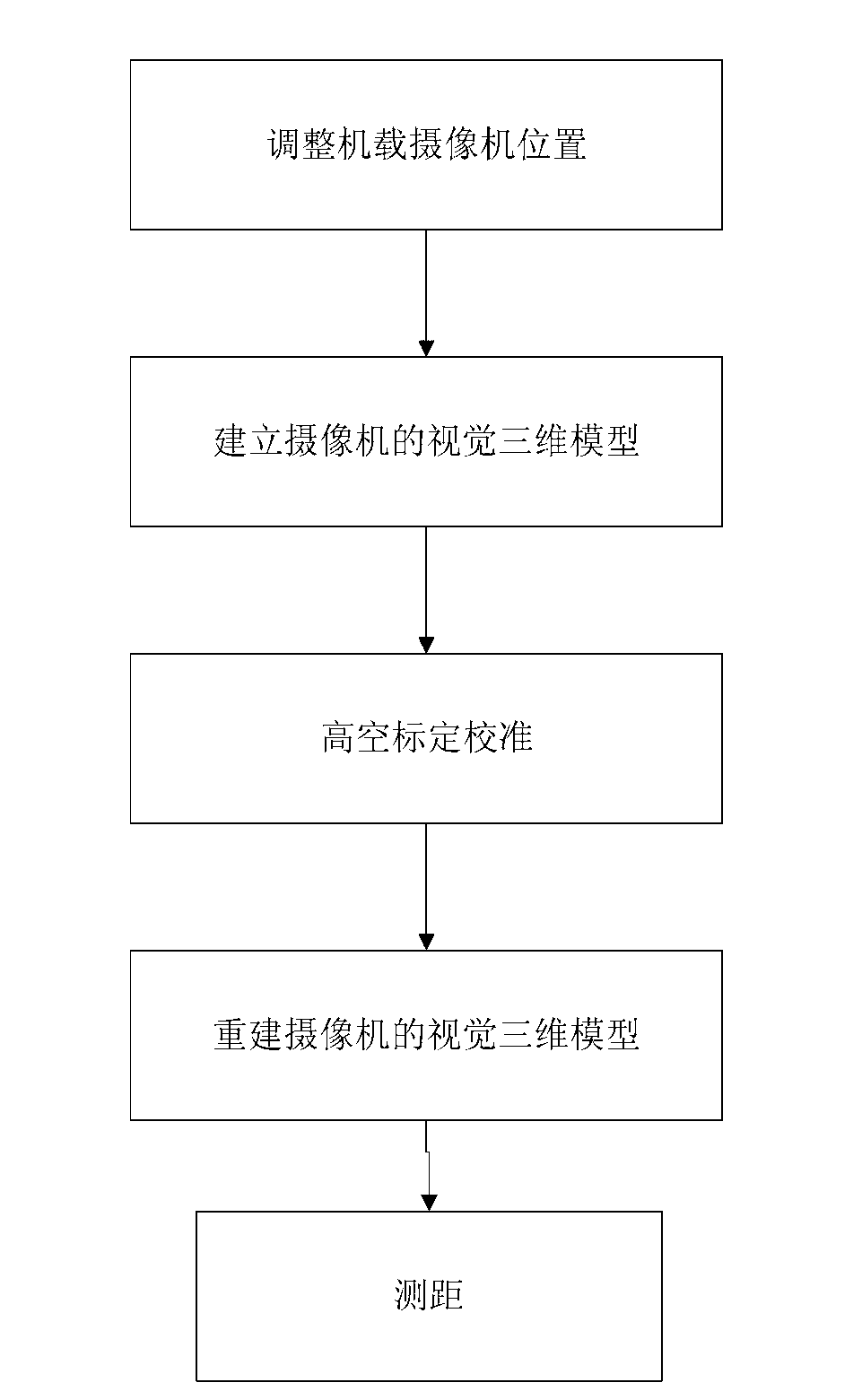
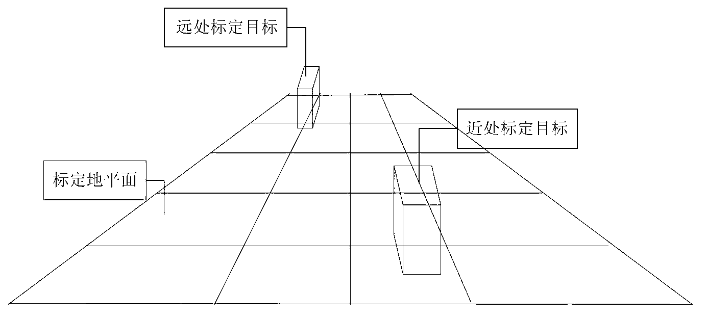
[0019] Hereinafter, the present invention will be further described in detail with reference to the embodiments and drawings, but the implementation of the present invention is not limited to this embodiment.

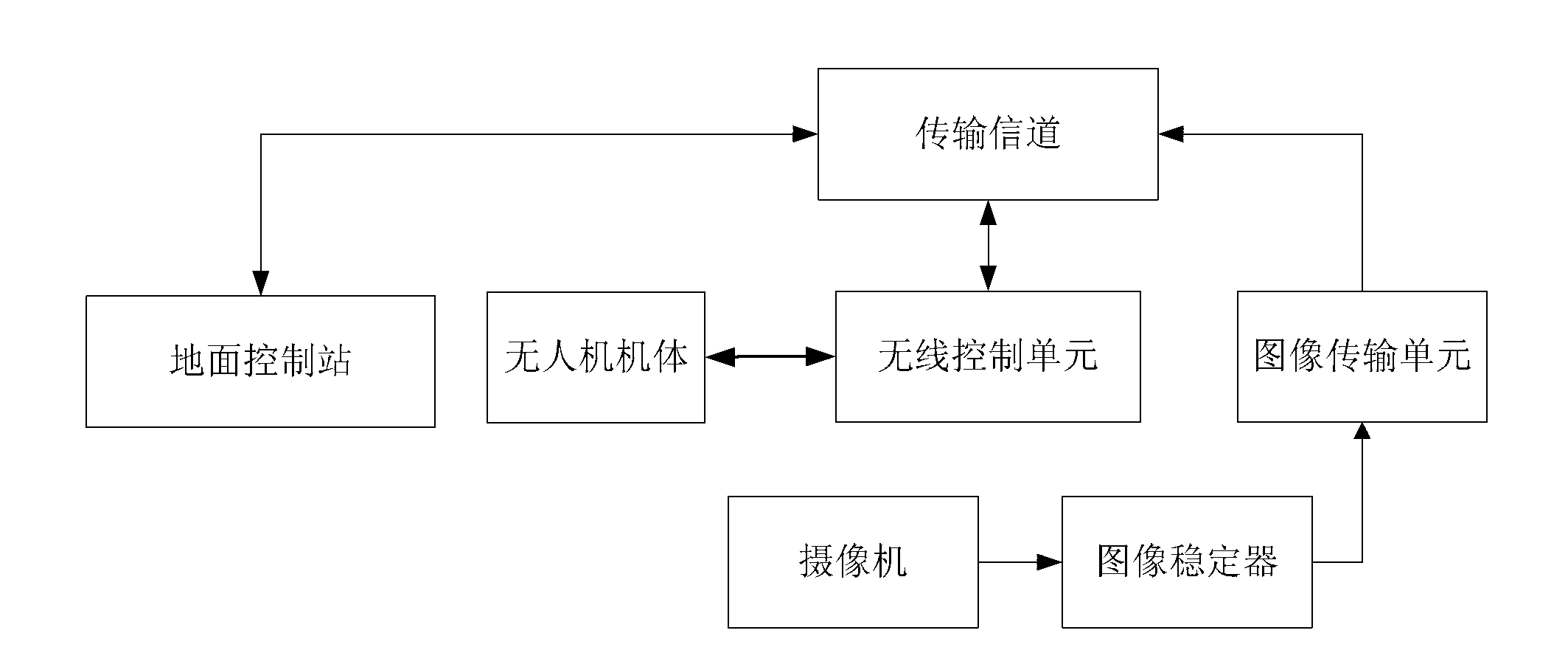
[0020] See figure 1 , The image-based UAV power line patrol measurement system of the present invention includes UAV body, camera, image stabilizer, image transmission unit, gyroscope, wireless control unit and ground control station, camera, image stabilizer, image transmission unit The gyroscope and wireless control unit are all fixed in the drone body; the camera, image stabilizer, and image transmission unit are connected in turn, the video of the camera is output to the image stabilizer, and the image transmission unit transmits the image stabilizer for stabilization After the image; the wireless control unit is connected with the drone body signal, the image transmission unit and the wireless control unit are also respectively connected with the ground control station...


PUM


Abstract

The invention relates to a system and a method for measuring an unmanned aerial vehicle electrical line patrol on the basis of images. A box body comprises an unmanned aerial vehicle body, a camera, an image transmission unit, a wireless control unit, a ground control station and a reference target which is arranged on the ground; the reference target is used for calibrating a three-dimensional scene and building the corresponding relation of the practical size of the scene and picture pixel values; the image transmission unit is respectively connected with the camera and the ground control station, and the wireless control unit is respectively connected with the unmanned aerial vehicle body and the ground control station; and the ground control station controls the flying and hovering of the unmanned aerial vehicle body through the wireless control unit, the images of the camera are obtained through the image transmission unit, a camera visual three-dimensional model is built according to the reference target and the images of the camera, a reference line is selected, and whether a line is safe or not is judged according to a distance from the measurement point of the three-dimensional model to the reference line. When the unmanned aerial vehicle is hovered, coordinate system measurement is carried out on a monitoring picture of a camera through a three-dimensional calibration method, and thus, automatic distance measurement is realized.

Description

Technical field [0001] The invention relates to a system and method for measuring the surrounding environment of the line when an unmanned aerial vehicle in the power industry performs line inspection operations. Background technique [0002] In the prior art, the power line inspection methods mainly include artificial ground line inspection, artificial high-altitude line inspection, robot line inspection, satellite remote sensing line inspection, manned helicopter high-altitude line inspection, and UAV flight control line inspection. Line patrolling is a meticulous and dangerous work. Today, with the development of modern technology, manual line patrolling is obviously inefficient and dangerous. Satellite remote sensing patrols need to be restricted by meteorological and geographic conditions. Therefore, UAV line inspection technology has received more and more attention and reuse. [0003] The traditional UAV line patrol only uses the video camera or camera equipped on the airb...

Claims


Application Information

Patent Timeline
Patent Type & Authority Applications(China)
IPC IPC(8): G01C11/00G01C3/00G06T7/00
Inventor 李三董军陈荣盛冉学彬宁淼福李刚韦德照谢佳亮汪建伟
Owner TIANSHENGQIAO BUREAU CSG EHV POWER TRANSMISSION CO
Why Eureka
Try Eureka