

Intelligent filtering method for airborne laser point cloud data
A technology of laser point cloud data and point cloud data, which is applied in the field of remote sensing surveying and mapping, can solve problems affecting the intelligent processing of LiDAR point cloud data, achieve the effects of improving processing efficiency and filtering accuracy, avoiding interference, and improving the degree of intelligence
- Summary
- Abstract
- Description
- Claims
- Application Information
AI Technical Summary
Problems solved by technology
Method used
Image

Examples
specific Embodiment
[0072] A specific embodiment of the present invention is as follows:
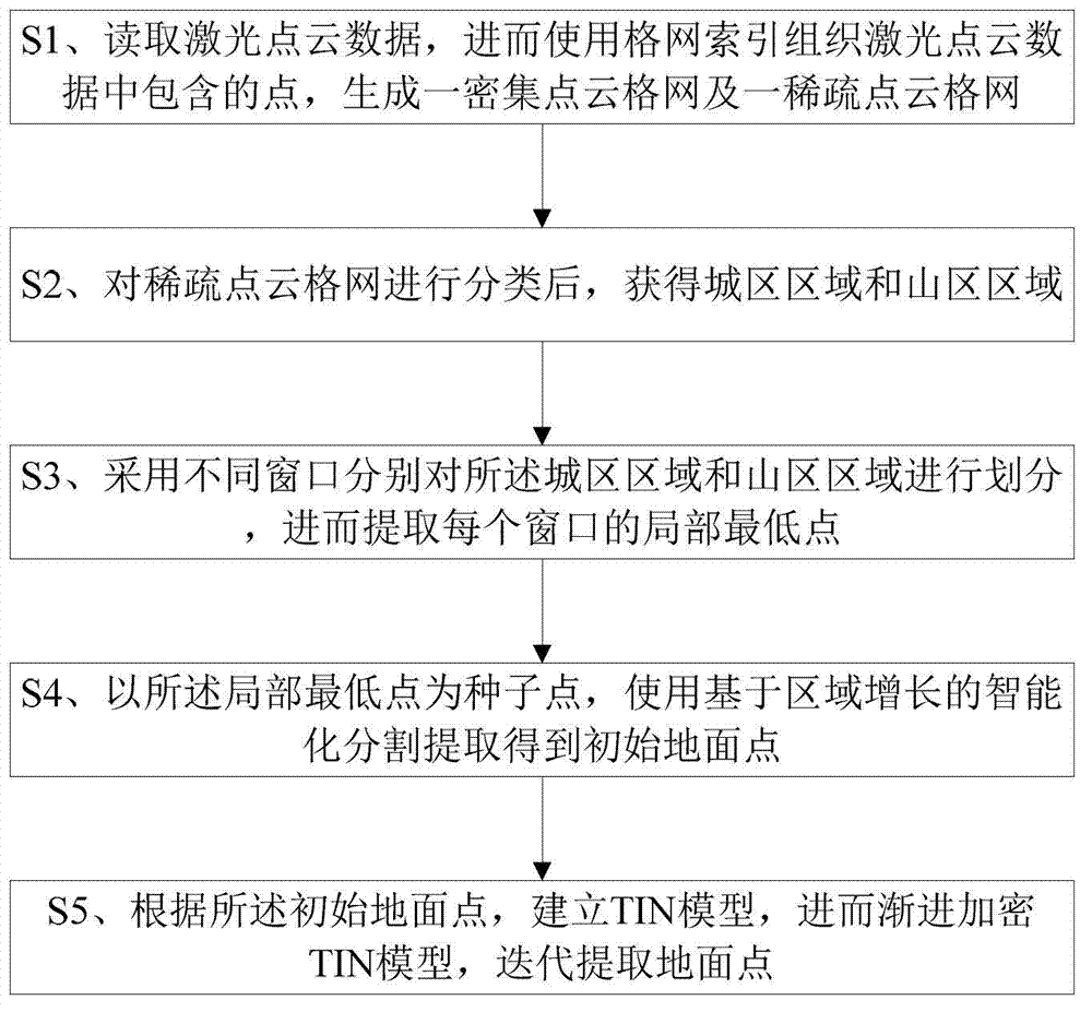
[0073] S100. Read the laser point cloud data, and then use the grid index to organize the points contained in the laser point cloud data to generate a dense point cloud grid and a sparse point cloud grid. Here, all points are divided and organized according to their coordinate rules, respectively Generate a dense point cloud grid of 1m×1m and a sparse point cloud grid of 4m×4m;
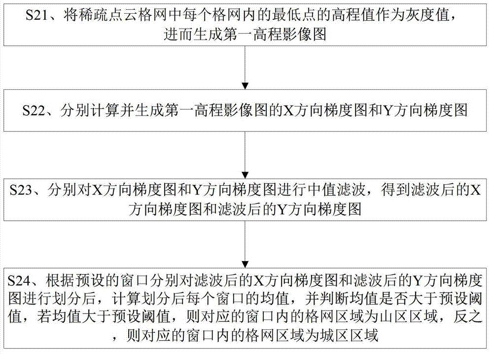
[0074] S101, using the elevation value of the lowest point in each grid in the sparse point cloud grid of 4m×4m as the gray value, and then generating the first elevation image map I h ;
[0075] S102, respectively calculate and generate the first elevation image map I h X-direction gradient map I x and Y direction gradient map I y , the specific calculation formula is as follows:
[0076]
[0077]
[0078] Wherein, W and H are respectively the width and height of the first elevation image map, and i and j are all natura...
PUM
 Abstract
Description
Claims
Application Information