
Dynamic layering rendering expression method of two-dimensional scalar field on electronic map

An electronic map and two-dimensional space technology, applied to maps/plans/charts, instruments, educational tools, etc., can solve the problems of large amount of data, difficult to use, conversion, slow transmission and rendering, etc., to achieve high processing efficiency and creative ideas Ingenious, computationally fast effects

Inactive Publication Date: 2013-02-20
NANJING UNIV
View PDF2 Cites 5 Cited by
  • Summary
  • Abstract
  • Description
  • Claims
  • Application Information

AI Technical Summary

Problems solved by technology

[0003] However, in electronic maps or Web GIS, there are some technical difficulties in rendering grid data: a. large amount of data, slow conversion, transmission, and rendering, and difficult to meet real-time requirements; b. grid boundary effect is not good; c. Difficult to use "transparency" or "translucency" if you want to overlay other map layers

Method used


Image

  • Dynamic layering rendering expression method of two-dimensional scalar field on electronic map
  • Dynamic layering rendering expression method of two-dimensional scalar field on electronic map
  • Dynamic layering rendering expression method of two-dimensional scalar field on electronic map

Examples


Embodiment Construction

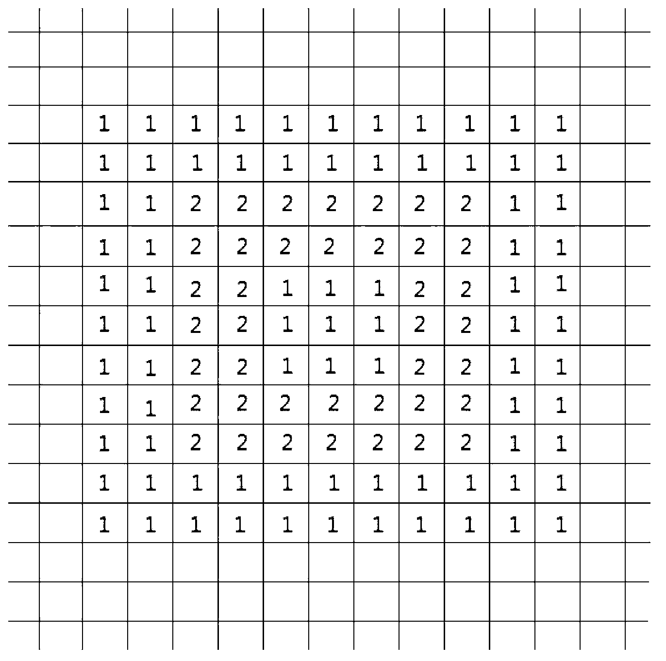
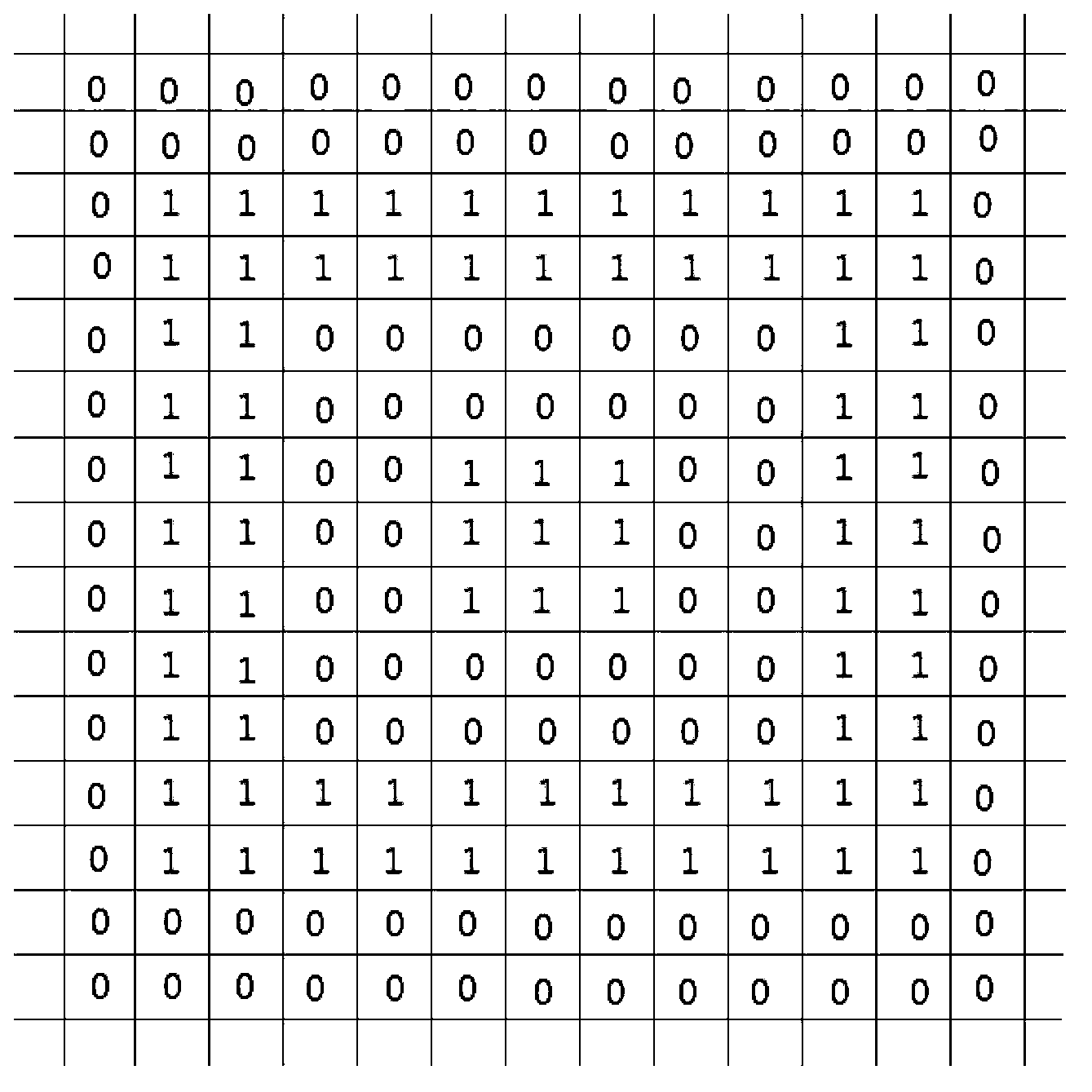
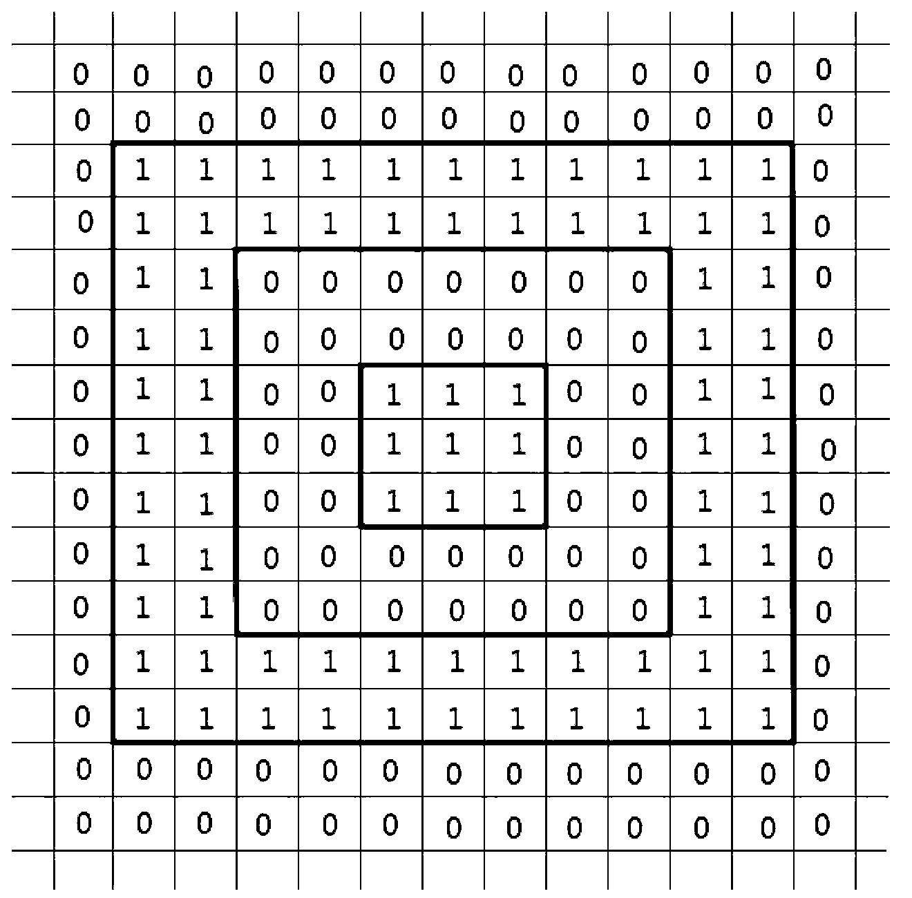
[0027] The purpose and effects of the present invention will become more apparent by referring to the accompanying drawings in detail of the present invention.

[0028] A dynamic layered rendering expression method for a two-dimensional space scalar field on an electronic map, comprising the following steps:

[0029] Step 1. The electronic map background program periodically receives field data about the atmosphere or hydrology, and the field data is grid data with a uniform format;

[0030] In this step, the electronic map background program judges whether the transmitted field data meets the format requirements and whether it is valid data. If the format does not meet the requirements, the data conversion unit converts it into field data that can be read by the background program of the electronic map. Then, give the execution command and the set of intervals, so that the background starts to calculate and process the field data (raster data).

[0031] Step 2. A number of ...


PUM


Abstract

The invention relates to a dynamic layering rendering expression method of a two-dimensional scalar field on an electronic map. Aiming at a boundary polygon collection with complicated space nested relationship, a thought that a hollow ring is formed by double boundaries is used, and a vector plane extracting method is provided according to parity judgment nested relationship containing polygon. The method can complete extraction of a layering vector plane of field data (raster data) rapidly at one time and returns the layering vector plane to a foreground program of the electronic map so as to perform rendering of surface layers at different regions. Compared with a traditional method, the method is rapid in computation speed, can extract all vector planes at different regions in the field data at one time, and solves the problem that a traditional electronic map or a Web geographic information system (GIS) is poor in timeliness and dynamics caused by large data volume and slow layering conversion in rendering of grid data. When the dynamic layering rendering expression method is used for superimposed display with other map layers, transparent or semitransparent coloring effect can be shown well.

Description

technical field [0001] The invention relates to a dynamic layered rendering expression method of a two-dimensional space scalar field on an electronic map, and belongs to the technical fields of map drawing and geographic information engineering. Background technique [0002] When simulating electronic maps, atmospheric / hydrological processes, etc., it is often necessary to express real-time calculated field data (raster data); at present, the main expression method is to use a layered display method based on a two-dimensional spatial scalar field. That is, the field data is divided into multiple regions according to different value ranges, and rendered in different colors. [0003] However, in electronic maps or Web GIS, there are some technical difficulties in rendering grid data: a. Large data volume, slow conversion, transmission, and rendering, difficult to meet real-time requirements; b. Grid boundary effect is not good; c. It is difficult to use the Transparency or T...

Claims


Application Information

Patent Timeline
IPC IPC(8): G09B29/00
Inventor 王结臣周生路程亮胡玮杨柳
Owner NANJING UNIV
Learn More