
Laser radar real-time imaging and building characteristic extracting method

A lidar, real-time imaging technology, applied in the field of remote sensing surveying and mapping, to achieve the effect of ensuring accuracy

Inactive Publication Date: 2013-04-03
BEIHANG UNIV
View PDF6 Cites 7 Cited by
  • Summary
  • Abstract
  • Description
  • Claims
  • Application Information

AI Technical Summary

Problems solved by technology

However, in this method, wavelet transform is only used as a denoising method, and does not involve the classification of ground and buildings and the extraction of building features.

Method used


Image

  • Laser radar real-time imaging and building characteristic extracting method
  • Laser radar real-time imaging and building characteristic extracting method
  • Laser radar real-time imaging and building characteristic extracting method

Examples


Embodiment Construction

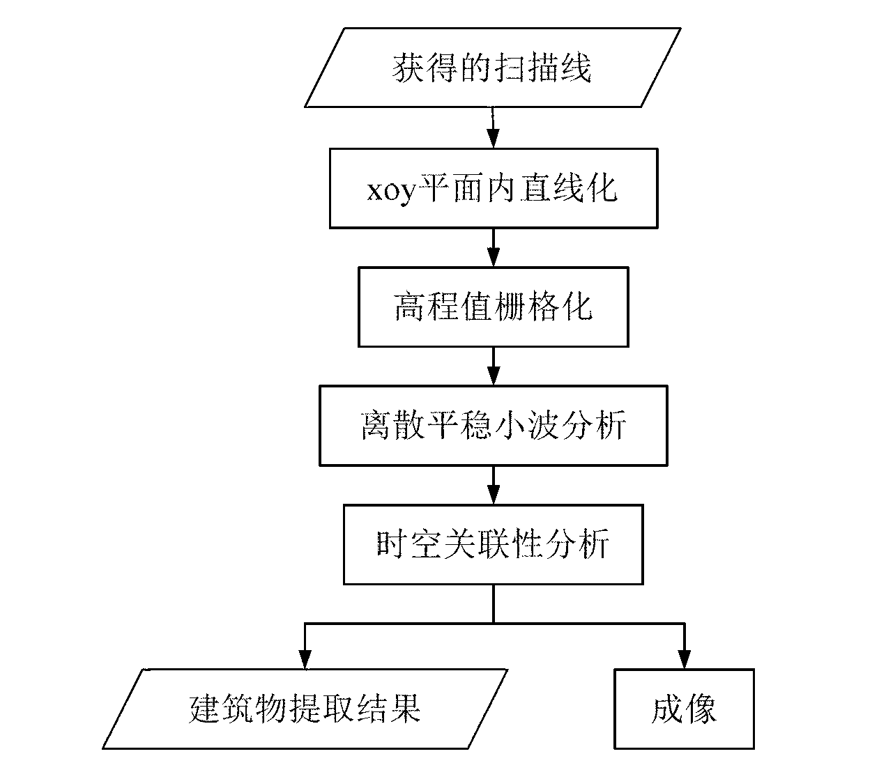
[0020] A kind of laser radar real-time imaging and the method for building feature extraction of the present invention, the steps are as follows:

[0021] Step 1. Linearize the laser footpoints belonging to the same scan line in the point cloud data in the xoy plane.

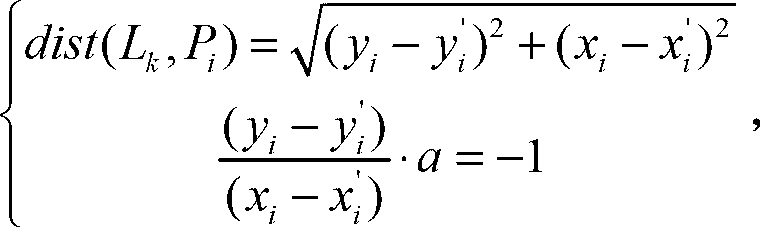
[0022] Under ideal conditions, the laser feet on a scanning line obtained by the laser radar through the rotation of the prism in the scanning mechanism should be relatively evenly distributed on the same straight line on the xoy plane. However, in actual situations, due to the elevation change of ground objects and the deviation of the heading angle, roll angle, and pitch angle of the loading platform of the scanning mechanism under the influence of complex airflow, the distance between the laser foot point on each scanning line and its ideal scanning line There is a certain distance difference between them. Under the influence of complex external conditions, the laser footpoints on the kth scanning line are u...


PUM


Abstract

The invention discloses a laser radar real-time imaging and building characteristic extracting method comprising the following steps of: mapping laser pin spots of a scanning line obtained by a laser radar to an ideal scanning line; carrying out rasterization on the ideal scanning line; obtaining elevation information at each grid position on the ideal scanning line through a linear interpolation method; carrying out graying treatment on the elevation information in the ideal scanning line, so that a probing area corresponding to the scanning line is imaged; and extracting building characteristic information in the ideal scanning line by using discrete stationary wavelet transform. By utilizing the method provided by the invention, the scanning lines of the laser pin spots in point cloud data of the laser radar can be processed one by one, so that the operations of real-time imaging, building characteristic extraction and the like in a scanning process of the laser radar can be realized.

Description

【Technical field】 [0001] The invention relates to the field of remote sensing surveying and mapping, in particular to a method for laser radar real-time imaging and building feature extraction. 【Background technique】 [0002] As an important part of the 3D geographic information system, buildings are usually used as important calibration objects in lidar point cloud data due to their relatively fixed positions and relatively regular shapes. Therefore, in the process of processing lidar point cloud data, how to extract the building location information and top surface type information contained in it in real time and accurately is an important problem that needs to be solved urgently. At present, the methods for filtering and segmenting lidar point cloud data basically adopt the "post-processing" method, such as: mathematical morphology filtering method, triangular mesh filtering method, region growing method, random sampling consistency method And K-means cluster analysis m...

Claims


Application Information

Patent Timeline
IPC IPC(8): G01S7/41
Inventor 徐立军李小路孔德明李端
Owner BEIHANG UNIV
Learn More