

Economical airborne oblique digital aerial photography system
A technology of aerial photography and oblique photography, which is applied in photogrammetry/video metrology, surveying and navigation, measuring devices, etc. It can solve the problems of high operating cost, expensive construction, single angle of oblique photography, etc., and achieve cost and operation cost The effect of low, reliable acquisition
- Summary
- Abstract
- Description
- Claims
- Application Information
AI Technical Summary
Problems solved by technology
Method used
Image

Examples
Embodiment Construction
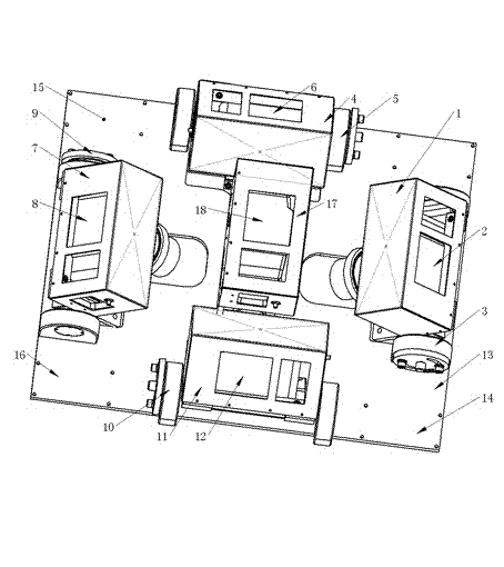
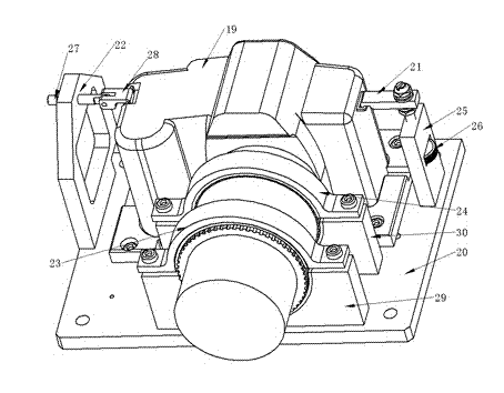
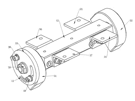
[0022] Figure 1-5 For an implementation example, its specific implementation method is:
[0023] exist figure 1 In the shown embodiment, the system consists of four oblique camera units, front, back, left and right, a vertical camera unit, connecting base plate, miniature GPS navigator, system controller and eight parts; front, rear, left and right four The oblique photography unit has the same basic structure, which is composed of a working camera, a camera fixing piece, a camera swivel seat and a camera protective cover. The vertical photographic unit has the same structure as the oblique photographic unit except that there is no camera swivel seat; the camera protective cover is made of iron material, There are camera viewfinder frame, camera control frame and memory card loading and unloading frame on it. The camera viewfinder frame is consistent with the position and size of the viewfinder on the camera. The camera control frame is consistent with the position of the ca...
PUM
 Abstract
Description
Claims
Application Information