Earth Observation Metadata Integration Method
An integrated method and earth observation technology, applied in the fields of electrical digital data processing, special data processing applications, instruments, etc., can solve the problems of metadata heterogeneity, inability to interface storage, conversion difficulties, etc.
- Summary
- Abstract
- Description
- Claims
- Application Information
AI Technical Summary
Problems solved by technology
Method used
Image
Examples
Embodiment 1
[0032] The earth observation metadata integration method includes the following specific steps:
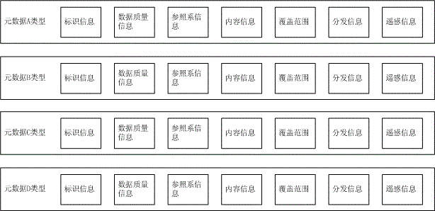
[0033] 1) Establish a metadata core catalog set. The information of the metadata core catalog set includes all spatial metadata attributes released by standardization organizations. If there are new attributes, the core catalog set will be expanded to cover all attributes. The metadata core catalog set is composed of records, each record corresponds to a metadata attribute, and the records include the following fields: ID, attribute name, attribute group, description, data type, source, wherein the attribute name includes Chinese Name and English name, the attribute name field saves the name of the metadata attribute, the attribute group field saves the attribute group where the metadata attribute is located, and the attribute group includes identification information, data quality information, reference system information, content information, coverage range, distribution informa...
PUM
 Abstract
Description
Claims
Application Information
 - R&D
- Intellectual Property
- Life Sciences
- Materials
- Tech Scout
- Unparalleled Data Quality
- Higher Quality Content
- 60% Fewer Hallucinations
Browse by: Latest US Patents, China's latest patents, Technical Efficacy Thesaurus, Application Domain, Technology Topic, Popular Technical Reports.
© 2025 PatSnap. All rights reserved.Legal|Privacy policy|Modern Slavery Act Transparency Statement|Sitemap|About US| Contact US: help@patsnap.com

