
Method for measuring speed of ocean current through integrated navigation

A technology of ocean current speed and integrated navigation, which is applied in the field of information measurement, can solve problems such as filtering divergence and measurement failure, and achieve the effect of fastness, high precision, and no lag in measurement results

Inactive Publication Date: 2013-08-14
HARBIN ENG UNIV
View PDF1 Cites 4 Cited by
  • Summary
  • Abstract
  • Description
  • Claims
  • Application Information

AI Technical Summary

Problems solved by technology

Published in "Torpedo Technology" in 2007, the name is the application of speed inertial navigation integrated navigation system on AUV; in 2004, the article "Research on SINS / DVL integrated navigation technology in AUV" published in "China Navigation", the above results are in line with the existing Some patents and articles use the water speed as the observation of the combined filter of the ship to estimate the error of the SINS, which will cause the filter to diverge due to the existence of the ocean current speed, and the measurement will fail (the filter needs the ground speed as the observation, while for the Water speed equals ground speed minus ocean current speed)

Method used


Image

  • Method for measuring speed of ocean current through integrated navigation
  • Method for measuring speed of ocean current through integrated navigation
  • Method for measuring speed of ocean current through integrated navigation

Examples


Embodiment Construction

[0019] The present invention will be further described below in conjunction with accompanying drawing:

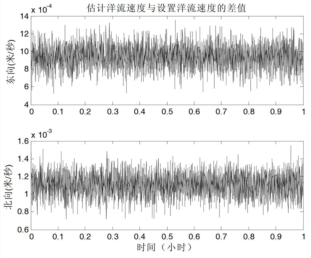
[0020] The SINS / GPS / DVL integrated navigation method of DVL under the water working mode to measure the ocean current velocity, using the strapdown inertial navigation system SINS equipped on the ship, the Doppler log DVL, combined with the ocean current velocity model, works in the integrated navigation state, real-time Measure the speed of ocean currents.

[0021] The error setting of the test condition SINS is: gyro constant value drift ε x =ε y =ε z =0.01°h, the random drift is 0.001°h, and the scale coefficient error is 10 -4 ; The random constant bias of the accelerometer is random drift of 10 -5 g. The ship works in a state of constant speed and direct sailing, with a speed of 10kn and a heading of 135°. Ocean current velocity V Cx =1kn,V Cy =1kn, the parameter β of the ocean current model x =5.4358×10 -5 beta x =5.3291×10 -5 ;

[0022] The SINS, DVL ...


PUM


Abstract

The invention relates to an information measuring method, particularly to a method that a water surface integrated navigation system uses Kalman filtering to measure ocean current when a ship voyages on the water surface. The method comprises the following steps: collecting sample values of a gyro and an accelerometer in a ship strapdown inertial navigation system; measuring the speed value and the position value of a water surface carrying device in a recursion manner; looking up the east orientation parameter and north orientation parameter of the ocean current model in a ship voyage sea area; setting the 14-dimension variable for the state of the water surface integrated navigation method; obtaining an observation value and an observation matrix of the water surface integrated navigation method; and performing Kalman filtering to measure the east orientation ocean current speed and the north orientation ocean current speed. The Kalman filtering method provided by the invention can measure the ocean current speed more quickly and accurately; the measuring result cannot lag and is quick; and as the measuring error is 10 <-3> m, which is far less than the ocean current speed, the precision is higher.

Description

technical field [0001] The invention relates to an information measurement method, in particular to a method for measuring ocean currents by a water surface integrated navigation system using a Kalman filter when a ship sails on the water surface. Background technique [0002] The strapdown inertial navigation system SINS has the advantage of independent and autonomous work, but its navigation error accumulates with time; GPS can provide accurate position information, but its autonomous performance is poor and susceptible to interference; Doppler log DVL can provide the speed of the ship information, but its operating distance is limited, limited by DVL's own performance, ship volume, power consumption, etc. In most cases, DVL can only provide water speed. Due to its own shortcomings, the above-mentioned single navigation system can no longer meet the requirements of ship navigation. Therefore, the above three systems are usually used in combination to learn from each other...

Claims


Application Information

Patent Timeline
Patent Type & Authority Applications(China)
IPC IPC(8): G01P5/00
Inventor 奔粤阳朱忠军李倩高伟于飞刘新源杨娇龙鲍桂清李敬春周广涛
Owner HARBIN ENG UNIV
Learn More