

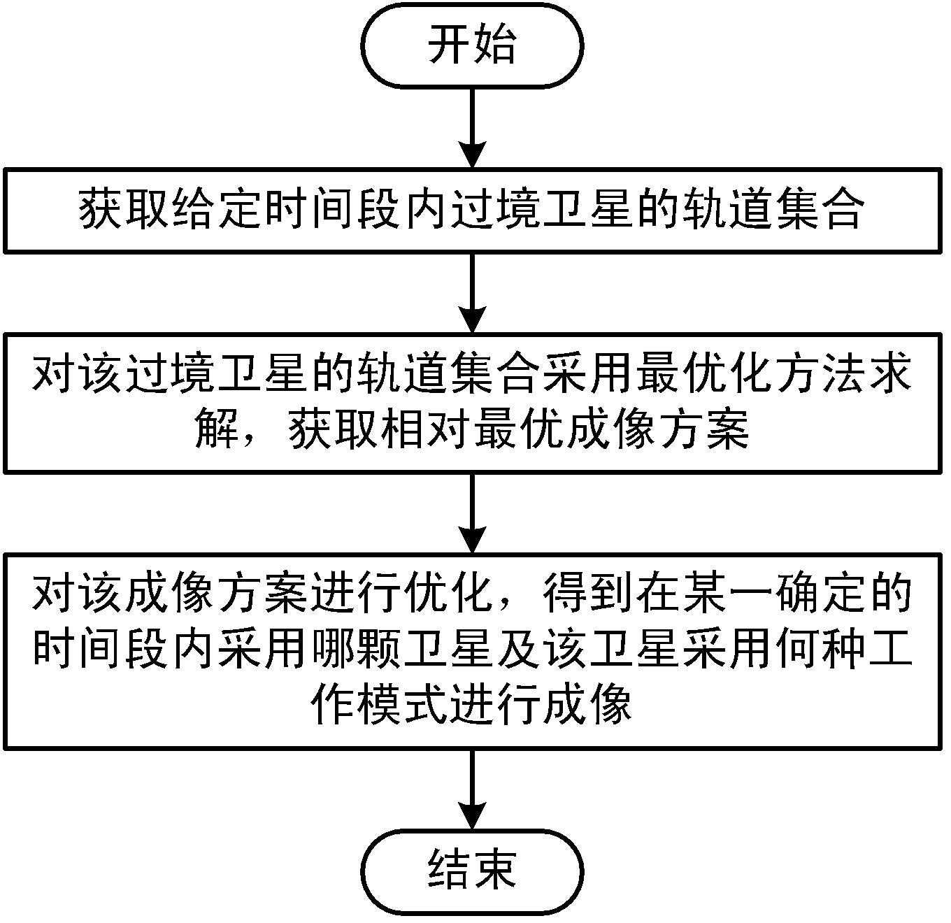
Method for realizing multi-satellite combined imaging
A satellite and imaging technology, applied in the field of satellite imaging, can solve problems such as the difficulty of manually compiling multi-satellite joint imaging schemes and the inability to comprehensively utilize multiple satellite resources
- Summary
- Abstract
- Description
- Claims
- Application Information
AI Technical Summary
Problems solved by technology
Method used
Image

Examples
Embodiment 1
[0090] From 2012 / 12 / 612:00:00 to 2013 / 1 / 512:00:00 (Beijing time) planning satellite {[HRVIR1, HRVIR2 of SPOT4], [HRG1, HRG2 of SPOT5], [TOP1, TOP2 of THEOS] } For the imaging scheme of the area {longitude range [115.5, 117.5], latitude range [39.5, 41.1], area: 30158.82 square kilometers}, the specific imaging scheme is shown in Table 1 below:
[0091]
[0092]
[0093] Table 1
Embodiment 2
[0095] From 2012 / 12 / 612:00:00 to 2013 / 1 / 512:00:00 (Beijing time) planning satellite {[HRVIR1, HRVIR2 of SPOT4], [HRG1, HRG2 of SPOT5], [TOP1, TOP2 of THEOS] } For the region {longitude range [73.5, 96.5], latitude range [34.0, 48.5], area: 2990802.24 square kilometers} imaging scheme, the specific scheme is shown in Table 2 below:
[0096]
[0097]
[0098] Table 2
PUM
 Abstract
Description
Claims
Application Information