Three-dimensional road generating system and method

A three-dimensional road and generation system technology, applied in the field of navigation, can solve the problems of huge workload of simulation data construction, large amount of data processing, high workload and cost

Inactive Publication Date: 2013-11-27
SHANGHAI ANYO NAVINFO INFORMATION TECH
View PDF2 Cites 22 Cited by
  • Summary
  • Abstract
  • Description
  • Claims
  • Application Information

AI Technical Summary

Problems solved by technology

Among them, the processing of the analog data of the image and the construction of the map are very heavy, and the displayed 3D map is difficult to be clear enough and close to reality
[0004] There is also a three-dimensional map of Gaode, which provides users with a three-dimensional city map similar to three-dimensional, which has a high degree of fidelity, but the digital data that constitutes the map

Method used


Image

  • Three-dimensional road generating system and method
  • Three-dimensional road generating system and method
  • Three-dimensional road generating system and method

Examples


Embodiment Construction

[0026] The present invention will be further described in detail below in conjunction with the accompanying drawings.

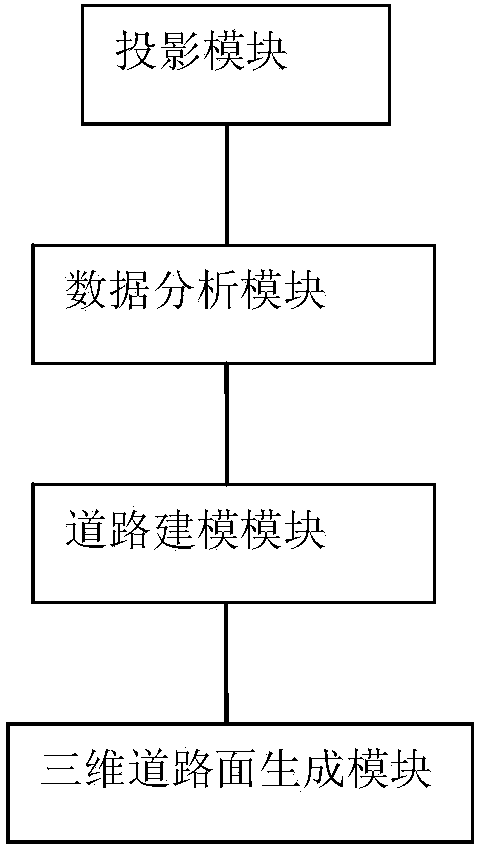
[0027] like figure 1 As shown, it is a three-dimensional road generation system according to an embodiment of the present invention, and the system includes:

[0028] The projection module is used to convert the acquired road latitude and longitude coordinates into geodetic coordinates;

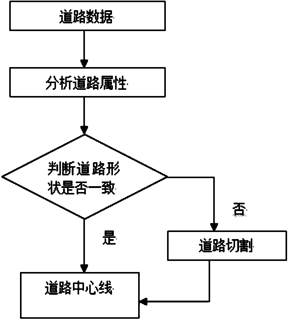
[0029] The data analysis module is used to cut the attribute data and geodetic coordinate data of the road to form the linear data of the road;

[0030] a road modeling module, used to analyze the linear data to determine whether dual-digital merging can be performed, and if so, perform dual-digital merging to form planar data;

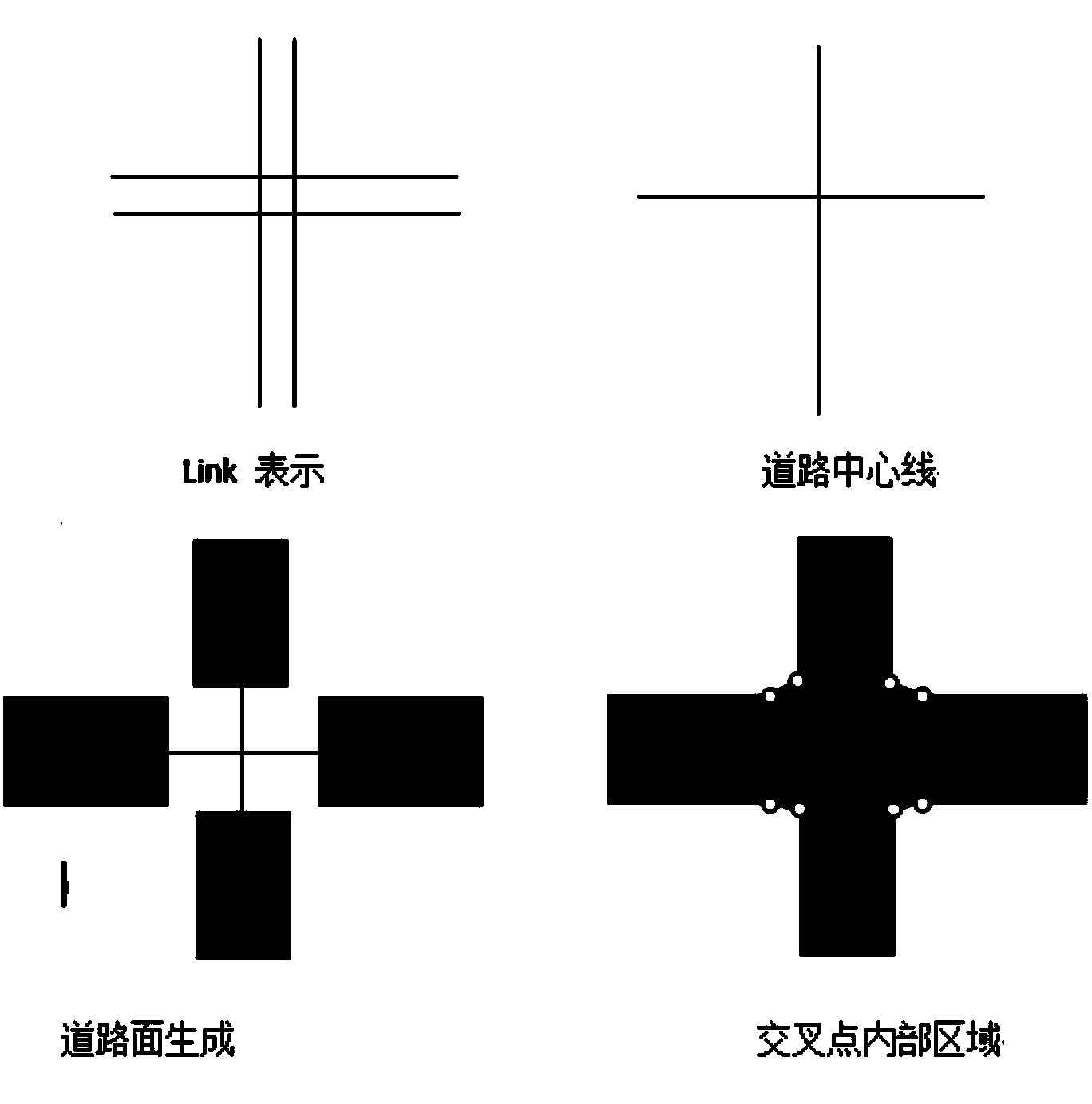
[0031] The three-dimensional road surface generation module is used for extracting the road centerline according to the surface data to generate the three-dimensional road surface.

[0032] In this system, GPS coordinates in the form of longitude...


PUM


Abstract

The invention provides a three-dimensional road generating system and method for the technical field of navigation. The system comprises a projection module, a data analysis module, a road modeling module and a three-dimensional road surface generating module, wherein the projection module is used for converting the obtained road longitude and latitude coordinate into a geodetic coordinate, the data analysis module is used for clipping attribute data of the road and the geodetic coordinate to form the linear data of the road, the road modeling module is used for analyzing the linear data and judging whether the dual-digitalized combination can be performed, if so, performing the dual-digitalized combination to form facet data; the three-dimensional road surface generating module is used for extracting the road axis according to the facet data to generate the three-dimensional rod surface. By analyzing the linear data of the road, the dual-digitalized combination is performed to form facet data, the data processing procedure of generating the three-dimensional surface is simplified, and the vivid three-dimensional urban road map is realized by using low cost and low workload.

Description

technical field [0001] The present invention relates to the technical field of navigation, in particular to a three-dimensional road generation system and method. Background technique [0002] With the advancement of science and technology, social development has entered an all-round information age marked by numbers and networks. At the same time, the concept of digital city came into being. The so-called digital city refers to the comprehensive use of computer digital means (GIS, remote sensing, telemetry, network, multimedia and virtual simulation and other technologies) to comprehensively digitally collect and process the city's infrastructure and functional mechanisms. It is a powerful function of digitization, networking, and optimized decision-making of complex systems such as ecological environment, population, economy, and society. In a digital city, roads in urban infrastructure are as important as a person's blood vessels, which maintain the vitality and safety ...

Claims


Application Information

Patent Timeline
IPC IPC(8): G01C21/26G06T17/00
Inventor 梁永杰刘昕顾津津蒋勇
Owner SHANGHAI ANYO NAVINFO INFORMATION TECH
Why Eureka
Try Eureka