
Slope fitting method based on DEM (dynamic effect model) data

A data and slope technology, applied in the field of visual navigation, can solve problems such as failure to judge obstacles, poor resistance to gross errors, and excessive calculation.

Active Publication Date: 2015-05-27
BEIJING INST OF CONTROL ENG
View PDF1 Cites 0 Cited by
  • Summary
  • Abstract
  • Description
  • Claims
  • Application Information

AI Technical Summary

Problems solved by technology

[0005] The technical problem of the present invention is: to overcome the problems of the existing slope fitting method, such as poor anti-gross error ability, excessive calculation amount and failure of obstacle judgment during the landing process of the spacecraft, etc., and provides a DEM data-based The slope fitting method, through the introduction of new processing methods such as equation transformation, position center transformation, and parameter median introduction, solves the problem of slope identification during lunar landing, improves the speed of fitting, and can be extended to more A wide range of fields such as Mars, asteroids or the safe landing of ships on the ground

Method used


Image

  • Slope fitting method based on DEM (dynamic effect model) data
  • Slope fitting method based on DEM (dynamic effect model) data
  • Slope fitting method based on DEM (dynamic effect model) data

Examples


Embodiment Construction

[0023] Slope fitting method flow chart of the present invention is as figure 1 As shown, the specific steps are as follows:

[0024] 1) 3D terrain data input. The 3D terrain data is directly output by the 3D imaging sensor. The sensor can be a laser imaging radar. The output format is "point set", denoted as U, and each point is in the format (X, Y, Z) representing three coordinate values , X, Y are the horizontal and vertical coordinates of the plane, and Z is the elevation coordinate.

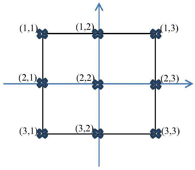
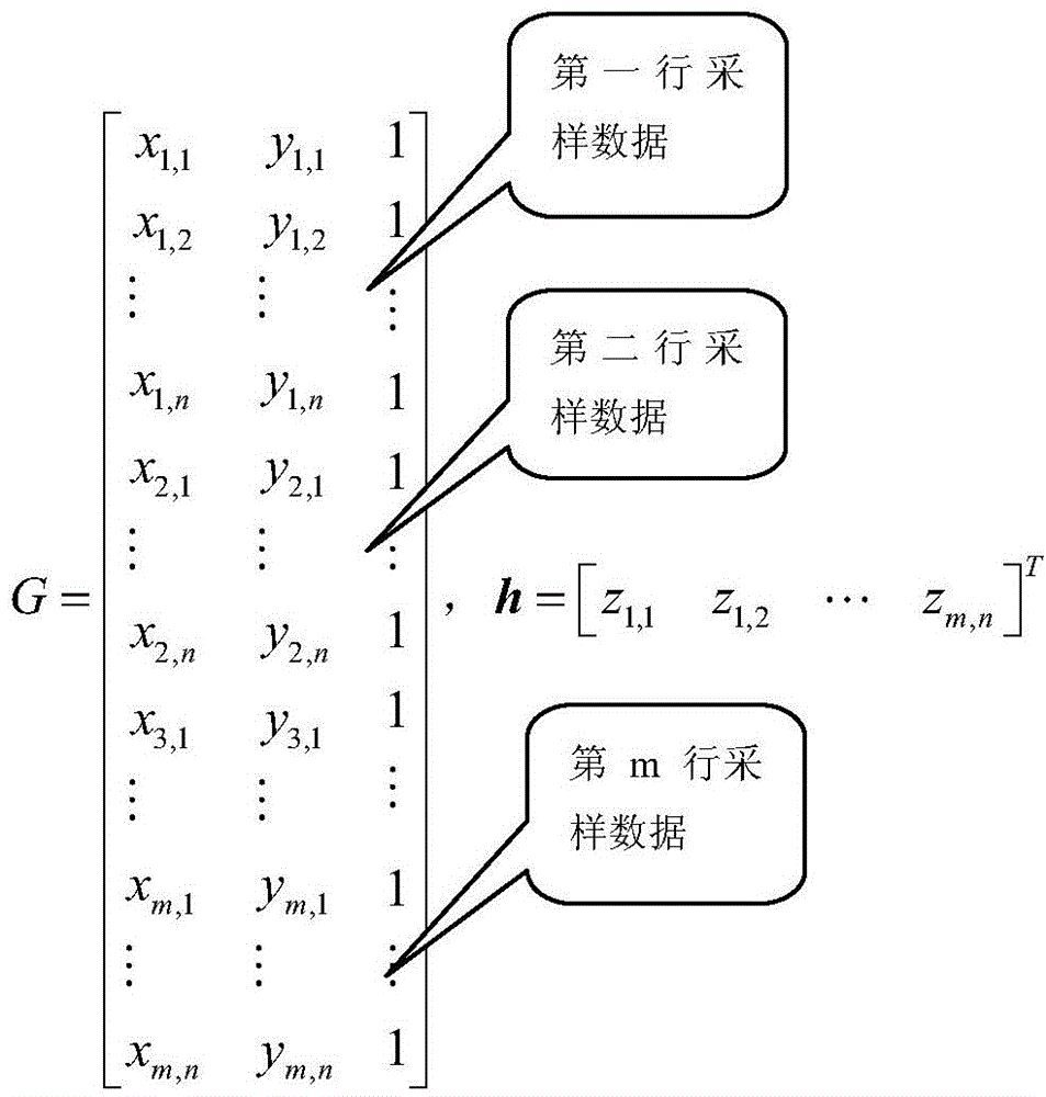
[0025] 2) Fitting data acquisition, due to the large number of points output by the sensor, considering the requirements of fast calculation, it is necessary to sample the point set at a certain interval (the interval dx in the X direction, and the interval dy in the Y direction). Generally, an odd matrix is ​​selected for acquisition, and the number of rows It is recorded as m, and the number of columns is recorded as n, such as 3×3, 5×5, 7×7, and it is recorded as (x i,j ,y i,j z i,j )...


PUM


Abstract

The invention provides a slope fitting method based on DEM (dynamic effect model) data. The method comprises the following steps that (1) three-dimensional topography data is obtained from a three-dimensional imaging sensor; (2) the alternate sampling is carried out on points included in the three-dimensional topography data for forming a collecting matrix; (3) K1X+K2Y+K3=Z is selected to be used as a slope plane fitting equation; (4) the center coordinate conversion is carried out on each sampling point in the collecting matrix; (5) the K calculation is algebraized to obtain each component k1_1, k1_2 to k1_m of K1, and each component k2_1, k2_2 to k2_n of K2; (6) k1_1, k1_2 to k1_m are sorted in order of size to obtain a middle value, the value K1 shown in the description is obtained, k2_1, k2_2 to k2_m are sorted in order of size to obtain a middle value, and the value K2 shown in the description is obtained; and (7) the slope angle phi is obtained through the calculation of a formula shown in the description according to K1 and K2 obtained in the step (6). The method provided by the invention has the characteristics that the topography slope estimation speed is high, and the robustness is high.

Description

technical field [0001] The invention belongs to the technical field of visual navigation and relates to a fast and robust slope fitting method. Background technique [0002] For the landing of extraterrestrial bodies, such as lunar surface exploration, since the landing terrain is unknown and there are a large number of impact craters and rocks distributed on the surface, it is very important to determine a safe landing area to avoid obstacles. [0003] Currently, sensors for safe obstacle avoidance include optical imaging sensors and laser three-dimensional imaging sensors. The former uses two-dimensional grayscale images for obstacle identification, and the latter uses elevation data, that is, DEM data for obstacle identification. Since the optical image cannot give the terrain height and the laser three-dimensional imaging sensor can provide elevation information, the laser three-dimensional imaging sensor has received more and more attention in the aerospace science and ...

Claims


Application Information

Patent Timeline
Patent Type & Authority Patents(China)
IPC IPC(8): G06F17/50
Inventor 王立周建涛杨春河王健蓉吴奋陟王永杰梁潇郑璇余成武
Owner BEIJING INST OF CONTROL ENG
Learn More