Indoor positioning system and method based on virtual Beidou satellite navigation signals

A technology of navigation signals and Beidou satellites, which is applied in the field of indoor positioning system based on virtual Beidou satellite navigation signals, and can solve the problem of small single-point coverage

Inactive Publication Date: 2014-02-12
OLINKSTAR CORP
View PDF0 Cites 27 Cited by
  • Summary
  • Abstract
  • Description
  • Claims
  • Application Information

AI Technical Summary

Problems solved by technology

But Wi-Fi also has its disadvantages, such as the small coverage of a single point, only 0.03km 2

Method used


Image

  • Indoor positioning system and method based on virtual Beidou satellite navigation signals
  • Indoor positioning system and method based on virtual Beidou satellite navigation signals
  • Indoor positioning system and method based on virtual Beidou satellite navigation signals

Examples


Embodiment Construction

[0028] Embodiments of the present invention will be further described in detail below in conjunction with the accompanying drawings.

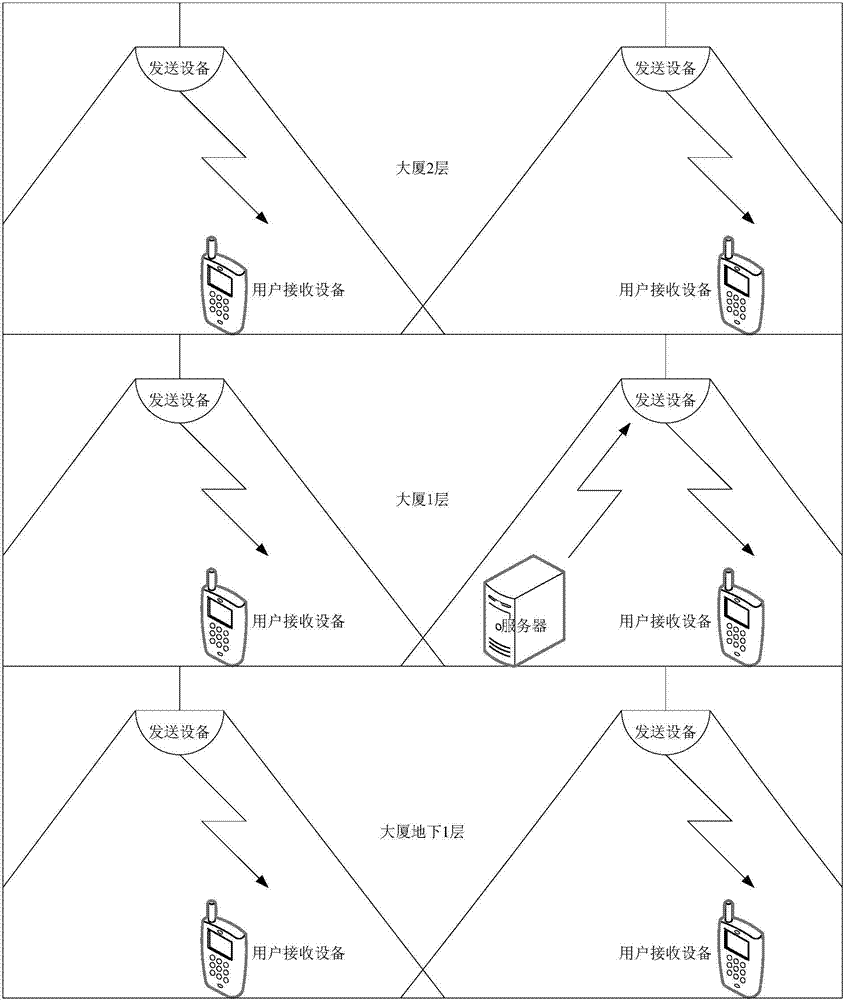
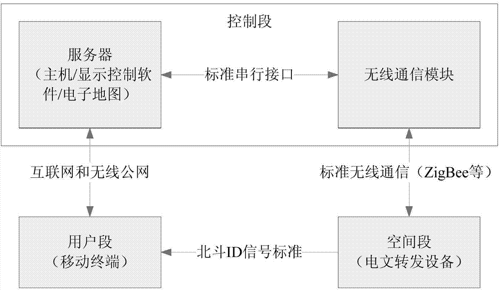
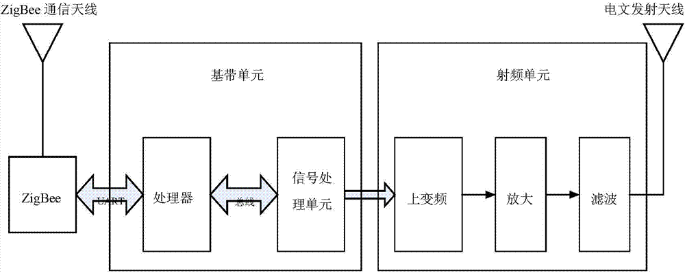
[0029] An indoor positioning method based on a virtual Beidou satellite navigation signal, indoor positioning is performed through a message forwarding device installed inside or outside a building; the message forwarding device transmits a virtual Beidou satellite navigation signal, and the signal structure of the virtual Beidou satellite navigation signal is the same as The signal structure of the Beidou navigation satellite signal is consistent, including occupying the same operating frequency point, using the same multiple access method, modulation method, same spreading code and message structure, including the following steps:

[0030] 1) According to the positioning accuracy requirements, multiple message forwarding devices are deployed in the coverage area of ​​indoor positioning. The networking principle is similar to the cellular syste...


PUM


Abstract

This invention provides an indoor positioning system and method based on virtual Beidou satellite navigation signals. The system is based on the hardware of the existing Beidou satellite navigation ground receiving equipment, transmits virtual Beidou satellite navigation signals through message retransmission equipment installed inside or outside a building, and provides highly reliable indoor positioning service for the existing Beidou satellite navigation ground receiving equipment. The system comprises a control section, a space section and a user section, wherein the control section comprises a server and a wireless communication module; the server is connected with the wireless communication module through a standard serial interface; the server is butted with the space section through the wireless communication module; the space section comprises a plurality of message retransmission equipment for generating virtual Beidou satellite navigation signals; the user section comprises a mobile hand-held terminal or a vehicle terminal and is connected with the server through the Internet or a wireless public network.

Description

technical field [0001] The invention relates to the technical field of indoor positioning, in particular to an indoor positioning system and method based on virtual Beidou satellite navigation signals. Background technique [0002] Satellite navigation and positioning system uses satellites to transmit radio signals for positioning and navigation. It has all-weather, high-precision, fast and real-time three-dimensional navigation, positioning, speed measurement and timing functions. The basic principle of satellite navigation and positioning is to measure the distance between the known satellite and the user's receiver, and then integrate the data of multiple satellites to know the specific position of the receiver. The role of the satellite part of the navigation system is to continuously transmit navigation messages, which include system time, clock correction parameters, ionospheric delay model parameters, satellite ephemeris and satellite health status information, etc. ...

Claims


Application Information

Patent Timeline
Patent Type & Authority Applications(China)
IPC IPC(8): H04W64/00
Inventor 不公告发明人
Owner OLINKSTAR CORP
Why Eureka
Try Eureka