Remote sensing data sampling method and system

A remote sensing data and remote sensing technology, which is applied in the field of remote sensing communication, can solve the problems of low sampling efficiency, low accuracy, and high complexity of remote sensing data sampling methods, and achieve the effect of reducing complexity and improving sampling efficiency and accuracy

Active Publication Date: 2014-04-23
SHENZHEN INST OF ADVANCED TECH
View PDF3 Cites 5 Cited by
  • Summary
  • Abstract
  • Description
  • Claims
  • Application Information

AI Technical Summary

Problems solved by technology

[0005] In view of this, the purpose of the embodiments of the present invention is to provide a method and system for sampling remote sensing data, w

Method used


Image

  • Remote sensing data sampling method and system
  • Remote sensing data sampling method and system
  • Remote sensing data sampling method and system

Examples


Embodiment Construction

[0037] In order to make the object, technical solution and advantages of the present invention clearer, the present invention will be further described in detail below in conjunction with the accompanying drawings and embodiments. It should be understood that the specific embodiments described here are only used to explain the present invention, not to limit the present invention.

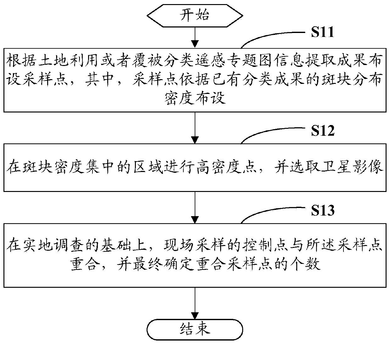
[0038] The specific embodiment of the present invention provides a kind of method of remote sensing data sampling, mainly comprises the following steps:

[0039] S11. Arranging sampling points according to information extraction results of land use or cover classification remote sensing thematic maps, wherein the sampling points are arranged according to the patch distribution density of existing classification results;

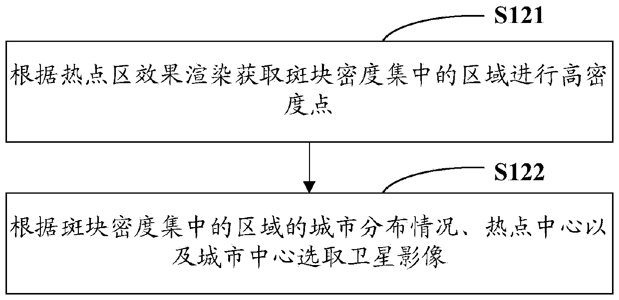
[0040] S12. Perform high-density points in the area where the plaque density is concentrated, and select satellite images;

[0041] S13. On the basis of field investigation, the ...


PUM


Abstract

The invention is suitable for the field of remote sensing communication and provides remote sensing data sampling method. The method comprises arranging sampling points based on land utilization or cover classification remote sensing thematic map information extraction achievements, wherein the sampling points are arranged according to the patch distribution density of the existing classification achievements; carrying out high density point in areas, of which the patch density is concentrated and selecting satellite images; and on the basis of field survey, control points of on-site sampling being overlapped with the sampling points and finally determining the number of the overlapped sampling points. The invention also provides a remote sensing data sampling system. The remote sensing data sampling method and system provided in the invention can greatly reduce complex degree of sampling means, and meanwhile, enables the sampling efficiency and accuracy to be obviously improved.

Description

technical field [0001] The invention relates to the field of remote sensing communication, in particular to a method and system for sampling remote sensing data. Background technique [0002] The remote sensing observation of electromagnetic wave reflection and emission radiation partially solves the spatial sampling problem. How to truly express the key geophysical parameters in the field of remote sensing, such as surface temperature, albedo, vegetation index, leaf area index, soil moisture content and surface flux, etc., requires further verification work. The field verification of remote sensing monitoring is the implementation process of extracting thematic category information and data quality from remote sensing data for field verification before using remote sensing thematic maps for scientific research and decision-making. [0003] Due to the complexity of traditional remote sensing data sampling methods, and the lag in authenticity testing of quantitative remote s...

Claims


Application Information

Patent Timeline
IPC IPC(8): G06K9/62
Inventor 彭树宏钱静
Owner SHENZHEN INST OF ADVANCED TECH
Why Eureka
Try Eureka