Ground object height calculation method based panoramic picture

A panoramic image and height calculation technology, applied to measuring devices, instruments, optical devices, etc., can solve the problems of relatively strict requirements on scene characteristics, long calculation time, and high computational complexity

Active Publication Date: 2014-06-04
SUZHOU SHENGJING INFORMATION TECH CO LTD
View PDF4 Cites 2 Cited by
  • Summary
  • Abstract
  • Description
  • Claims
  • Application Information

AI Technical Summary

Problems solved by technology

[0003] Continuous panorama, also known as street view, can not only provide general users with the function of viewing the world without leaving home, but also put forward higher requirements for the application of street view in special industries. At present, a popular application is to use panoramic images for Measurement and 3D reconstruction, the tradit...

Method used


Image

  • Ground object height calculation method based panoramic picture
  • Ground object height calculation method based panoramic picture
  • Ground object height calculation method based panoramic picture

Examples


Embodiment Construction

[0041] Below in conjunction with accompanying drawing, the present invention is described in further detail:

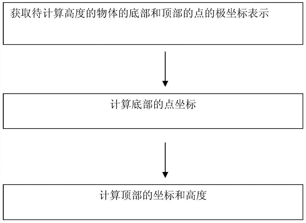
[0042] figure 1 It is a flow chart of the method of the present invention. A method for calculating the height of a ground object based on a panoramic image, comprising the steps of:

[0043] (1) Obtain the polar coordinate representation of the bottom and top points of the object whose height is to be calculated;

[0044] (2) Calculate the point coordinates of the bottom;

[0045] (3) Calculate the coordinates and height of the top.

[0046] Further, in the step (1)

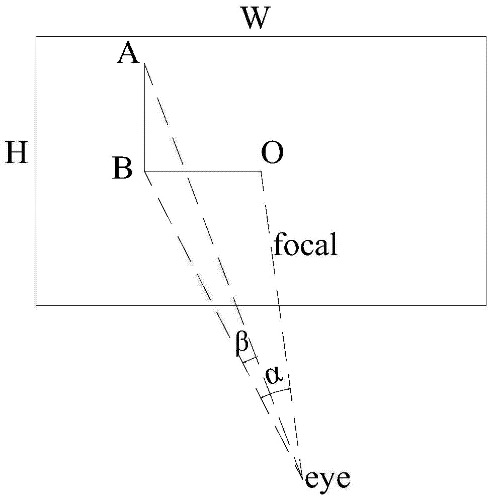
[0047] Get the top and bottom screen coordinates of the mouse click (x 屏幕 ,y 屏幕 ), this point is the position on the screen after the spherical projection of the panoramic image is rasterized by the 3D rendering engine;

[0048] Calculate the polar coordinate representation of the top and bottom. This process is the inverse process of rasterization in computer graphics. Assume that the panoramic ...


PUM


Abstract

The invention discloses a ground object height calculation method based on a panoramic picture. The method comprises the steps of firstly, obtaining a starting point and an end point for marking the height of the object to be solved from the picture, wherein the point of the bottom of the object should be on the ground or quite close to the ground; then calculating the three-dimensional point position of the point of the bottom based on the projection principle, then three-dimensional point positions of the point of the top, and finally calculating the height of the object. According to the method, data processing difficulty can be reduced, the calculation speed can be improved, and the application cost can be reduced.

Description

Technical field: [0001] The invention relates to a method for calculating the height of ground objects based on panoramic images. Background technique: [0002] Panorama (Panorama) is to stitch one or more groups of photos taken by the camera ring 360 degrees into a panoramic image. Panorama virtual reality (also called real scene virtual reality) is a virtual reality technology based on the real scene of the panoramic image. Azimuth interactively watch the restored display of the real scene. With the support of the playback plug-in, use the mouse to control the direction of looking around, from right to near or far, so that the audience feels that they are in a real environment, as if browsing the beautiful scenery in the real scene in a window. The virtual panorama technology based on static images is a primary virtual reality technology that can be realized on a microcomputer platform. You can also really feel the outside world. [0003] Continuous panorama, also known...

Claims


Application Information

Patent Timeline
IPC IPC(8): G01B11/03
Inventor 胡伏原刘盼
Owner SUZHOU SHENGJING INFORMATION TECH CO LTD
Why Eureka
Try Eureka