Method and server for pushing information based on filtering and clustering method
A technology of pushing information and clustering method, applied to methods and servers, and pushing information field based on filtering and clustering method, can solve the problems of complex calculation process, inability to meet business requirements, long calculation time, etc., and achieve simple calculation, The effect of short processing time and reduced overhead
- Summary
- Abstract
- Description
- Claims
- Application Information
AI Technical Summary
Problems solved by technology
Method used
Image
Examples
Embodiment 1
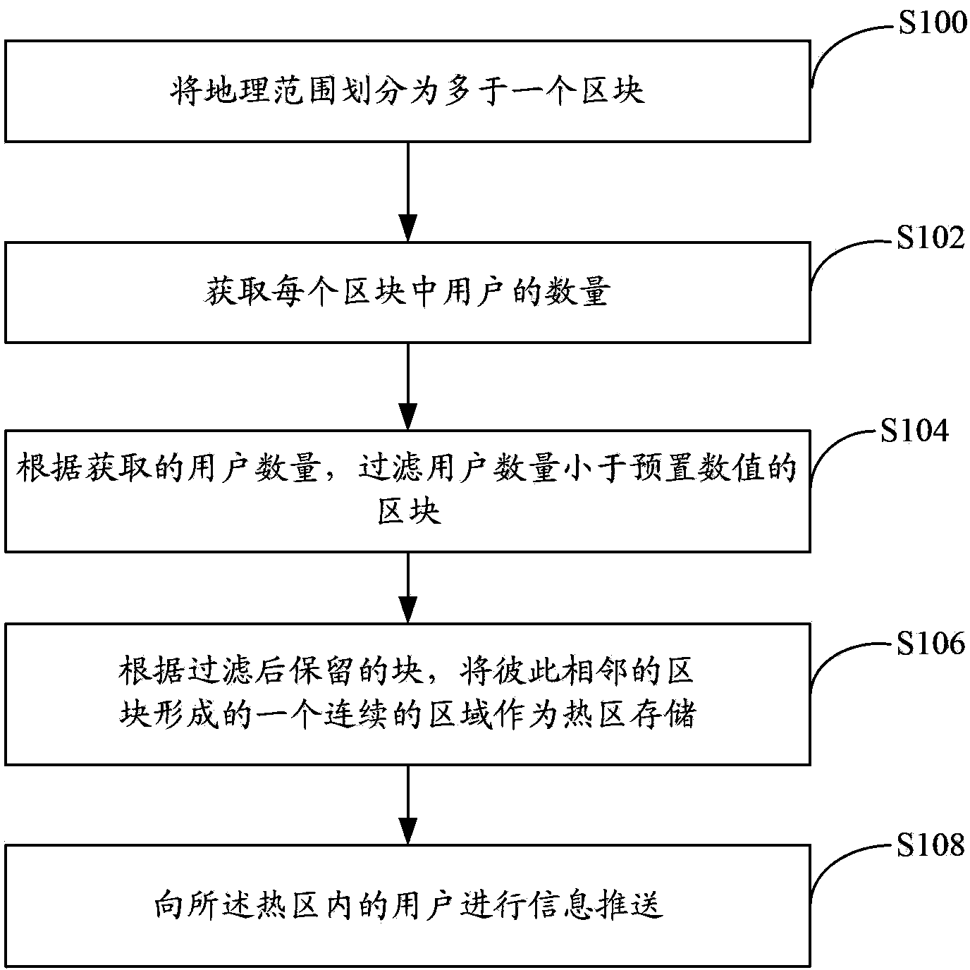
[0036] An embodiment of the present invention provides a method for pushing information based on a filter clustering method. Such as figure 1 As shown, the method includes:
[0037] Step S100, divide the geographical area into more than one block. Geographic scope can refer to an area with a certain area. For example, the total area of Shenzhen can be used as a geographical scope, or the total area of China can be used as a geographical scope; the geographical scope can be divided into smaller blocks as a plane, here The so-called blocks can be regular and closely arranged figures, for example: circles, squares, rectangles, hexagons, pentagons, etc. of the same size; or blocks can also be irregular figures of different sizes Stitching seamlessly forms geographic ranges. In order to facilitate machine implementation, the present invention can be realized by using a square grid as the so-called "block" in the embodiment. Each block also represents a geographic area of ...
Embodiment 2
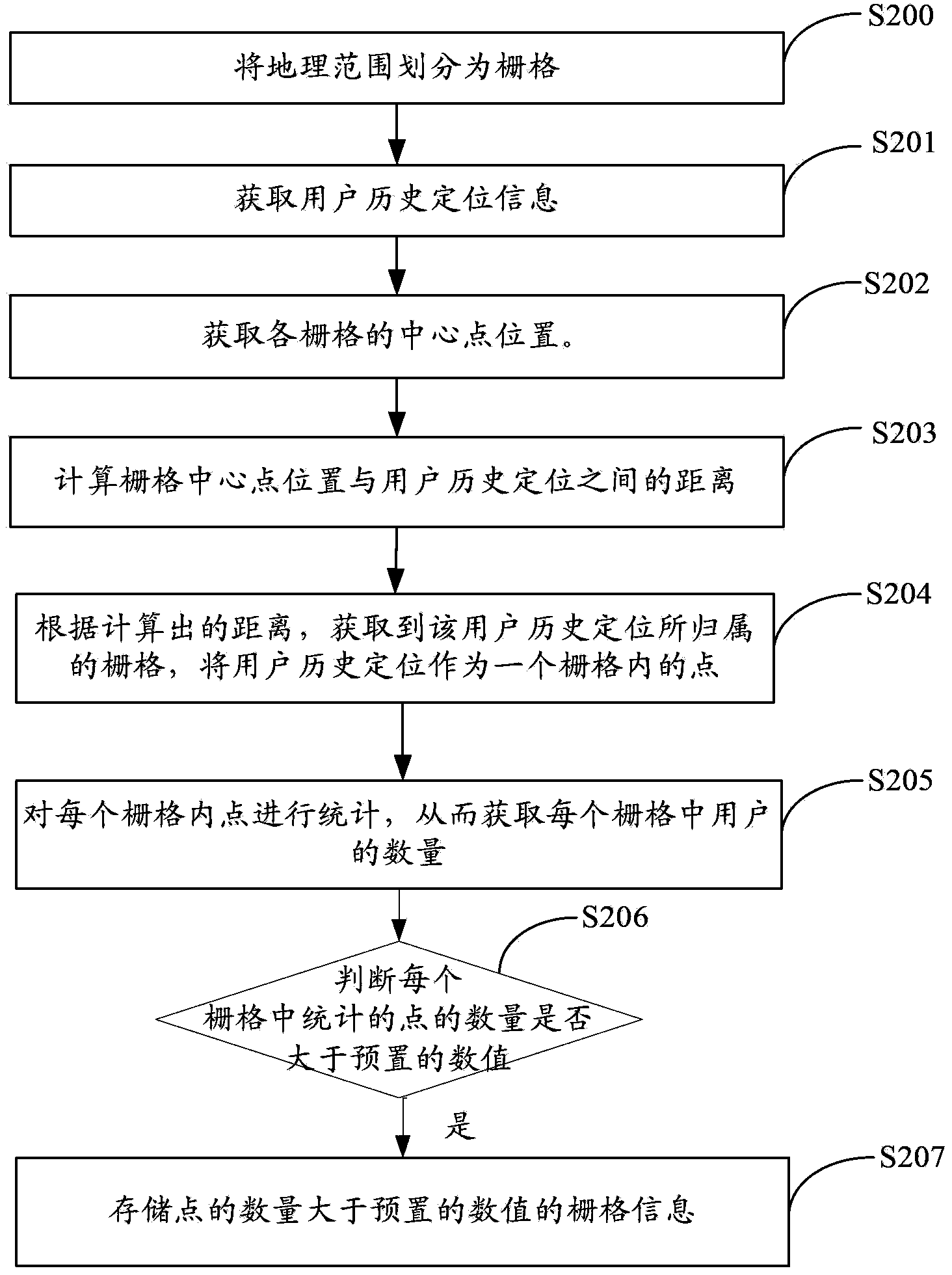
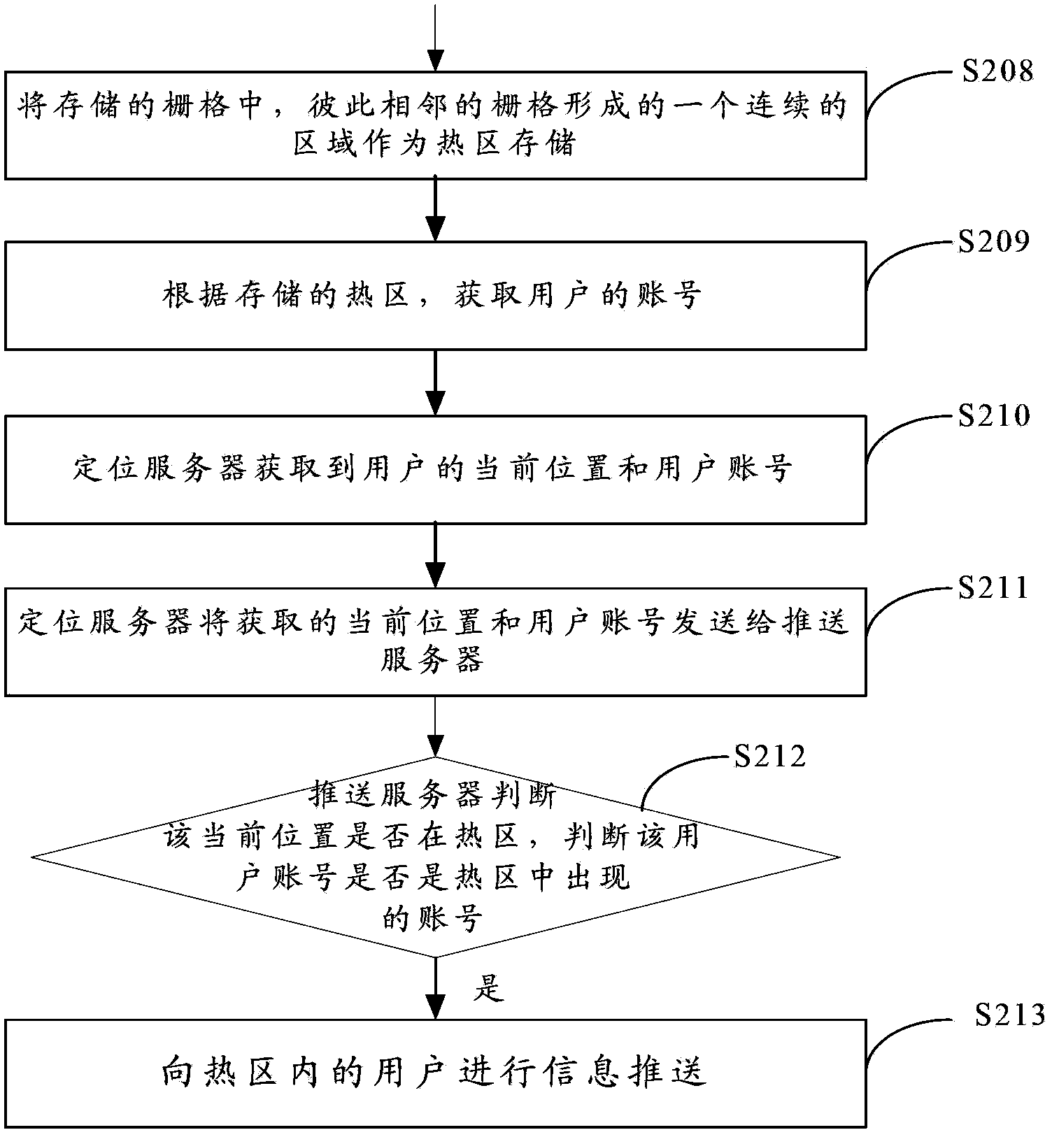
[0050] An embodiment of the present invention provides a method for pushing information based on a filter clustering method. Such as Figure 2a with Figure 2b As shown, the method includes:
[0051] Step S200, the server divides the geographical range into grids. Among them, specifically, the surface of a certain geographical area (for example: the two-dimensional plane of Shenzhen City) can be divided into grid arrays of uniform size and close proximity. The smallest unit of the grid can be a square or a rectangle, which can be based on specific design requirements However, the embodiment of the present invention focuses on the case where the smallest grid unit is a square for description.
[0052] The server obtains the user's location according to the positioning operation, and the user's specific location falls into a specific grid, which is convenient for the server to calculate relevant data based on the user's historical location information, as reference informatio...
Embodiment 3
[0074] An embodiment of the present invention provides a server, such as image 3 As shown, the server includes: a segmentation unit 300, an acquisition quantity unit 302, a filtering unit 304, an aggregation unit 306, and a service unit 308;
[0075] The segmentation unit 300 is configured to divide the geographical range into more than one block. As a plane, the geographical range can be divided into smaller blocks. The blocks mentioned here can be regular and closely arranged graphics, such as: circles, squares, rectangles, hexagons, pentagons, etc. of the same size etc.; or a block may also be a geographical range formed seamlessly by splicing irregular graphics of different sizes. In order to facilitate machine implementation, the present invention can be realized by using a square grid as the so-called "block" in the embodiment. Each block also represents a geographic area of a certain size.
[0076] The server obtains the user's location according to the positionin...
PUM
 Abstract
Description
Claims
Application Information
 - R&D
- Intellectual Property
- Life Sciences
- Materials
- Tech Scout
- Unparalleled Data Quality
- Higher Quality Content
- 60% Fewer Hallucinations
Browse by: Latest US Patents, China's latest patents, Technical Efficacy Thesaurus, Application Domain, Technology Topic, Popular Technical Reports.
© 2025 PatSnap. All rights reserved.Legal|Privacy policy|Modern Slavery Act Transparency Statement|Sitemap|About US| Contact US: help@patsnap.com


