Method for carrying out inclined stripe imaging on targets in agile satellite maneuvering
A technology of oblique strips and satellites, applied in the field of aerospace remote sensing, to achieve the effects of simplified mission planning, high efficiency, and improved imaging performance
- Summary
- Abstract
- Description
- Claims
- Application Information
AI Technical Summary
Problems solved by technology
Method used
Image

Examples
Embodiment Construction
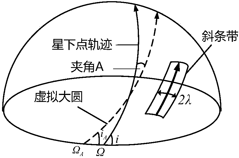
[0025] The strip area forming a certain angle with the track of the sub-satellite point is called "oblique strip". At present, there is no relevant discussion on "slant strips". However, if you want to observe a long and narrow target area and use "slant strips" to cover the target area, its geometric definition and coverage judgment method must be given. On this basis, it is necessary to give the attitude calculation method of the satellite optical axis pointing to the target strip in real time to realize the imaging.
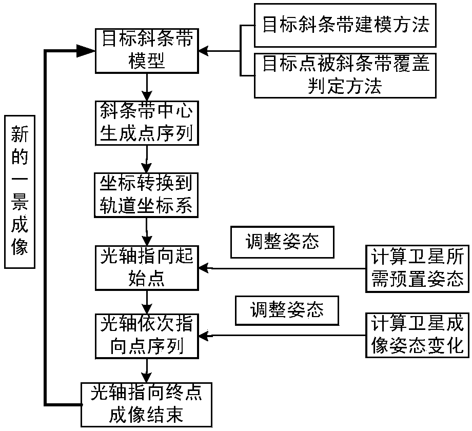
[0026] like figure 1 As shown, it is a flow chart of the method of the present invention. From a large perspective, the method of the present invention mainly includes two components: the model establishment of the ground target strip and the imaging of the target oblique strip.
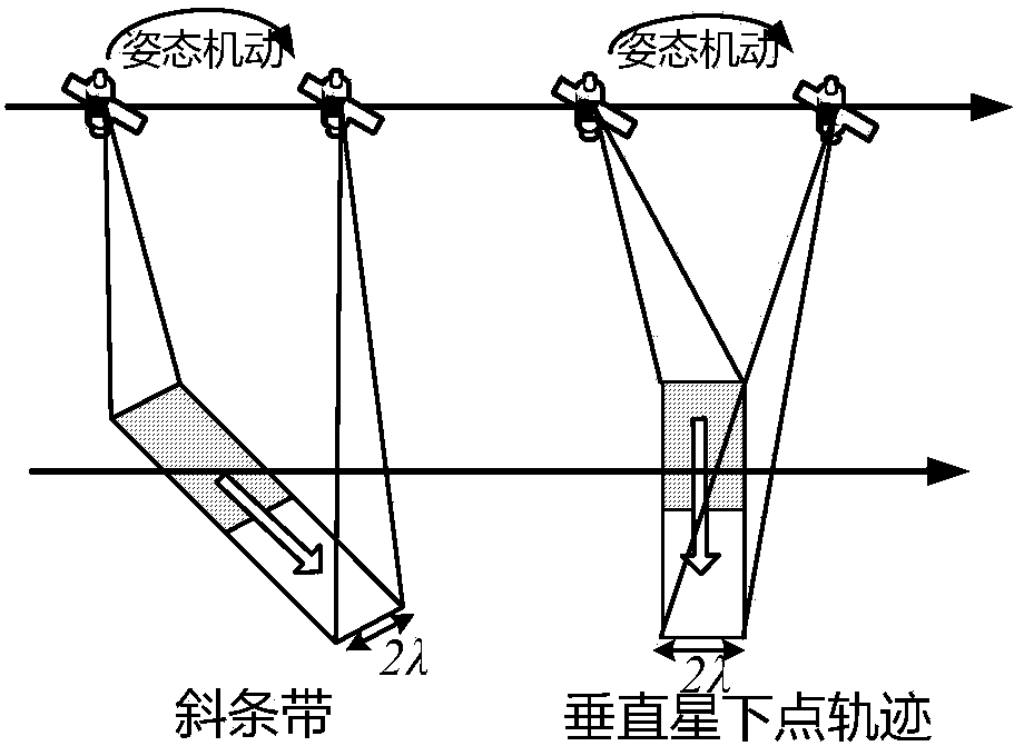
[0027] To complete the imaging deviated from the sub-satellite point, it is first necessary to model the target area that deviates from the track of the sub-satellite point, and the...
PUM
 Abstract
Description
Claims
Application Information