Flight method of aircraft passing through radar area

A technology of aircraft and radar, applied in the field of aircraft navigation, can solve problems that are rarely considered at the same time

Inactive Publication Date: 2015-03-11
CHINESE ACAD OF SURVEYING & MAPPING
View PDF8 Cites 16 Cited by
  • Summary
  • Abstract
  • Description
  • Claims
  • Application Information

AI Technical Summary

Problems solved by technology

[0005] Traditional flight path planning often only considers the earth's surface terrain environment and meteorological environment, and is designed for

Method used


Image

  • Flight method of aircraft passing through radar area
  • Flight method of aircraft passing through radar area
  • Flight method of aircraft passing through radar area

Examples


Embodiment Construction

[0054] In order to facilitate those skilled in the art to understand and implement the present invention, the present invention will be further described in detail below in conjunction with the accompanying drawings and specific embodiments.

[0055] Such as Figure 8As shown, the present embodiment provides a flight method for an aircraft passing through a radar zone, which specifically includes the following steps:

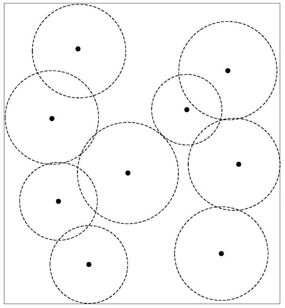
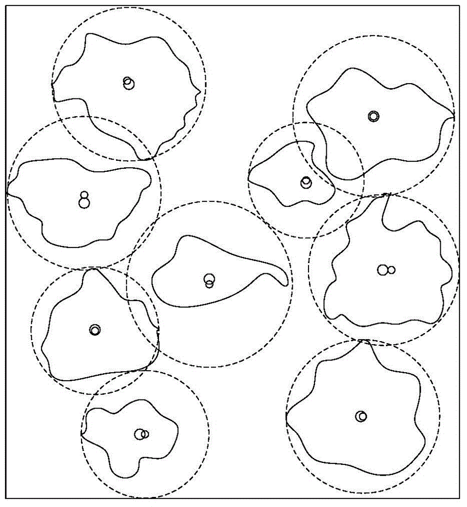
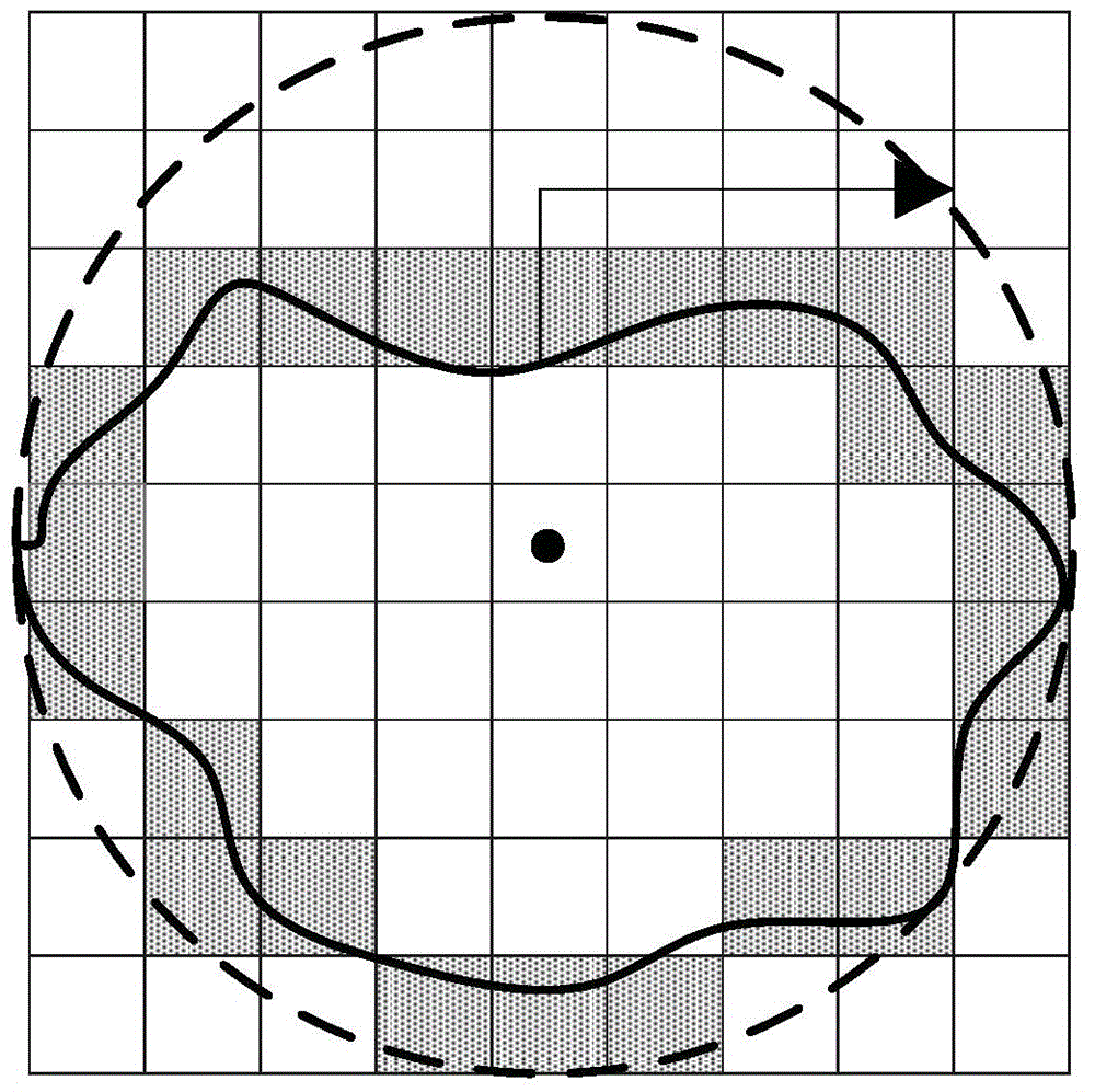
[0056] 1. Obtain radar site distribution data, radar attribute data, radar deployment area terrain data and aircraft attributes;

[0057] Among them, the main data preprocessing includes the following parts:

[0058] (1) Radar site distribution data, which is mainly used to calculate the raster map of the radar field of view, and the latitude and longitude data of the radar station distribution are associated with the spatial database of the radar attribute data (such as the radar's own parameters such as the radius of the radar field of view).

[0059] (2) Th...


PUM


Abstract

The invention relates to the field of aircraft navigation, and in particularly relates to a flight method of an aircraft passing through radar area, and the method comprises the following steps: S1, obtaining radar site distribution data, radar attribute data, radar deployment area terrain data and aircraft attributes; S2, according to the curvature of the earth and the radar deployment area terrain data, calculating radar visual range; S3, calculating connectivity analysis of grid points in a radar invisible areato obtain all radar grid points to gather and construct a safe flight planning path; S4, and navigating the aircraft according to the safe flight planning path in the S3. The flight method fully considers the obstacle of complex terrain environment and the aircraft itself attribute constraints, the most prominent is the consideration of the radar area constraint, complex battlefield environment is fully simulated and analyzed to infinitely close to the real battlefield geographical environment, and optimized path navigation for the aircraft to safely pass through the deployment area is provided.

Description

technical field [0001] The invention relates to the field of aircraft navigation, in particular to a flight method for an aircraft passing through a radar zone. Background technique [0002] With the development of science and technology, path planning is a key technology in some fields. Many scholars at home and abroad have studied path planning and achieved a lot of results. Path planning has a wide range of applications, and is currently mainly used in route navigation, virtual reality, intelligent computing, and robotics. [0003] Path planning is one of the main research contents of motion planning. Motion planning consists of path planning and trajectory planning. The sequence of points or curves connecting the starting point and the end point is called a path, and the strategy that forms the path is called path planning. There are many researches on path planning in robotics and virtual reality. The main research contents can be summarized as: 1) path planning in st...

Claims


Application Information

Patent Timeline
IPC IPC(8): G01C21/20
CPCG01C21/20
Inventor 陶坤旺张福浩胡璐锦仇阿根
Owner CHINESE ACAD OF SURVEYING & MAPPING
Why Eureka
Try Eureka