Geographical coordinate projection transformation method

A technology of projection change and geographic coordinates, applied in the field of spatial information

Inactive Publication Date: 2015-04-22
CHINA AGRI UNIV
View PDF3 Cites 13 Cited by
  • Summary
  • Abstract
  • Description
  • Claims
  • Application Information

AI Technical Summary

Problems solved by technology

[0009] The technical problem to be solved by the present invention is how to reduce the complexity of the calculation method of geographic coordinate projection changes and improve the efficiency and accuracy of large data conversion

Method used


Image

  • Geographical coordinate projection transformation method
  • Geographical coordinate projection transformation method
  • Geographical coordinate projection transformation method

Examples


Embodiment Construction

[0073] The present invention will be described in further detail below in conjunction with the accompanying drawings and embodiments. The following examples are used to illustrate the present invention, but should not be used to limit the scope of the present invention.

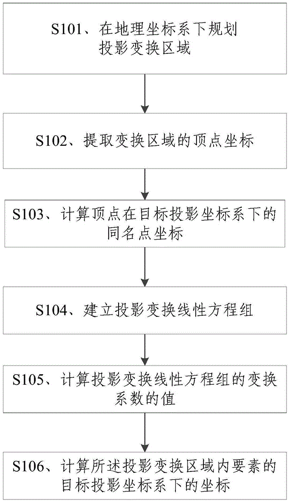
[0074] Figure 1A It is a flow chart of a method for changing geographic coordinate projection of the present invention; the method includes the following steps:

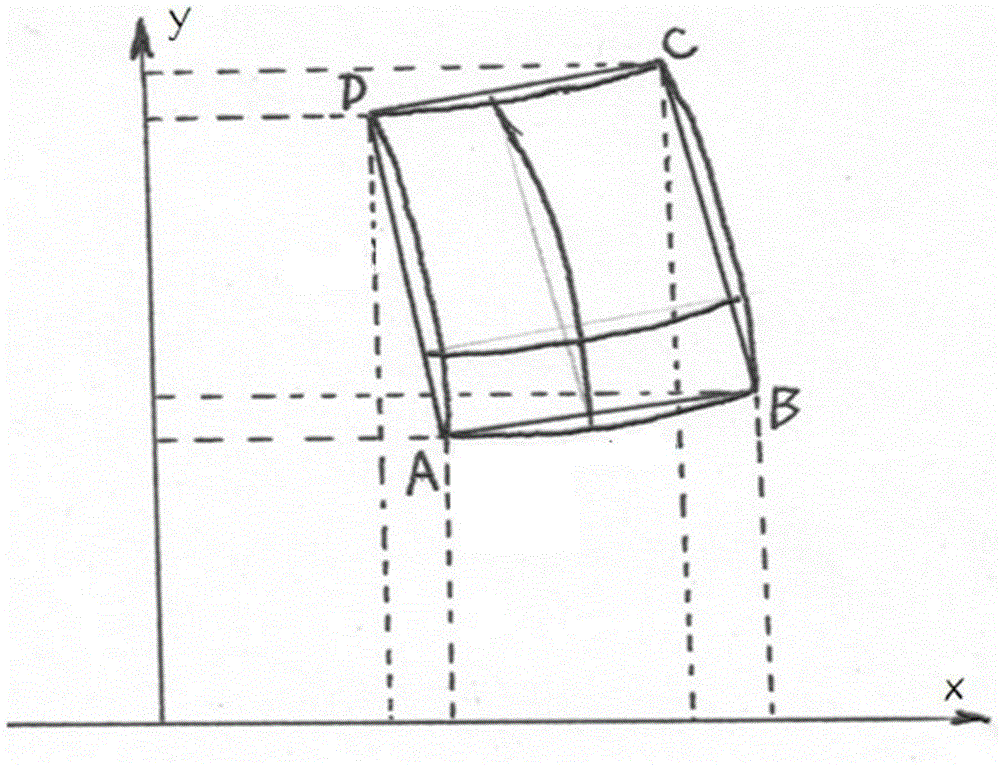
[0075] S101. Planning the projection area under the geographic coordinate system as a two-dimensional projection transformation area, the projection transformation area is a geometric figure with the smallest area that can cover the projection area; preferably a rectangle, and the projection transformation area is A rectangle with the smallest area that can cover the projected area;

[0076] The earth can be modeled as a spheroid very approximately, that is to say, each meridian of the earth is an ellipse with the same north-south symmetry axis, t...


PUM


Abstract

The invention discloses a geographical coordinate projection transformation method. The method comprises the steps of extracting the coordinates of a vertex of a transformation area, calculating the coordinates of a homonymy point of the vertex under a target projected coordinate system, setting up a projection transformation linear system of equations, and calculating the coordinates of elements in the projection transformation area under the target projected coordinate system according to the projection transformation linear system of equations. Meridians and latitude lines in a small local area are represented through straight lines respectively, spherical surface calculation is converted to planar calculation, the calculating speed of geographical coordinate projection transformation can be increased, error control can be achieved by controlling the size of the local area, and the requirements of actual application can be met with little cost, wherein the actual application relates to mass data transformation, and the requirements for transformation precision and transformation speed are high.

Description

technical field [0001] The present invention relates to the technical field of spatial information, and more specifically relates to a method for changing geographic coordinate projection. Background technique [0002] Latitude and longitude and plane coordinates are two basic data coordinate systems of GIS. Point data collected by GPS and satellite image data obtained by sensors are often latitude and longitude data (WGS84), while map data processed and used in industrial application fields, including land resource management, transportation management, etc., no matter Whether it is a vector format or a grid format, it is often XY data based on plane coordinates. Therefore, in the actual integrated application process of multi-source spatial data such as GPS data, remote sensing data, and map data, the speed and accuracy of longitude-latitude data projection transformation are one of the key factors affecting application efficiency and accuracy. [0003] There is a very c...

Claims


Application Information

Patent Timeline
Patent Type & Authority Applications(China)
IPC IPC(8): G06T3/00
CPCG06T3/0043G06T2207/30181
Inventor 严泰来叶思菁朱德海李林张超姚晓闯杜振博刘帝佑
Owner CHINA AGRI UNIV
Why Eureka
Try Eureka