

Method for analyzing elevation matching quality of laser radar flight strip
A laser radar, matching quality technology, applied in the field of remote sensing, can solve the problems of low efficiency and inability to evaluate the data of the flight zone, and achieve the effect of comprehensive evaluation results and saving manpower and material resources.
- Summary
- Abstract
- Description
- Claims
- Application Information
AI Technical Summary
Problems solved by technology
Method used
Image

Examples
Embodiment Construction
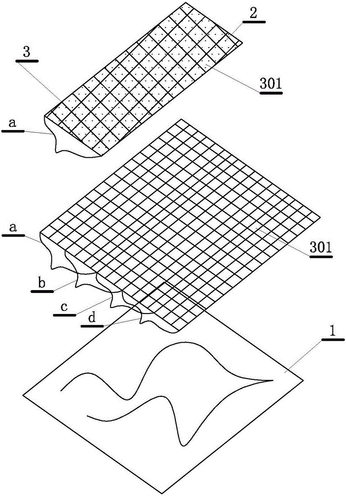
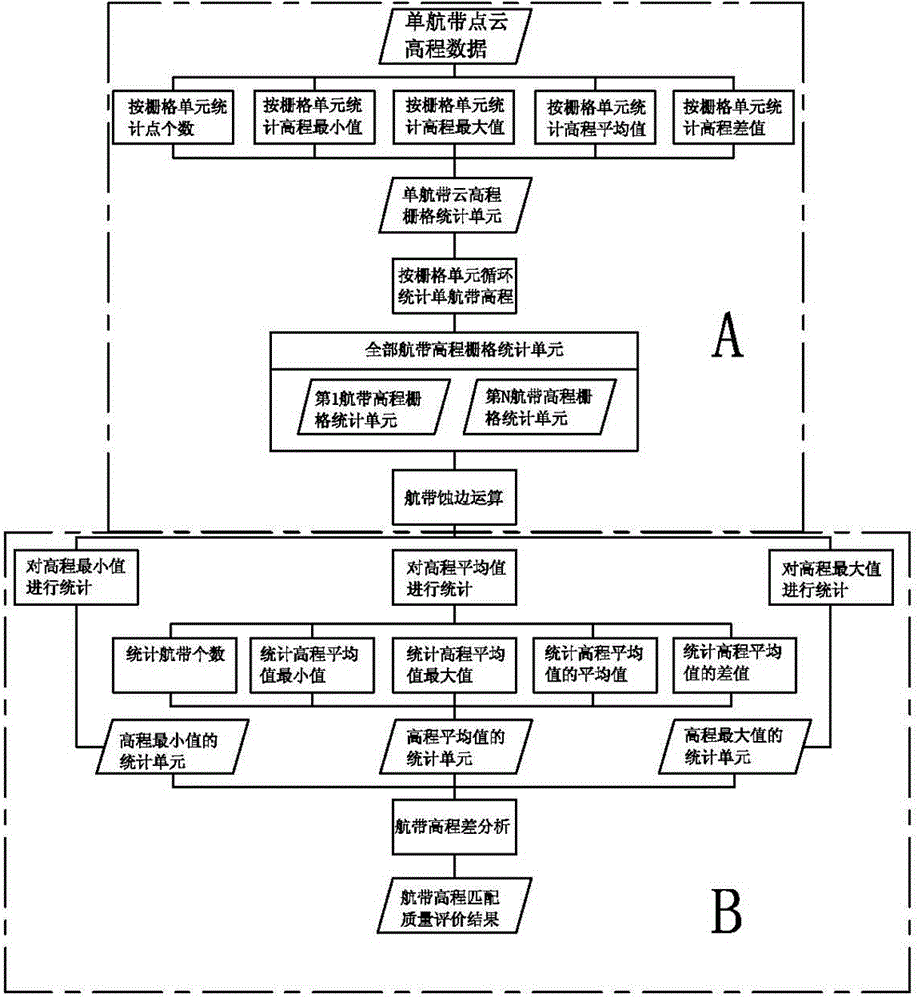
[0025] A method for analyzing the quality of lidar flight zone elevation matching, such as figure 1 and figure 2 As shown, it includes the acquisition of lidar point cloud data 2 covering multiple airways a, b, c, and d covering an area 1, which is the ground object obtained by the airborne lidar scanning system from different directions for radar scanning of the same area Echo shooting point data, there are overlapping areas between multiple flight strips, the point cloud data includes the plane coordinates and elevation data of each echo point; it obtains the echo through parameters such as GPS, IMU and laser direction vector Obtained in the three-dimensional coordinates of the point are known plane coordinates and elevation data, wherein the method includes the step of establishing a plane coordinate rasterization of the point cloud data, a step of processing the grid data of the overlapping area, and a step of outputting data results;
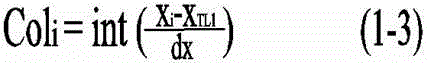
[0026] The described planar coordi...
PUM
 Abstract
Description
Claims
Application Information