

Modeling method and device for zenith tropospheric delay as well as measuring method and device
A zenith troposphere and delay modeling technology, which is applied in the field of satellite positioning and can solve the problems of complex use of VMF1 functions, real-time download, and no zenith delay correction model in the troposphere.
- Summary
- Abstract
- Description
- Claims
- Application Information
AI Technical Summary
Problems solved by technology
Method used
Image

Examples
Embodiment Construction
[0047] Below in conjunction with the drawings, preferred embodiments of the present invention are given and described in detail.
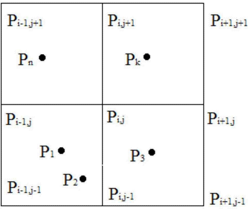
[0048] Since there are many GNSS stations distributed in the land state network, and the distribution is relatively uniform in mainland China, it is feasible to use the zenith delay measured by GNSS stations for modeling. The present invention adopts the tropospheric zenith delay measured by the GNSS measuring station of the land state network, and analyzes the time-space characteristics of the tropospheric zenith delay corresponding to each GNSS measuring station, and performs regional modeling on this basis, and the specific modeling steps as follows:
[0049] First, obtain the tropospheric zenith delay measured by each land state network GNSS station distributed in mainland China.
[0050] Then, since the dry delay, which accounts for 90% of the tropospheric zenith delay, is related to air temperature and pressure, the pressure decreases expone...
PUM
 Abstract
Description
Claims
Application Information