Remote sensing image fusion method based on multi-redundancy dictionary and sparse reconstruction

A technology of remote sensing image fusion and sparse reconstruction, applied in the field of image fusion, it can solve the problem of difficulty in balancing spectral information and spatial resolution, and achieve the effect of improving spatial resolution and quality.

Active Publication Date: 2015-07-22
XIDIAN UNIV
View PDF10 Cites 12 Cited by
  • Summary
  • Abstract
  • Description
  • Claims
  • Application Information

AI Technical Summary

Problems solved by technology

[0007] The purpose of the present invention is to address the deficiencies of the above-mentioned prior art, and propose a remote sensing image fusion method based on multiple redundant dictionaries and sparse reconstruction, to solve the problem of spectral information and space in the fusion process of multispectral and panchromatic images in the prior art. It is difficult to balance the resolution and improve the quality of the fusion image

Method used


Image

  • Remote sensing image fusion method based on multi-redundancy dictionary and sparse reconstruction
  • Remote sensing image fusion method based on multi-redundancy dictionary and sparse reconstruction
  • Remote sensing image fusion method based on multi-redundancy dictionary and sparse reconstruction

Examples


Embodiment Construction

[0031] The technical solutions and effects of the present invention will be described in further detail below with reference to the accompanying drawings.

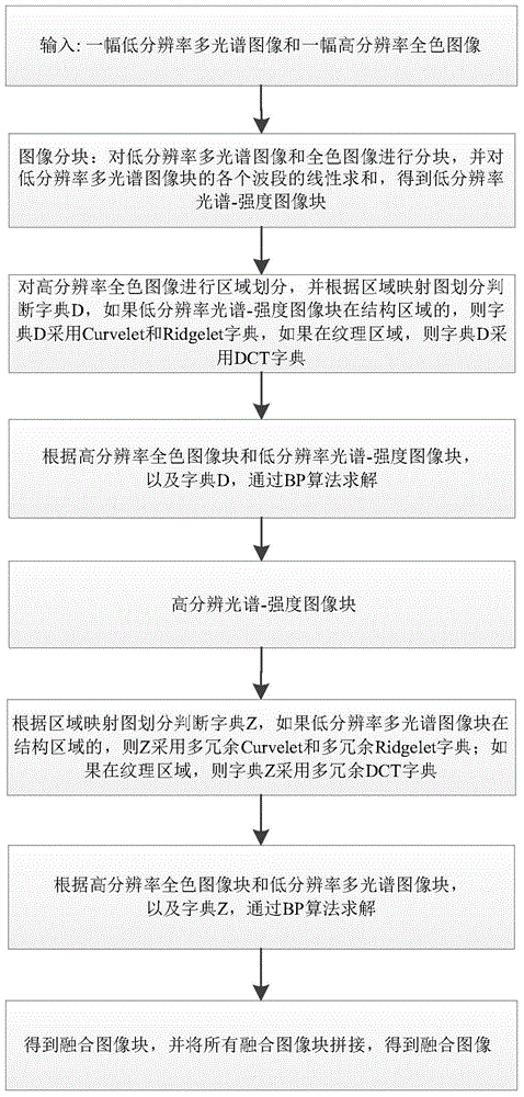
[0032] refer to figure 1 , the implementation steps of the present invention are as follows:

[0033] Step 1, input image.

[0034] A high-resolution panchromatic image f and a low-resolution multispectral image g whose size is a quarter of the size of the high-resolution panchromatic image are selected from QuickBird satellite images as input images.

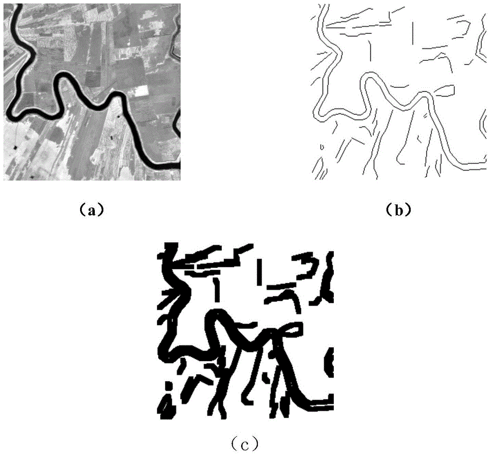
[0035] Step 2, obtain the region map of the high-resolution panchromatic image.

[0036] 2a) Demarcation of structural and non-structural regions of high-resolution panchromatic images

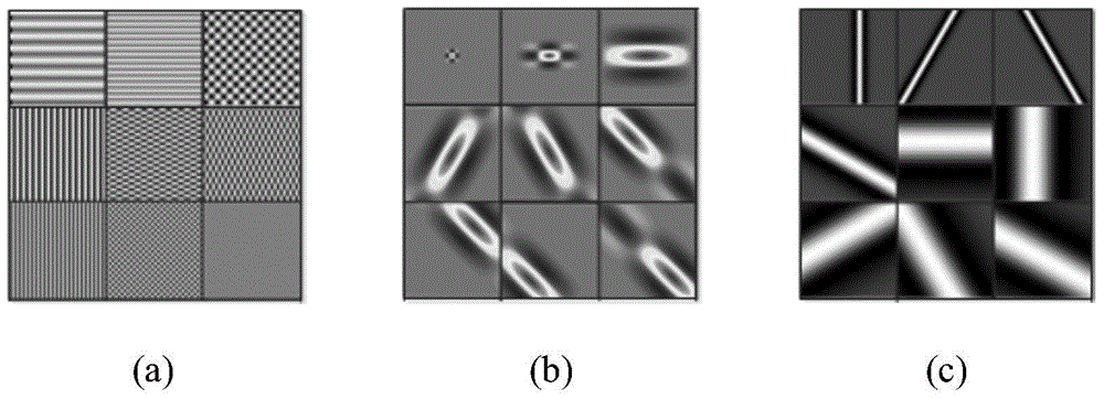
[0037] The division of regions can be obtained according to methods such as traditional edge detection methods, region growth, and Primal Sketch diagrams. The present invention obtains according to Primal Sketch diagrams, that is, first extracts the Primal of the high-resolution panchrom...


PUM


Abstract

The invention discloses a remote sensing image fusion method based on multi-redundancy dictionary and sparse reconstruction and mainly solves the problem that spectral information and spatial resolution are imbalanced in multi-spectrum and panchromatic image fusion process. The remote sensing image fusion method includes steps of 1, splitting high-resolution panchromatic image and low-resolution multi-spectrum image blocks; 2, summing various wave bands linearly of the low-resolution multi-spectrum image blocks to obtain low-resolution spectrum-strength image blocks; 3, acquiring the high-resolution spectrum-strength image blocks according to the low-resolution spectrum-strength image blocks; 4, acquiring fusion image blocks according to the high-resolution spectrum-strength image blocks and the low-resolution multi-spectrum image blocks; 5, combining the fusion image blocks to obtain fusion images. The remote sensing image fusion method has the advantages of spectrum retainability and high spatial resolution of the fusion images and can be used for object identification, meteorological monitoring, environmental monitoring, urban planning and disaster and damage prevention and reduction.

Description

technical field [0001] The invention belongs to the technical field of intelligent image processing, and in particular relates to an image fusion method, which can be used in target recognition, meteorological monitoring, environmental monitoring, land utilization, urban planning, and disaster prevention and reduction. Background technique [0002] In recent years, satellite technology has developed rapidly on a global scale. So far, major developed countries and a few developing countries in the world, including China and India, have launched hundreds of satellites successively. The operating bands cover visible light to invisible near-infrared, Short-wave infrared, mid-infrared, far-infrared, microwave and other broad frequency domains. These satellites transmit massive amounts of satellite remote sensing data covering the globe to satellite ground stations and mobile receiving stations scattered around the world every day. These remote sensing data provide rich and valua...

Claims


Application Information

Patent Timeline
Patent Type & Authority Applications(China)
IPC IPC(8): G06T3/40
CPCG06T3/4053G06T3/4061
Inventor 刘芳石程李玲玲郝红侠焦李成尚荣华马文萍杨淑媛马晶晶
Owner XIDIAN UNIV
Why Eureka
Try Eureka