Road boundary detection method based on three-dimensional laser radar

A three-dimensional laser and boundary detection technology, applied in the field of intelligent vehicle environment perception, can solve the problems that cannot be applied to rural roads, etc., and achieve the effect of small impact, low time complexity and good robustness

Inactive Publication Date: 2015-08-19
HEFEI INSTITUTES OF PHYSICAL SCIENCE - CHINESE ACAD OF SCI
View PDF2 Cites 61 Cited by
  • Summary
  • Abstract
  • Description
  • Claims
  • Application Information

AI Technical Summary

Problems solved by technology

[0005] The methods mentioned in the above two patents are only applicable to the situation where there are no obstacles such as vehicles on the road, and CN201110002490 is only aimed at structured roads. For u

Method used


Image

  • Road boundary detection method based on three-dimensional laser radar
  • Road boundary detection method based on three-dimensional laser radar
  • Road boundary detection method based on three-dimensional laser radar

Examples


Embodiment Construction

[0040] Below in conjunction with embodiment the present invention is described in further detail:

[0041] The road boundary detection method based on three-dimensional laser radar, specifically:

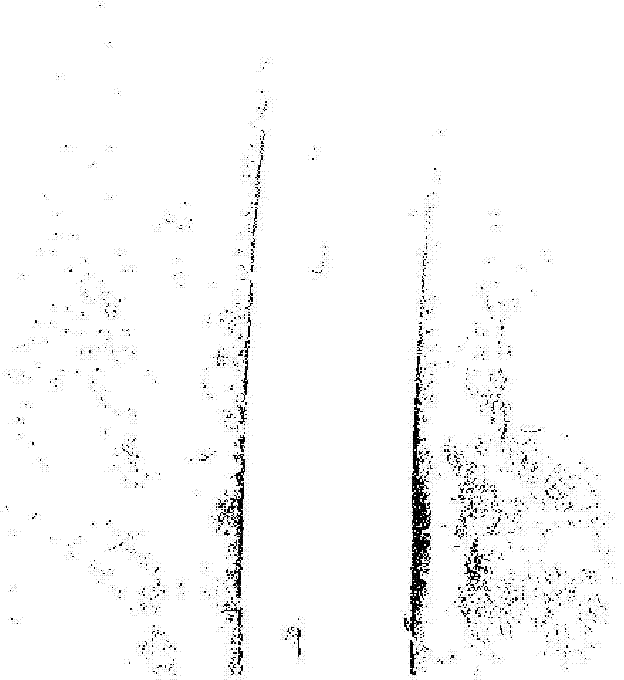
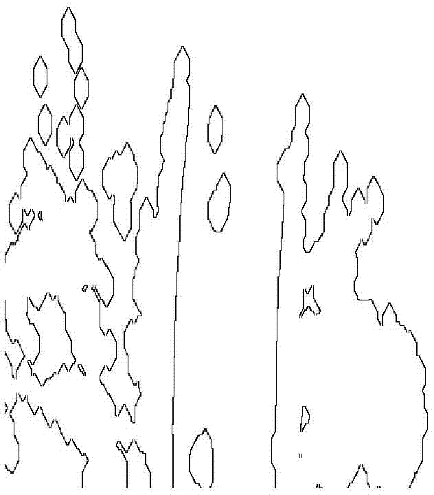
[0042] Step 1, projecting the point cloud data collected by the 3D lidar to generate a binary raster image;

[0043] Step 1.1, transform the data obtained by the 3D lidar into the car body coordinate system, and the 3D data point P in the radar coordinate system v and the point P in the body coordinate system c The conversion relationship is P c =P v R+t, where R and t are external parameters obtained after calibration.

[0044] Step 1.2, divide the point cloud data into a series of small squares with a side length of 0.2m within the rectangular range of 82.4 meters in front of the origin of the car body coordinate system, 20 meters in the back, and 51.2 meters in the left and right, and a square is a grid Grid, get 512*512 grids, where the origin of the car body coordinate sys...


PUM


Abstract

The present invention discloses a road boundary detection method based on a three-dimensional laser radar. In the process of intelligent vehicle driving, point cloud data collected by a vehicle-mounted three-dimensional laser radar is subjected to rasterizing processing to generate a binary raster graphic. The binary raster graphic is subjected to a distance conversion operation to obtain a distance grey-scale map, a filing distance is smaller than the narrow space between obstacle points of certain thresholds, the overall contour of the obstacle points is not changed, and an obstacle area contour map is obtained. A region growing method is used, with the position of an intelligent vehicle as a start point, the region growing is carried out forward, the passable area contour map of a road is obtained, and combined with the original binary raster graphic, a road area contour map is obtained. The contours of two sides of the road area contour map are extracted, the second function fitting is carried out, and a road boundary is obtained. The method is applicable to an urban road, a rural road and other roads, the influence of obstacles on a detection effect is small, the time complexity is low, the real-time processing is achieved, day and night work is achieved, and the algorithm robustness is good.

Description

Technical field: [0001] The invention mainly relates to the field of environment perception of intelligent vehicles, and in particular to a real-time detection method of road boundaries based on three-dimensional laser radar, which is applied to autonomous driving or assisted driving of intelligent vehicles. Background technique: [0002] One of the prerequisites for autonomous driving or assisted driving of smart cars is to quickly and effectively detect road areas. Most of the current research on road detection is based on images or radar. The image shows the most direct color and texture information, and there is good coherence between pixels, so the research on image-based road boundary detection is mostly carried out according to the characteristics of the road boundary. However, the shortcomings of the image are also obvious. The detection effect is greatly disturbed by factors such as light intensity and road surface material, and the field of view of the camera is l...

Claims


Application Information

Patent Timeline
IPC IPC(8): G06K9/00
CPCG06V20/588
Inventor 梁华为陈涛王智灵
Owner HEFEI INSTITUTES OF PHYSICAL SCIENCE - CHINESE ACAD OF SCI
Why Eureka
Try Eureka