
Map display method and apparatus

A display method and map technology, applied in the field of communication, can solve problems such as inaccurate real-time road conditions and long transmission time, and achieve the effect of improving speed and efficiency

Active Publication Date: 2015-10-21
XIAOMI INC
View PDF4 Cites 14 Cited by
  • Summary
  • Abstract
  • Description
  • Claims
  • Application Information

AI Technical Summary

Problems solved by technology

In related technologies, the real-time traffic condition service usually obtains real-time traffic condition data by the server, and then generates a data packet and sends it to the terminal. This method takes a long time to transmit, and there will be a certain delay when the real-time traffic condition data arrives at the terminal. Real-time traffic conditions are not accurate

Method used


Image

  • Map display method and apparatus
  • Map display method and apparatus
  • Map display method and apparatus

Examples


Embodiment Construction

[0106] The exemplary embodiments will be described in detail here, and examples thereof are shown in the accompanying drawings. When the following description refers to the accompanying drawings, unless otherwise indicated, the same numbers in different drawings represent the same or similar elements. The implementation manners described in the following exemplary embodiments do not represent all implementation manners consistent with the present disclosure. Rather, they are only examples of devices and methods consistent with some aspects of the present disclosure as detailed in the appended claims.

[0107] The terms used in the present disclosure are only for the purpose of describing specific embodiments, and are not intended to limit the present disclosure. The singular forms "a", "said" and "the" used in the present disclosure and appended claims are also intended to include plural forms, unless the context clearly indicates other meanings. It should also be understood th...


PUM


Abstract

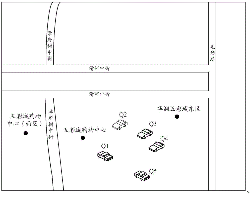
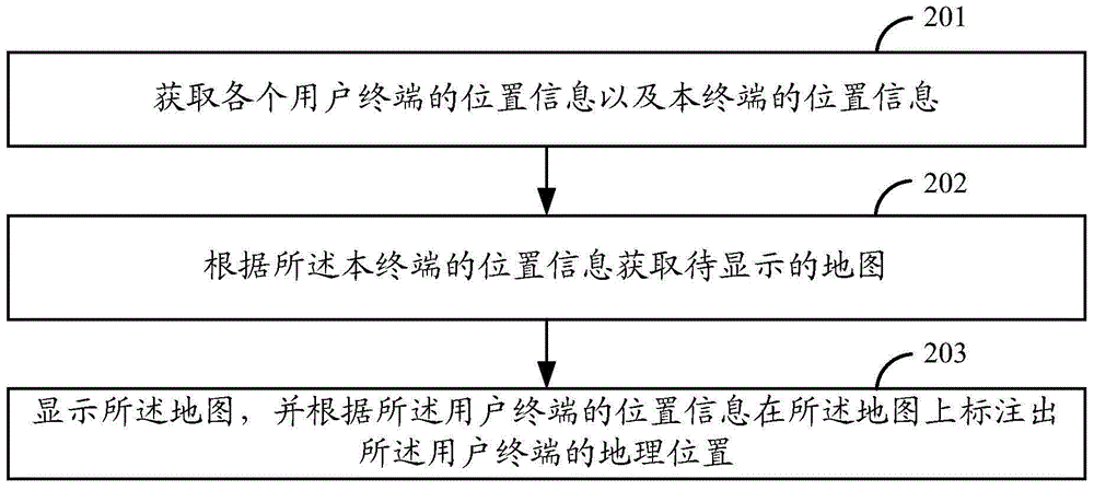
The present invention relates to a map display method and apparatus. The method comprises: acquiring position information of each user terminal and position information of a local terminal; according to the position information of the local terminal, acquiring a map to be displayed; and displaying the map and according to the position information of the user terminals, labeling geographic positions of the user terminals on the map. According to the present invention, the terminal shares the respective position information, so that a speed that the terminal acquires the position information of other terminals can be improved, and thus, map display efficiency is obviously improved; and the terminal can more rapidly label the geographic position of each user terminal on the map, so that real-time road condition information is more accurate and user experience is good.

Description

Technical field [0001] This application relates to the field of communication technology, and in particular to a map display method and device. Background technique [0002] Geographic location data is currently widely used in various application fields. There are currently a variety of applications that provide services for users around geographic location data, such as electronic map services, driving navigation services, route search services, and real-time traffic and road conditions services. In related technologies, the real-time road condition service usually obtains real-time road condition data from the server, and then generates data packets to send to the terminal. This method takes a long time to transmit, and there will be a certain delay when the real-time road condition data arrives at the terminal, resulting in the terminal obtaining Real-time traffic conditions are not accurate. Summary of the invention [0003] In order to overcome the problems in the related ar...

Claims


Application Information

Patent Timeline
IPC IPC(8): G06F17/30
CPCG06F16/29G06F16/9537
Inventor 谭康喜梁鑫许超
Owner XIAOMI INC
Learn More