
Wave and tide measuring method based on Beidou ground-based augmentation system
A ground-based enhancement system and tidal technology, which is applied to measurement devices, radio wave measurement systems, satellite radio beacon positioning systems, etc., can solve the problems of large size, large financial resources, and labor-intensive tidal wells, and achieve simple, convenient and reliable installation. , The effect of simple hardware and low cost
- Summary
- Abstract
- Description
- Claims
- Application Information
AI Technical Summary
Problems solved by technology
Method used
Image


Examples
Embodiment Construction
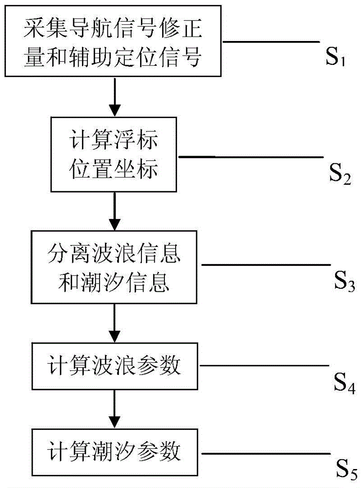
[0025] Combine below figure 1 A further description of the method of measuring waves and tides based on the Beidou ground-based augmentation system:
[0026] Firstly, the navigation signal correction and auxiliary positioning signal (S1) are collected from the Beidou ground-based augmentation system by using the differential data communication module installed in the buoy; then the buoy position coordinates (S2) are calculated according to the collected The obtained navigation signal correction and auxiliary positioning signal and the GNSS satellite signal output by the GNSS receiver execute the classic satellite differential positioning analysis method to calculate the three-dimensional position coordinates X, Y, Z of the buoy in the ECEF coordinate system; then separate the waves Information and tidal information (S3) is the three-dimensional position coordinate X of the wave separated from the three-dimensional position coordinates X, Y, Z of the buoy using a high-pass filt...
PUM
 Abstract
Description
Claims
Application Information