
Wireless sensor network positioning method based on unmanned autonomous aircraft

A wireless sensor and network positioning technology, applied in positioning, radio wave measurement systems, instruments, etc., can solve the problems of large positioning errors, achieve the effects of avoiding errors, avoiding positioning errors, reducing hardware costs and beacon deployment costs

Active Publication Date: 2016-02-24
WENZHOU UNIVERSITY
View PDF16 Cites 19 Cited by
  • Summary
  • Abstract
  • Description
  • Claims
  • Application Information

AI Technical Summary

Problems solved by technology

[0007] In order to overcome the shortcomings of the existing positioning algorithm based on mobile anchor nodes, which are affected by the irregular propagation of radio frequency signals and have large positioning errors, the present invention provides a wireless sensor network positioning method based on unmanned autonomous aircraft

Method used


Image

  • Wireless sensor network positioning method based on unmanned autonomous aircraft
  • Wireless sensor network positioning method based on unmanned autonomous aircraft
  • Wireless sensor network positioning method based on unmanned autonomous aircraft

Examples


Embodiment Construction

[0047] Embodiments of the present invention will be further described below in conjunction with accompanying drawings:

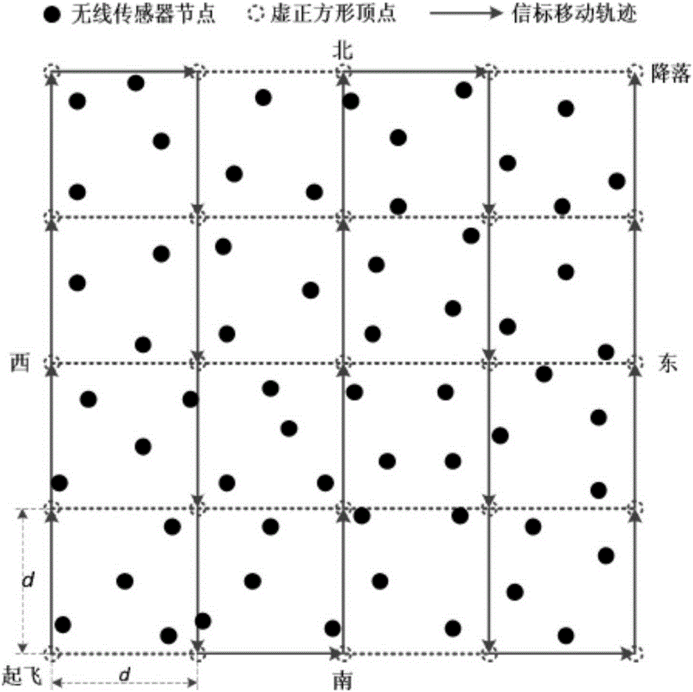
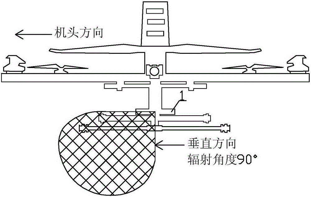
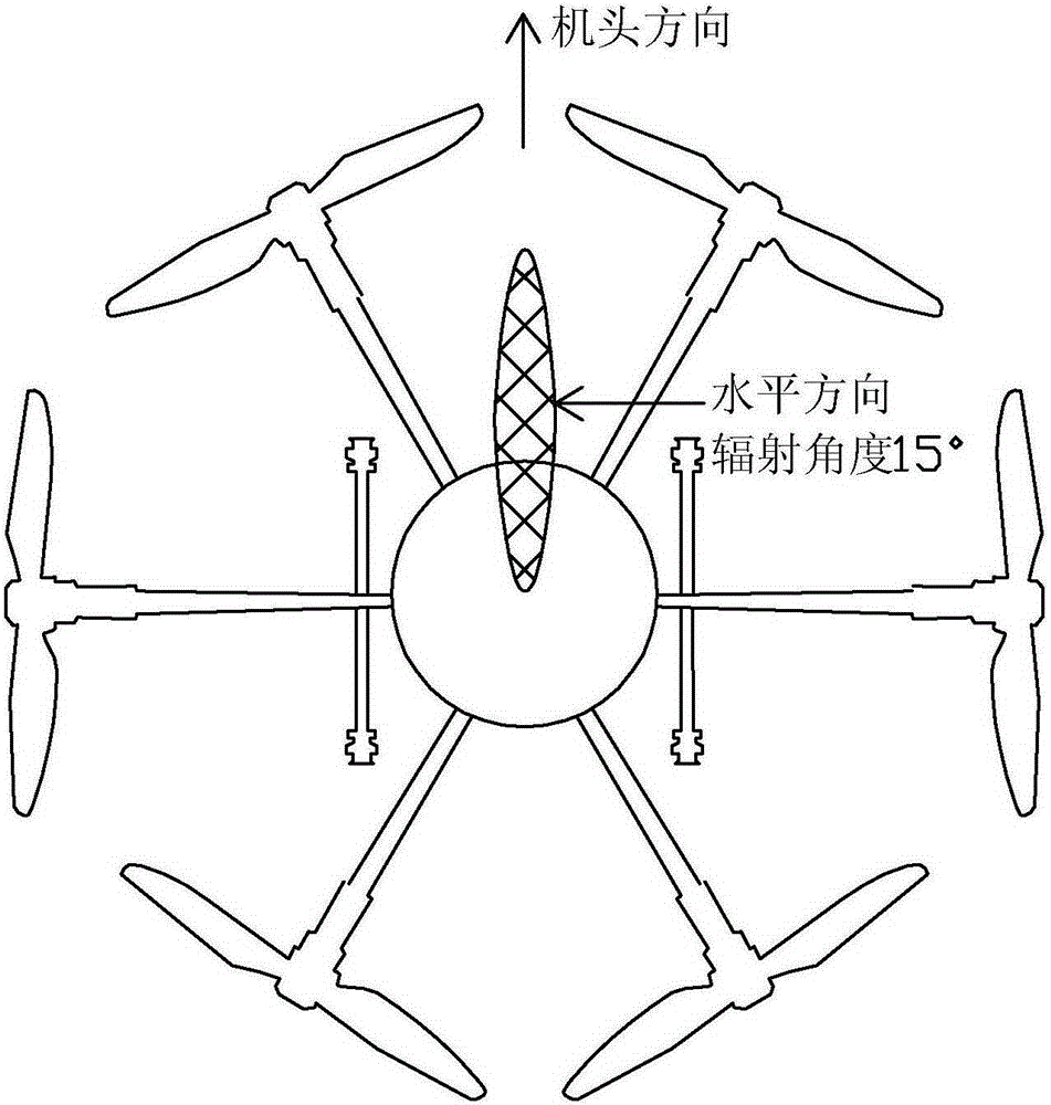
[0048] A wireless sensor network positioning method based on unmanned autonomous aircraft. The method uses an unmanned autonomous aircraft that carries a directional antenna, can know its own positioning information in real time, and can hover at a fixed point to carry a mobile anchor node. Each sensor node receives the mobile anchor node. Broadcast beacon signals and use geometric relationships to calculate its own position. The positioning method of the present invention is composed of three parts: mobile anchor node movement and beacon broadcast based on unmanned autonomous aircraft, beacon reception and processing of each sensor node, and geographic location calculation of each sensor node.

[0049] like figure 1 As shown, before the positioning is implemented, the sensor nodes in the wireless sensor network are randomly deployed in the sensor deploymen...


PUM


Abstract

The invention relates to a wireless sensor network positioning method based on an unmanned autonomous aircraft, and the method comprises the steps: employing the unmanned autonomous aircraft to carry a directional antenna and a mobile anchor node for movement and beacon broadcast; enabling all sensor nodes to be distributed in a sensor arrangement region for receiving and processing a beacon signal; and calculating geographic information according to the positioning information corresponding to a maximum value point of at least three receiving signal intensities stored by each sensor node. There is no need to convert the receiving signal intensities into distances, thereby effectively avoiding errors caused by the conversion from the receiving signal intensities to distances. A wireless signal transmitted by the mobile anchor node in the air is better in linear sight distance communication environment, and the method can effectively prevent a barrier from causing a positioning error.

Description

technical field [0001] The invention relates to a wireless sensor network positioning method, in particular to a wireless sensor network positioning algorithm based on the characteristics of an unmanned autonomous aircraft and the maximum value of received signal strength. Background technique [0002] In typical wireless sensor network applications such as environmental monitoring, forest fire prevention, intelligent transportation, and military reconnaissance, location is one of the most basic contextual information. In addition to being used to report incident locations, location information can also be used for object tracking, movement trajectory prediction, and geographic location-based routing and data queries. Therefore, the self-location of sensor nodes is a prerequisite for the application of wireless sensor networks. [0003] Wireless sensor network positioning means that wireless sensor nodes determine their own position through a certain method or technology. ...

Claims


Application Information

Patent Timeline
IPC IPC(8): G01S5/02
CPCG01S5/0252
Inventor 李艳徐玉沈佩佩胡杨杰周继良钱毅敏刘泽华刘军
Owner WENZHOU UNIVERSITY
Features
  • Generate Ideas
  • Intellectual Property
  • Life Sciences
  • Materials
  • Tech Scout
  • Unparalleled Data Quality
  • Higher Quality Content
  • 60% Fewer Hallucinations
Learn More