Supercharge Your Innovation With Domain-Expert AI Agents!

A method and system for automatically identifying straw burning fire points

An automatic identification and fire point technology, which is applied in character and pattern recognition, instruments, computer components, etc., can solve the problem of small spatial resolution of MODIS, misjudgment of fire point removal effect and accuracy, and inability to remove water well and other issues to achieve the effect of improving accuracy and efficiency

Active Publication Date: 2017-10-17
张弓
View PDF3 Cites 0 Cited by
  • Summary
  • Abstract
  • Description
  • Claims
  • Application Information

AI Technical Summary

Problems solved by technology

[0003] The current straw burning monitoring method is based on MODIS or other satellite data to obtain straw burning points, but the spatial resolution of MODIS is small, and the land type of the area cannot be accurately identified based on MODIS or other satellite data, so water bodies cannot be well excluded, etc. In farmland areas, the effect and accuracy of removing misjudged fire points are not ideal

Method used


Image

  • A method and system for automatically identifying straw burning fire points
  • A method and system for automatically identifying straw burning fire points
  • A method and system for automatically identifying straw burning fire points

Examples


Embodiment Construction

[0039] The following will clearly and completely describe the technical solutions in the embodiments of the present invention with reference to the accompanying drawings in the embodiments of the present invention. Obviously, the described embodiments are only some, not all, embodiments of the present invention. Based on the embodiments of the present invention, all other embodiments obtained by persons of ordinary skill in the art without making creative efforts belong to the protection scope of the present invention.

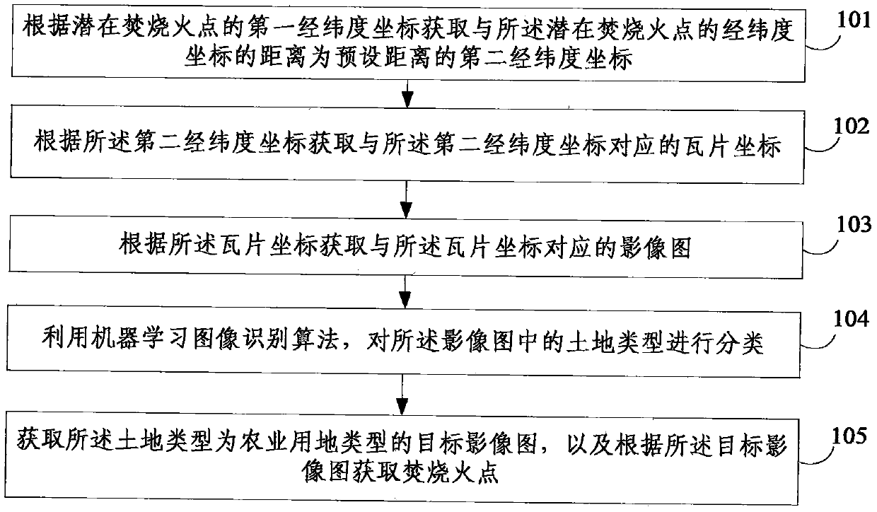
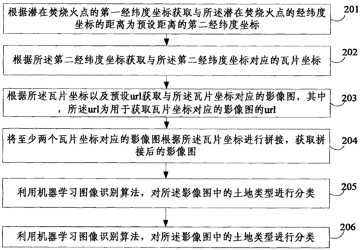
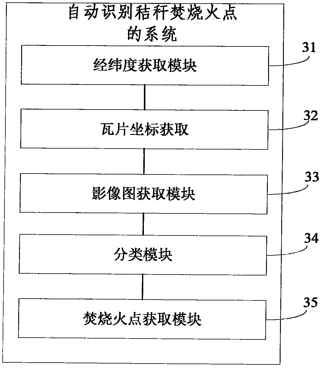
[0040] figure 1 A schematic flow chart of a method for automatically identifying straw burning fire points provided by an embodiment of the present invention, as shown in figure 1 As shown, the method includes the following steps:

[0041] 101. Acquire, according to the first latitude and longitude coordinates of a potential burning fire point, a second latitude and longitude coordinate whose distance from the latitude and longitude coordinates of the potenti...


PUM


Abstract

The present invention provides a method and system for automatically identifying the fire point of straw burning, the method comprising: according to the first latitude and longitude coordinates of the potential burning fire point, the distance from the latitude and longitude coordinates of the potential burning fire point is the preset distance. Two longitude and latitude coordinates; obtain the tile coordinates corresponding to the second longitude and latitude coordinates according to the second longitude and latitude coordinates; obtain the image map corresponding to the tile coordinates according to the tile coordinates; use the machine learning image recognition algorithm to analyze the land type in the image map Classification; Obtain the target image map whose land type is agricultural land type, and obtain the burning fire point according to the target image map. The above method obtains high-resolution remote sensing image maps within the range of potential burning fire points according to the tile coordinates in the preset url, and automatically removes misjudged fire points among potential fire points according to the high-resolution remote sensing images, which has a high efficiency and accuracy.

Description

technical field [0001] The invention relates to the technical field of identification of fire points of incineration, in particular to a method and system for automatically identifying fire points of straw incineration. Background technique [0002] In order to improve the quality of the atmospheric environment, protect the public's right to know, and strengthen the supervision of public opinion, the environmental protection departments in various regions will use remote sensing monitoring and other methods to monitor the burning of straw during the national autumn harvest. [0003] The current straw burning monitoring method is based on MODIS or other satellite data to obtain the straw burning point, but the spatial resolution of MODIS is small, and the land type of the area cannot be accurately identified based on MODIS or other satellite data, so water bodies cannot be well excluded, etc. In farmland areas, the effect and accuracy of using it to remove misjudged fire poin...

Claims


Application Information

Patent Timeline
Patent Type & Authority Patents(China)
IPC IPC(8): G06K9/62G06K9/36
CPCG06V10/20G06V2201/07G06F18/241
Inventor 张弓顾竹李正学
Owner 张弓
Features
  • R&D
  • Intellectual Property
  • Life Sciences
  • Materials
  • Tech Scout
  • Unparalleled Data Quality
  • Higher Quality Content
  • 60% Fewer Hallucinations
Learn More