Exploration hole geological record base drawing generation method based on parallel photography

A technology for geological cataloging and exploration holes, which is applied in the field of generating basemaps for geological cataloging of exploration holes based on parallel photography, and can solve the problems of small coverage area of ​​the camera site, unpracticalability, and sharp drop in operation efficiency.

Inactive Publication Date: 2016-06-29
HOHAI UNIV
View PDF4 Cites 10 Cited by
  • Summary
  • Abstract
  • Description
  • Claims
  • Application Information

AI Technical Summary

Problems solved by technology

The existing photographic geological recording technology is mainly suitable for large caverns. If it is directly used for geological recording of ex

Method used


Image

  • Exploration hole geological record base drawing generation method based on parallel photography
  • Exploration hole geological record base drawing generation method based on parallel photography
  • Exploration hole geological record base drawing generation method based on parallel photography

Examples


Embodiment Construction

[0053] The present invention will be described in further detail below in conjunction with the accompanying drawings and embodiments.

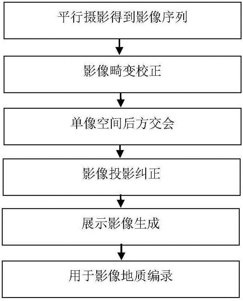
[0054] figure 1 It is a schematic flow chart of an embodiment of the present invention. A method for generating a geological record base map of an exploration cave based on parallel photography described in this embodiment comprises the following steps:

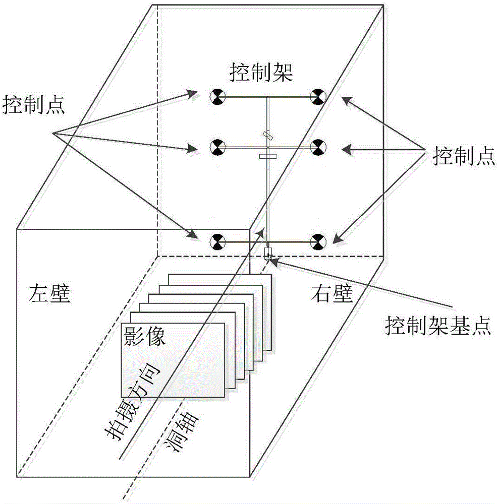
[0055] Step 1. Parallel photography to obtain image sequences: adopt the control method based on the movable control frame and the photography method in which the main optical axis of photography is parallel to the axis of the hole, and shoot image sequences facing the direction of the movable control frame at a certain distance along the central axis of the exploration hole ;

[0056] Step 2. Image preprocessing: including image distortion correction and image single-image space resection calculation, so as to obtain exploration cave image data with known internal and external orientation ...


PUM


Abstract

The invention relates to an exploration hole geological record base drawing generation method based on parallel photography. The method includes: using a shooting manner, that a shooting principal optical axis is parallel with a hole axis, based on the control manner of a movable control rack to shoot an image sequence along the central axis of an exploration hole; performing image distortion correction and single image space resection calculation to obtain exploration image data, with good image forming quality, of known interior and exterior orientation elements; correcting image projection, to be more specific, projecting an exploration hole original image with the image forming distortion influence being eliminated to object space to form an object space target image, and spreading into a plane according to the requirement to obtain a single exploration hole display image; generating a display image, to be more specific, splicing single display images in a certain section of the exploration hole to generate the image geological record base drawing. The method has the advantages that exploration hole geological information can be fast, efficiently and accurately collected and analyzed and processed, record result forms are enriched and are easy in informatization application, and the geological record precision requirement can be satisfied.

Description

technical field [0001] The invention relates to the technical field of photogrammetry, in particular to a method for generating a base map of geological records of exploration caves based on parallel photography. Background technique [0002] Geological cataloging is a technical process of describing, measuring and recording various geological phenomena in geological prospecting and exploration. material. Traditional geological catalogs are mainly based on geological sketches, relying on manual site surveys to draw geological structural lines, measure and mark the occurrence of structural planes. This kind of operation method has a large workload, high labor intensity, great interference from construction, and the geometric accuracy of the catalog is low, and the information feedback is slow. At the same time, the catalog results are not easy to be statistically analyzed and shared. It is no longer suitable for the development of real productivity and modern engineering. T...

Claims


Application Information

Patent Timeline
IPC IPC(8): G01C11/02G01C11/08G06T5/00
CPCG01C11/02G01C11/08G06T5/006
Inventor 李浩毛羽丰杨彪吴铭飞苏博
Owner HOHAI UNIV
Why Eureka
Try Eureka