Method for simulating global ocean effect on digital earth

A technology of digital earth and simulation method, which is applied to the details of 3D image data, 3D modeling, image data processing, etc. It can solve the problems of pre-calculating borders, etc., to improve efficiency, improve ocean display effect, and optimize processing efficiency Effect

Active Publication Date: 2016-08-24
THE 28TH RES INST OF CHINA ELECTRONICS TECH GROUP CORP
View PDF4 Cites 9 Cited by
  • Summary
  • Abstract
  • Description
  • Claims
  • Application Information

AI Technical Summary

Problems solved by technology

There have been many researches in this area, but there are still some shortcomings in the use of LOD technology, such as the need to pre-calculate different layers, the problem of joining edges between layers, etc.

Method used


Image

  • Method for simulating global ocean effect on digital earth
  • Method for simulating global ocean effect on digital earth
  • Method for simulating global ocean effect on digital earth

Examples


Embodiment Construction

[0016] The present invention will be further described below in conjunction with the accompanying drawings and specific embodiments.

[0017] The concrete implementation steps of this method are as follows:

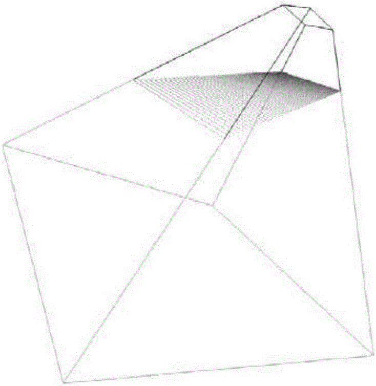
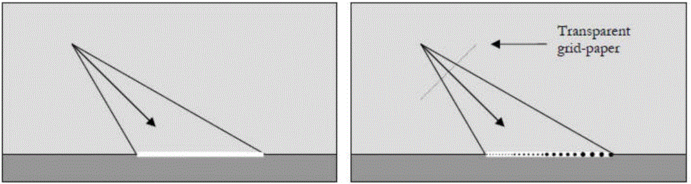
[0018] 1. Create a regular grid.

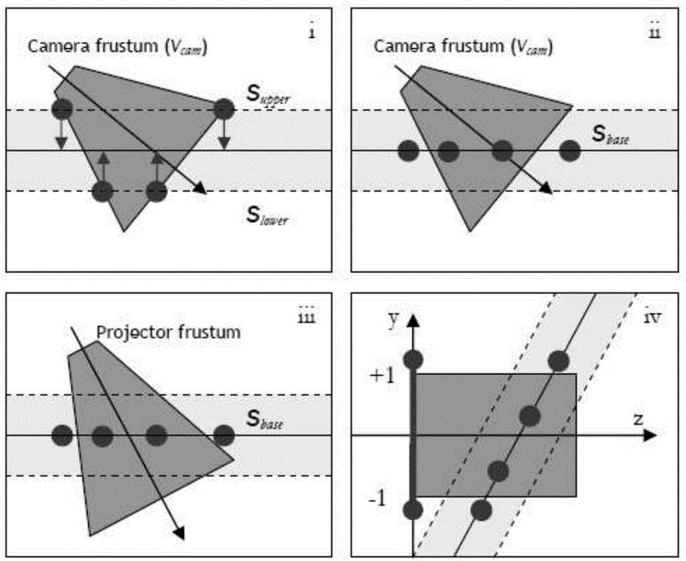
[0019] Create a regular grid in the projection space, so that the plane where the grid is located is perpendicular to the line of sight and faces the viewpoint; the regular grid consists of n*n vertices, and the vertex structure V={Lng, Lat, Alt}, Among them, Lng is the longitude, Lat is the latitude, and Alt is the height; the specific generation algorithm of the projection grid is:

[0020] (11) Generate the perspective projection matrix M of the camera through parameters such as camera position and direction perspective ;

[0021] (12) Visibility judgment is performed by checking whether the displacement volume and the view frustum intersect, and if it is not visible, no rendering is required;

[0022] (13) Create a new camera. In...


PUM


Abstract

The invention provides a method for simulating a global ocean effect on a digital earth. The method includes the steps of first, creating a regular net, projecting the net onto a reference plane in a world coordinate system, outputting a height information map (Heightmap) of a digital earth by using an RTT of orthogonal projection, simulating the movement process of a sea wave according to a height field function, acquiring height information from the Heightmap, calculating the vertex transparency, and finally rendering the net. The method can be used for simulating the global ocean effect on the three-dimensional digital earth; achieves smooth transition between the ocean and the land and excellently shows a coastline effect; exhibits the underwater visibility in a transparent manner and also can be used for simulating an underwater beach effect in offshore; and can well apply the data generated in the simulation to special efficiency simulation of a water surface or underwater target, such as tail waves, side waves and the like.

Description

technical field [0001] The invention belongs to the field of computer three-dimensional simulation, in particular to a method for simulating global ocean effects on a digital earth. Background technique [0002] In real-time computer graphics, the demand for rendering a realistic large-area water surface such as the sea surface on a 3D digital globe is becoming more and more intense. With the development of graphics hardware, current computers can also draw real-time dynamic water surfaces, and research in this area has become a current hot spot. [0003] If we want to paint an undulating water surface, we must first create a dynamic, high-resolution polygonal representation of it. If the area of ​​the water surface is large, in order to achieve scalability, the level of detail (LOD) method is usually adopted to determine the level of the grid according to the height and distance of the viewpoint, reducing the amount of data that needs to be rendered. There have been many ...

Claims


Application Information

Patent Timeline
Patent Type & Authority Applications(China)
IPC IPC(8): G06T15/00G06T15/04G06T15/10G06T15/50G06T17/05G06T19/20
CPCG06T15/005G06T15/04G06T15/10G06T15/50G06T17/05G06T19/20G06T2200/04G06T2219/2012
Inventor 李彭伟王颖强士卿杨华张晔嘉孙翌晨
Owner THE 28TH RES INST OF CHINA ELECTRONICS TECH GROUP CORP
Why Eureka
Try Eureka