City impervious surface extraction method based on fusion of SAR image and optical remote sensing image

A technology of optical remote sensing and image fusion, which is applied in the directions of instruments, computing, character and pattern recognition, etc., to achieve high-precision results

Inactive Publication Date: 2016-09-07
WUHAN UNIV
View PDF0 Cites 31 Cited by
  • Summary
  • Abstract
  • Description
  • Claims
  • Application Information

AI Technical Summary

Problems solved by technology

Most of these methods estimate impervious surfaces based on a single optical remote sensing image data source. Due to the complexity of urban impervious surfaces and the similarity between building materials, it is difficult to use a single

Method used


Image

  • City impervious surface extraction method based on fusion of SAR image and optical remote sensing image
  • City impervious surface extraction method based on fusion of SAR image and optical remote sensing image
  • City impervious surface extraction method based on fusion of SAR image and optical remote sensing image

Examples


Embodiment Construction

[0023] During specific implementation, the process provided by the technical solution of the present invention can be automatically run by those skilled in the art using computer software technology. In order to better understand the technical solution of the present invention, the present invention will be further described in detail below in conjunction with the accompanying drawings and embodiments.

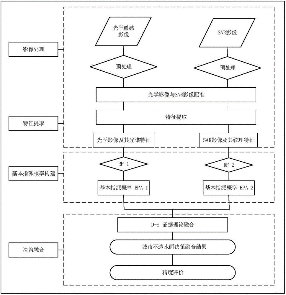
[0024] see figure 1 , the embodiment of the present invention includes the following steps:

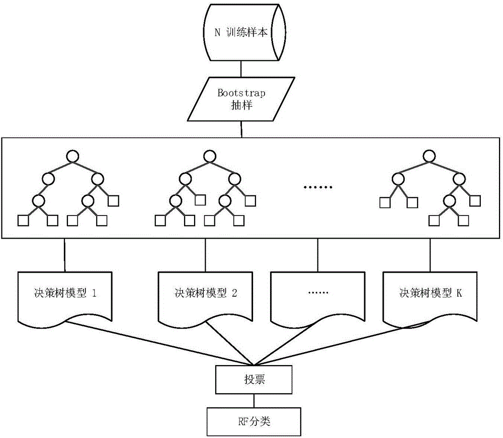
[0025] Step a, referring to Google Earth images and high spatial resolution remote sensing images (such as Quick Bird, IKONOS, WorldView series, etc.), according to the characteristics of the land type and image resolution in the study area, pre-select several samples to form a total sample set, and use random sampling The method generates a classifier training set (for the establishment of a random forest classifier) ​​and a classifier test set (for random forest classifier testing)...


PUM


Abstract

Provided is a city impervious surface extraction method based on fusion of an SAR image and an optical remote sensing image. The method comprises that a general sample set formed by samples of a research area is selected in advance, and a classifier training set, a classifier test set and a precision verification set of impervious surface extraction results are generated from the general sample set in a random sampling method; the optical remote sensing image is configured with the SAR image of the research area, and features are extracted from the optical remote sensing image and the SAR image; training is carried out, the city impervious surface is extracted preliminarily on the basis of a random forest classifier, and optimal remote sensing image data, SAR image data and an impervious surface RF preliminary extraction result are obtained; decision level fusion is carried out by utilizing a D-S evidence theory synthesis rule, and a final impervious surface extraction result of the research area is obtained; and the precision of each extraction result is verified via the precision verification set. Advantages of the optical remote sensing image and SAR image data sources are utilized fully, the SAR image and optical remote sensing image fusion method based on the RF and D-S evidence theory is provided, and the impervious surface of higher precision in the city is obtained.

Description

technical field [0001] The invention belongs to the field of remote sensing image data information extraction, and relates to an urban impermeable surface extraction method based on the fusion of SAR images and optical remote sensing images. Background technique [0002] Impervious surface refers to the unnatural surface through which water cannot seep into the soil, including various artificial buildings, roads, parking lots, airports, etc. As an indicator to measure the degree of urbanization development, impermeable surface has increased in recent years with the acceleration of urbanization, leading to a series of urban environmental problems such as reduced surface transpiration, accelerated surface runoff, and urban heat islands. appear. Therefore, extracting the distribution and coverage of impervious surfaces is of great significance to the assessment of the urban ecological environment and the monitoring and management of the urbanization process. Due to its low co...

Claims


Application Information

Patent Timeline
IPC IPC(8): G06K9/00G06K9/62
CPCG06V20/176G06F18/285
Inventor 邵振峰付虎艳丁霖张源
Owner WUHAN UNIV
Why Eureka
Try Eureka