Mobile phone sensor-based indoor planar graph construction method adopting crowdsourcing mode

A construction method and sensor technology, applied in the field of automatic construction of indoor floor plans, can solve the problems of inability to obtain architectural design structure drawings, high cost and privacy, and inability to implement indoor positioning and navigation

Inactive Publication Date: 2017-02-22
UNIV OF ELECTRONIC SCI & TECH OF CHINA
View PDF8 Cites 14 Cited by
  • Summary
  • Abstract
  • Description
  • Claims
  • Application Information

AI Technical Summary

Problems solved by technology

Although these methods can create and draw maps of some buildings, due to high cost and privacy, most indoor environments cannot be mapped by professional methods, and architectural design structura

Method used


Image

  • Mobile phone sensor-based indoor planar graph construction method adopting crowdsourcing mode
  • Mobile phone sensor-based indoor planar graph construction method adopting crowdsourcing mode
  • Mobile phone sensor-based indoor planar graph construction method adopting crowdsourcing mode

Examples


Embodiment Construction

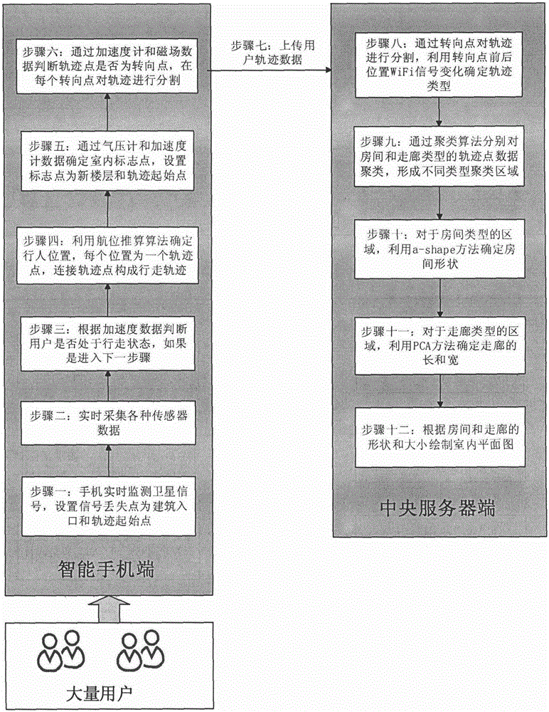
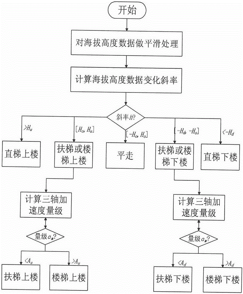
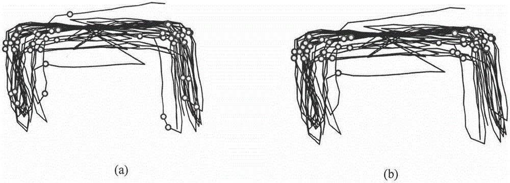
[0028] This method uses crowdsourcing to automatically construct the indoor floor plan, which requires the participation of a large number of ordinary users. Each participating user carries a smartphone with an integrated accelerometer, magnetometer, barometer, satellite navigation system receiver, and WiFi adapter. The accelerometer can measure the three-axis acceleration of the mobile phone in real time, the magnetometer can measure the three-axis magnetic field strength of the mobile phone in real time, the barometer can measure the air pressure value of the mobile phone to calculate the altitude, and the satellite navigation system (GPS or Beidou) The receiver can receive the signal of the navigation satellite and obtain the current geographic location coordinates, and the WiFi adapter can measure the WiFi access device and its signal strength in the environment. During the user participation process, the smart phone and each sensor are turned on, and the data collection a...


PUM


Abstract

The present invention discloses an intelligent mobile phone sensor-based indoor planar graph automatic construction method adopting a crowdsourcing mode. Compared with the prior art, the method of the present invention identifies the pedestrian activities according to the altitude data and the acceleration data to determine whether the users go upstairs or downstairs by the stairs, the vertical ladders or escalators, thereby being able to construct the indoor planar graphs of multiple floors. The method of the present invention combines a clustering algorithm to determine the doorway positions of the rooms according to the WiFi signal change front and behind the turning point positions in a pedestrian track, thereby being able to construct the more accurate room positions and sizes. By adopting a principal component analysis method, the method of the present invention can determine the lengths and widths of the corridors. The beneficial effects of the present invention are that: the mobile phone sensor data can be acquired and processed on the condition of only using the intelligent mobile phones and on the condition of general user passive participation, the approximate indoor planar graphs of the floors can be constructed automatically, and the problems that the large-scale indoor planar graph construction is difficult, the participation of the professional staff is needed, and the cost is high, are solved.

Description

technical field [0001] The invention relates to pedestrian dead reckoning technology and indoor map construction technology, in particular to a method for automatically constructing an indoor floor plan by collecting a large amount of pedestrian walking trajectory information in a crowdsourcing manner through smart phone sensors. Background technique [0002] With the development of positioning and navigation technology, various location-based services have an increasing demand for maps. After years of development, the construction and drawing of outdoor maps has a mature method. Professional surveyors collect data through professional equipment, and then process and draw maps through professional geographic software. However, the construction and drawing of indoor maps has been a problem to be solved, and it is also one of the main factors hindering the widespread application of location-based services indoors. At present, the construction of indoor maps is mainly done by ...

Claims


Application Information

Patent Timeline
IPC IPC(8): G09B29/00
CPCG09B29/005
Inventor 周瑞罗磊张洋铭张东阳卢帅陈洁松
Owner UNIV OF ELECTRONIC SCI & TECH OF CHINA
Why Eureka
Try Eureka