A Visibility Graph Network Construction Method for Terrain Visibility Analysis

A network construction and visibility technology, applied in the field of visibility analysis, can solve problems such as processing difficulties and DEM data increasing in series, and achieve the effect of improving processing efficiency

Active Publication Date: 2019-05-31
NANJING NORMAL UNIVERSITY
View PDF3 Cites 0 Cited by
  • Summary
  • Abstract
  • Description
  • Claims
  • Application Information

AI Technical Summary

Problems solved by technology

On the other hand, with the emergence of various new sensors and measurement technologies, DEM data is increasing exponentially, which makes it very difficult to process large-scale data in a stand-alone environment

Method used


Image

  • A Visibility Graph Network Construction Method for Terrain Visibility Analysis
  • A Visibility Graph Network Construction Method for Terrain Visibility Analysis
  • A Visibility Graph Network Construction Method for Terrain Visibility Analysis

Examples


Embodiment Construction

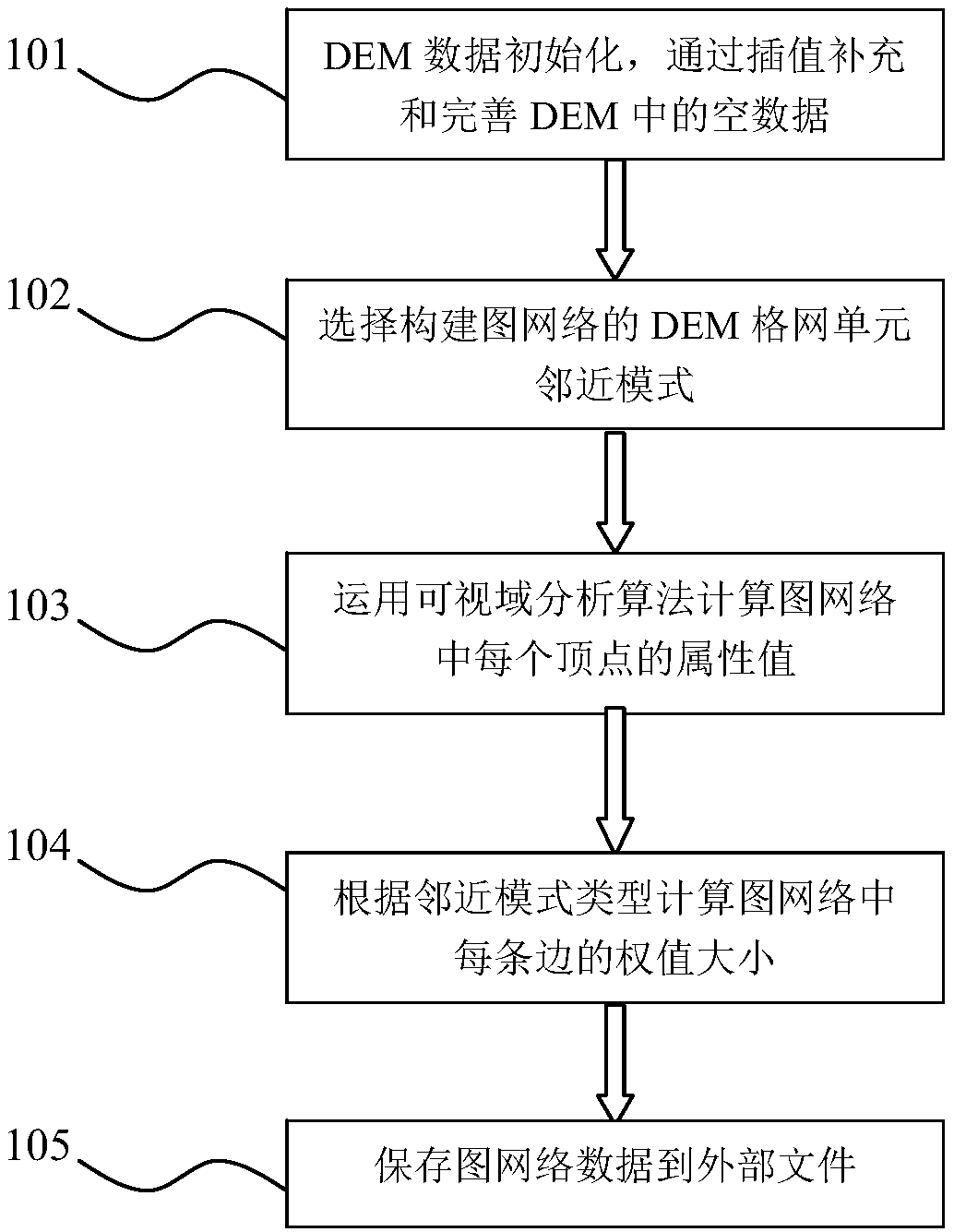
[0032] The present invention will be described in detail below in conjunction with the accompanying drawings. It should be pointed out that the described embodiments are only considered for the purpose of illustration rather than limitation of the invention.

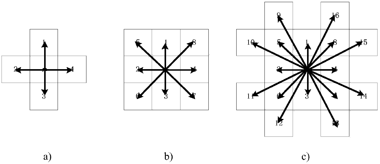
[0033] Embodiments of the present invention provide a graph network construction method oriented to visibility analysis and application modeling, the purpose of which is to divide the optimization modeling problem of terrain visibility analysis application into two steps to complete. Convert the field model data of the digital elevation model into graph data expressed by a graph model, and then optimize modeling and model solution based on the graph model. The advantage of this is that it can simplify the complexity of modeling and the efficiency of model solving.

[0034] For example, in the path planning problem based on visibility analysis, the digital elevation model is first converted into a graph network model, an...


PUM


Abstract

The invention provides a terrain visibility analysis-oriented visibility graph network construction method. The method includes the following steps: (1) scanning DEM grid data, analyzing whether null data exist, and if yes, performing interpolation calculation, and supplementing data; (2) selecting a DEM grid unit neighbor mode of a constructed graph network, mode types including a 4-grid unit neighbor mode, a 8-grid unit neighbor mode and 16-grid unit neighbor mode; (3) calculating attribute values of vertices in the visibility graph network: based on a visible range analysis algorithm, calculating the number of visible grid points of a grid unit corresponding to each vertex in the network or the area of a visible range; (4) according to the selected neighbor mode type, calculating the weights of sides in the visibility graph network; and (5) saving visibility graph network data. The terrain visibility analysis-oriented visibility graph network construction method provided by the invention can be completely applied to graph network-based optimization modeling and solving of different fields of terrain visibility analysis of large-scale mass data, and processing efficiency can be improved.

Description

technical field [0001] The invention belongs to the technical field of visibility analysis of digital terrain analysis, and relates to the realization of a method for converting DEM data using a regular grid model into a visual network conversion method based on graph theory, and further provides visibility based on a visual network model. Analysis and application lay the foundation. Background technique [0002] Digital Terrain Analysis (DTA) is a digital information processing technology for terrain attribute calculation and feature extraction based on Digital Elevation Model (DEM). Visibility analysis is an important terrain analysis factor of digital terrain analysis, including visibility analysis and visibility analysis. Visibility analysis, also known as terrain visibility analysis, refers to the range of terrain that can be seen from a single or multiple geographic locations or the degree of visibility with other geographic locations. It is an indispensable part of d...

Claims


Application Information

Patent Timeline
Patent Type & Authority Patents(China)
IPC IPC(8): G06T17/05G06F17/50
CPCG06F30/20G06T17/05
Inventor 窦万峰李亚楠
Owner NANJING NORMAL UNIVERSITY
Why Eureka
Try Eureka