Passive location algorithm for electro-optical pod

An optoelectronic pod and passive positioning technology, which is applied in satellite radio beacon positioning systems, navigation calculation tools, radio wave measurement systems, etc. Poor performance, etc.

Active Publication Date: 2017-04-26
LUOYANG INST OF ELECTRO OPTICAL EQUIP OF AVIC
View PDF5 Cites 17 Cited by
  • Summary
  • Abstract
  • Description
  • Claims
  • Application Information

AI Technical Summary

Problems solved by technology

The essence of this method is to use the estimated height information instead of the slant distance information of the laser rangefinder to complete the calculation, but the application effect is poor, and it has requirements for the flatness of the terrain. The greater the terrain undulation, the greater the error, and the error Unable to quantify
[0004] Therefore, the existing positioning algorithms cannot take into account the current market requirements for accuracy and concealment

Method used


Image

  • Passive location algorithm for electro-optical pod
  • Passive location algorithm for electro-optical pod
  • Passive location algorithm for electro-optical pod

Examples


Embodiment Construction

[0023] Embodiments of the present invention are described in detail below, and the embodiments are exemplary and intended to explain the present invention, but should not be construed as limiting the present invention.

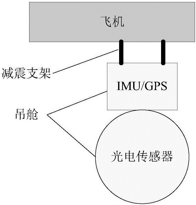
[0024] The photoelectric pod installation method is as follows: figure 1 , IMU and GPS are rigidly connected to the photoelectric pod, which can reduce the angle error caused by the shock absorber.

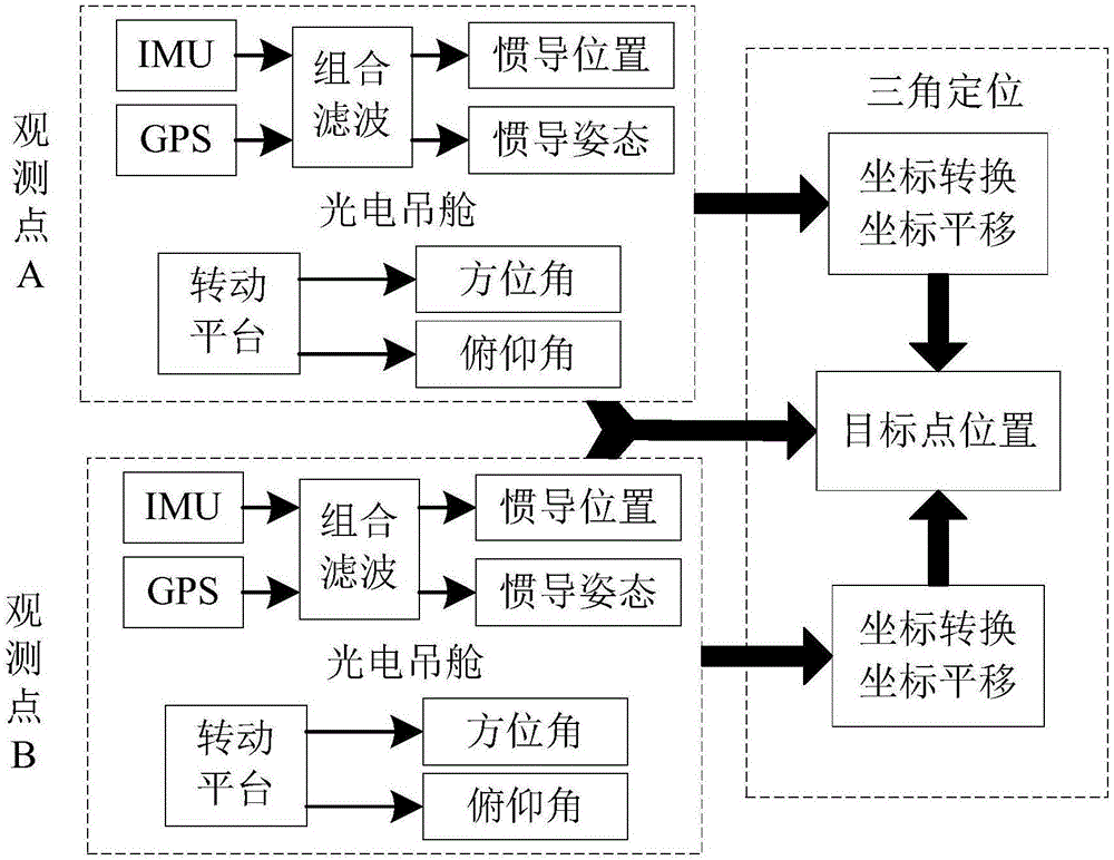
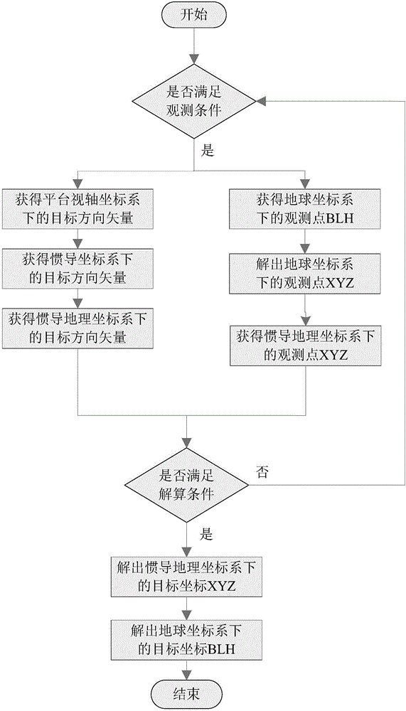
[0025] The overall scheme of this algorithm is as follows figure 2 , the algorithm flow is as follows image 3 .

[0026] The coordinate system defined by this algorithm is as follows:

[0027] 1. Earth coordinate system (OXYZ q )

[0028] The earth coordinate system is established based on the reference ellipsoid of the earth, and the origin O q at the Earth's center of mass, O q x q Pointing to the North Pole, O q Y q It is located on the intersection of the equatorial plane and the prime meridian, pointing positively to 0°longitude. o q Z q Determ...


PUM


Abstract

The invention provides a passive location algorithm for an electro-optical pod. According to the passive location algorithm, the pod locks a target to the center of an optical axis through manual searching or image tracking, and at the moment, target observation information acquired by the pod through an IMU(inertial measurement unit), a GPS (global positioning system) and an azimuth-pitching two-framework goniometer includes own GPS coordinates, pod heading pitching roll postures and framework azimuth-pitching angles; at least two groups of observation information are acquired, and an accurate position of the target is acquired through error correction, coordinate transformation and triangular transformation. A test result shows that the passive location algorithm is high in precision, high in adaptability and good in stability.

Description

technical field [0001] The invention belongs to the technical field of positioning processing algorithms, in particular to a passive positioning algorithm for a photoelectric pod, which realizes the calculation of the precise position of a target on the optical axis of the pod. Background technique [0002] The traditional photoelectric pod target positioning technology uses the distance information measured by the laser rangefinder, the position information obtained by GPS, the attitude information calculated by the IMU (inertial measurement unit) and the angle information measured by the angle sensor. Accurate coordinates of the target are obtained by means of a method, which requires that the photoelectric pod must be equipped with a laser rangefinder. The pod is generally large in size and weight, which affects the endurance time, ceiling and speed of the aircraft system, and is not suitable for mounting on small unmanned vehicles. on board. Moreover, the active positio...

Claims


Application Information

Patent Timeline
Patent Type & Authority Applications(China)
IPC IPC(8): G01C21/20G01S19/48
CPCG01C21/20G01S19/48
Inventor 杜明昊张龙浩徐梁沈腾赵胜斌
Owner LUOYANG INST OF ELECTRO OPTICAL EQUIP OF AVIC
Why Eureka
Try Eureka