
Satellite telemetry data clustering method based on time series special points

A technology of satellite telemetry data and time series, applied in the field of satellite telemetry data clustering, can solve the problems of lack of automatic intelligent labeling methods and difficult data labeling, and achieve the effect of improving the quality of clustering and reducing the amount of data.

Active Publication Date: 2017-05-24
HARBIN INST OF TECH
View PDF5 Cites 9 Cited by
  • Summary
  • Abstract
  • Description
  • Claims
  • Application Information

AI Technical Summary

Problems solved by technology

However, the analysis of existing satellite telemetry data is mostly based on manual labeling, and it is difficult to complete the labeling of large amounts of data without automatic intelligent labeling means.

Method used


Image

  • Satellite telemetry data clustering method based on time series special points
  • Satellite telemetry data clustering method based on time series special points
  • Satellite telemetry data clustering method based on time series special points

Examples


Embodiment Construction

[0014] The present invention will be described in further detail below: the present embodiment is implemented on the premise of the technical solution of the present invention, and detailed implementation is provided, but the protection scope of the present invention is not limited to the following examples.

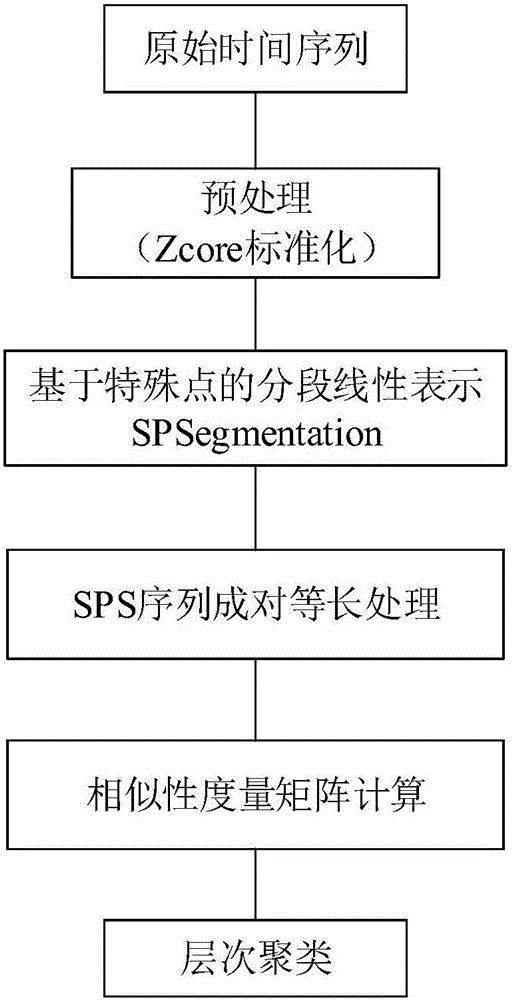
[0015] A method for clustering satellite telemetry data based on special points in time series involved in this embodiment, such as figure 1 As shown, it can be seen that the satellite telemetry data clustering method based on special points in time series is mainly completed through five steps:

[0016] Step 1: For the original time series sequence set X=[X 1 ,X 2 ,...,X l ], using the Zscore algorithm for preprocessing;

[0017] Step 2: Use the SPSegmentation (Special Points Segmentation) segmentation representation method to extract each original time series X i All the special points of form the special point sequence SPS i =[x i (t p1 ),x i (t p2 ),…,x i (...


PUM


Abstract

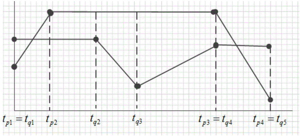
The invention provides a satellite telemetry data clustering method based on time series special point. The satellite telemetry data clustering method comprises steps that step1, a Zscore algorithm is used for preprocessing of an original time series set X=(x1, x2...Xl); step2, an SPSegmentation segmentation expression method is used to extract all of special points of every original time series Xi to form a special point series SPSi=(xi(tp1), xi(tp2).. .xi(tpk)), which is used to replace the original series to be used as clustering input; step3, the corresponding time position supplementing and aligning processing of any two special point series SPSi and SPSj is carried out, and then the time positions of the special points of the sequences corresponding to the various elements of the two SPS on an original time axis are aligned with each other; step 4, the similarity coefficient calculation of the aligned special point series is carried out, and because the sequence aligning is carried out, most of similarity measurement calculations are usable, and finally, a PSPS_Dist similarity matrix is acquired; step 5, an agglomerative hierarchical clustering algorithm is adopted to realize time series clustering.

Description

technical field [0001] The invention relates to a satellite telemetry data clustering method based on special points in time series, and belongs to the technical field of time series clustering methods. Background technique [0002] Satellite telemetry data is the only basis for satellite working status and health status that operation managers can obtain during satellite in-orbit operation. Automated and intelligent analysis of satellite telemetry data using methods such as data mining and machine learning is of great value for on-orbit operation, maintenance and health management of satellites, and is currently a hot and challenging issue in the field of aerospace research at home and abroad. However, the analysis of existing satellite telemetry data is mostly based on manual labeling, and it is difficult to complete the labeling of large amounts of data without automatic intelligent labeling means. Contents of the invention [0003] The purpose of the present invention...

Claims


Application Information

Patent Timeline
Patent Type & Authority Applications(China)
IPC IPC(8): G06K9/62
CPCG06F18/231
Inventor 刘大同张玉杰彭宇宋歌彭喜元
Owner HARBIN INST OF TECH
Learn More