

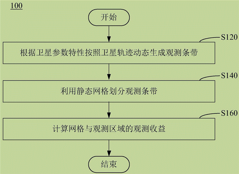
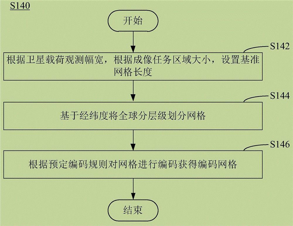
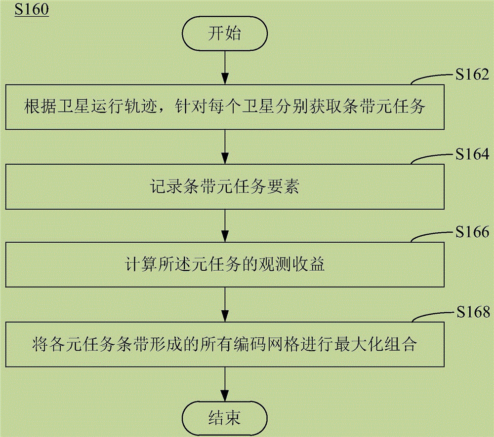
Satellite dynamic strip region resolution method described by static mesh
A static grid and area technology, applied in the field of satellite observation, can solve the problems of accuracy loss, inconsistent grid cell size, inconvenient use, etc., to avoid differences and facilitate unified processing.
- Summary
- Abstract
- Description
- Claims
- Application Information
AI Technical Summary
Problems solved by technology
Method used
Image

Examples
Embodiment Construction
[0046] The following description with reference to the accompanying drawings is provided to assist in a comprehensive understanding of various embodiments of the present disclosure as defined by the claims and their equivalents. The following description includes various specific details to aid in understanding, but these are to be regarded as merely exemplary. Accordingly, those of ordinary skill in the art will recognize that various changes and modifications of the various embodiments described herein can be made without departing from the scope and spirit of the disclosure. Also, descriptions of well-known functions and constructions may be omitted for clarity and conciseness.
[0047] The terms and words used in the following description and claims are not limited to the bibliographical meanings, but, are merely used by the inventor to enable a clear and consistent understanding of the present disclosure. Accordingly, it should be apparent to those skilled in the art tha...
PUM
 Abstract
Description
Claims
Application Information