Method for calculating geomorphologic unit hydrograph initial probability through digital elevation model

A technology of digital elevation model and unit line, applied in calculation, 3D modeling, image data processing, etc., can solve problems such as unfavorable development of instantaneous unit line of landform, limitation of application of instantaneous unit line of landform, failure to obtain accuracy, etc., and achieve data source Stable and reliable, objective and reasonable results, high calculation efficiency

Active Publication Date: 2017-05-31
HOHAI UNIV
View PDF3 Cites 16 Cited by
  • Summary
  • Abstract
  • Description
  • Claims
  • Application Information

AI Technical Summary

Problems solved by technology

However, the Smart law itself is a law obtained based on data statistics. When using it to estimate the initial probability, it often cannot get good accur

Method used


Image

  • Method for calculating geomorphologic unit hydrograph initial probability through digital elevation model
  • Method for calculating geomorphologic unit hydrograph initial probability through digital elevation model
  • Method for calculating geomorphologic unit hydrograph initial probability through digital elevation model

Examples


Embodiment Construction

[0065] The present invention will be further described below in conjunction with the accompanying drawings and specific embodiments.

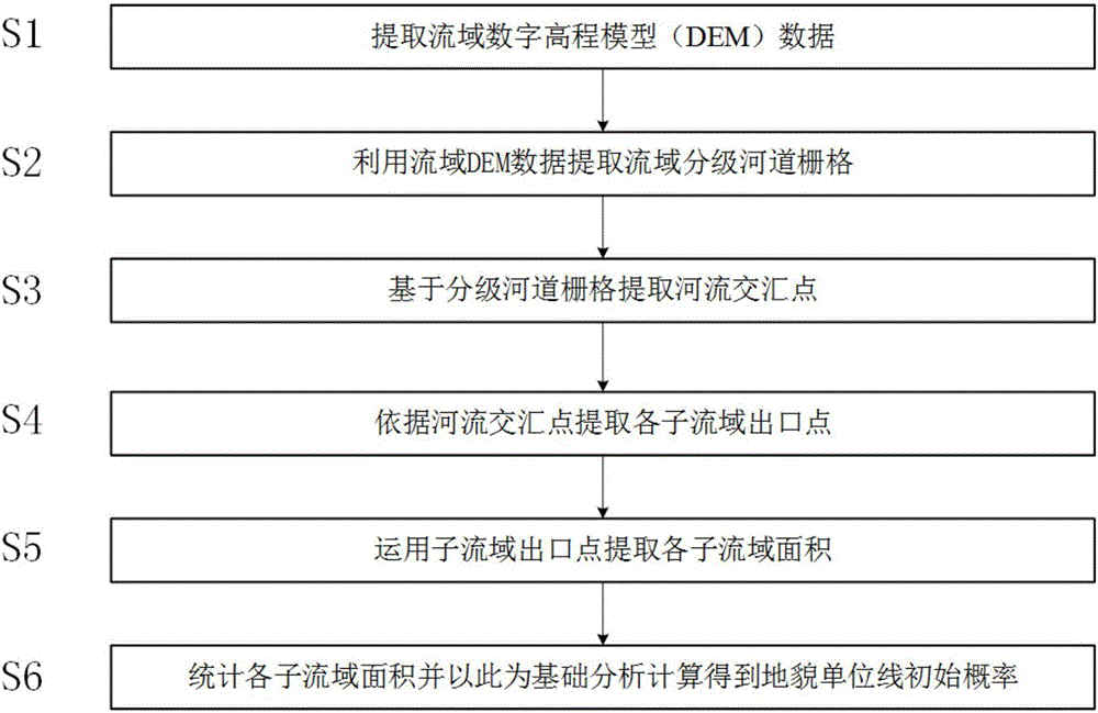
[0066] Such as Figure 1 to Figure 9 As shown, a kind of method that the present invention provides based on digital elevation model calculates the initial probability of topographic unit line, comprises the following steps:

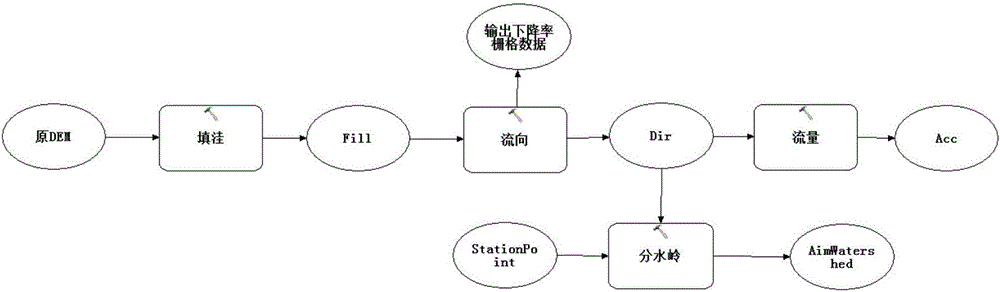
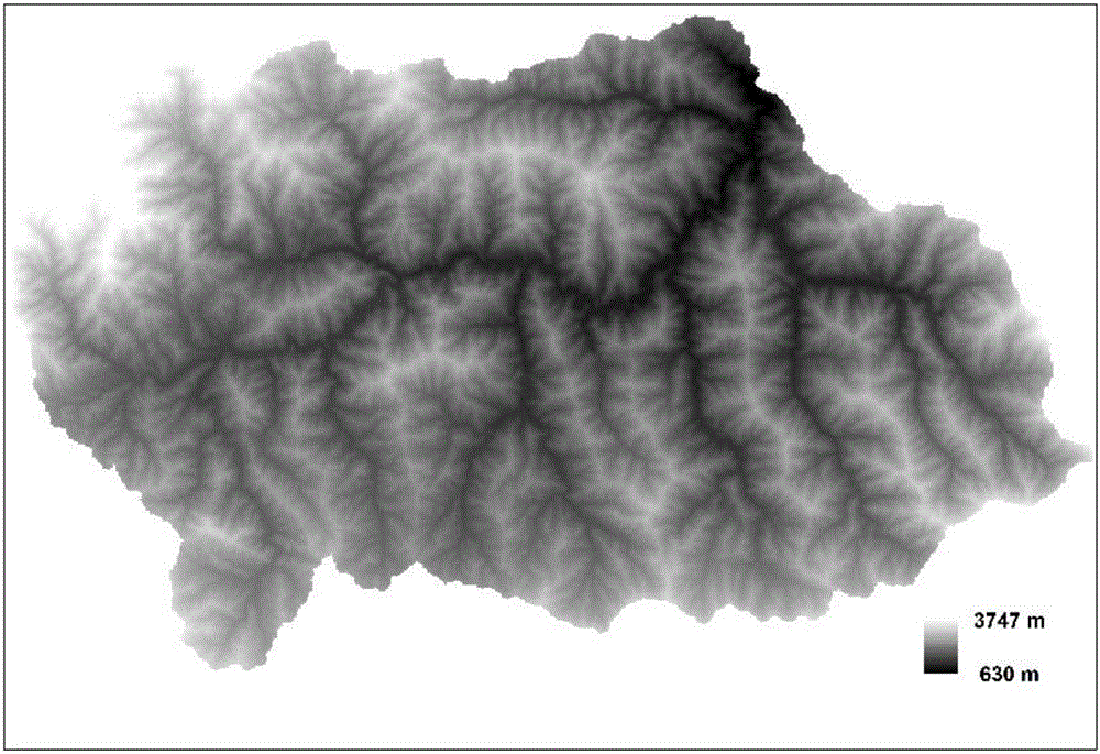
[0067] S1. Using the topographic information system software ArcGIS to build a geoprocessing workflow such as figure 2 , to extract the digital elevation model (DEM) raster data of the target watershed such as image 3 , which includes:

[0068] 1) Filling, to obtain the grid Fill after filling;

[0069] 2) Calculate the flow direction to obtain the flow direction grid Dir;

[0070] 3) Calculate the confluence flow to obtain the cumulative flow grid Acc;

[0071] 4) Determine the StationPiont, the outlet station of the watershed;

[0072] 5) Extract the target watershed AimWatershed;

[0073] S2. Using the DEM dat...


PUM


Abstract

The invention provides a method for calculating geomorphologic unit hydrograph initial probability through a digital elevation model. The method includes the following main steps that drainage basin digital elevation model (DEM) data is extracted; drainage basin classification riverway grids are extracted through the drainage basin DEM data; river confluence points are extracted based on the classification riverway grids; sub-basin outlet points are extracted according to the river confluence points; sub-basin areas are extracted through the sub-basin outlet points; the geomorphologic unit hydrograph initial probability is obtained through analytical calculation based on the sub-basin areas. The method for calculating the geomorphologic unit hydrograph initial probability through the digital elevation model has the advantages that the data resource is stable and reliable, the calculation efficiency is high, and the result is objective and reasonable, which facilitates the direct solution of the geomorphologic unit hydrograph initial probability.

Description

technical field [0001] The invention belongs to the technical field of hydrology, and in particular relates to a method for calculating the initial probability of a geomorphic unit line based on a digital elevation model. Background technique [0002] Modern studies believe that the hydrological response of a watershed is the result of the joint effect of landform diffusion and hydrodynamic diffusion on the net rain with a certain temporal and spatial distribution on the watershed. This revelation of the basin's confluence mechanism makes it possible for hydrologists and physical geographers to try to theoretically establish the connection between the basin's topographic features and the basin's hydrological response. One of the methods is based on the Horton-Strahler river classification theory, and borrows the method of macroscopic performance of a large number of "particles" in statistical physics to establish a geomorphic unit line. [0003] An important step in establi...

Claims


Application Information

Patent Timeline
IPC IPC(8): G06T17/05
Inventor 童冰星李致家邓元倩
Owner HOHAI UNIV
Why Eureka
Try Eureka