Method of processing flight path of unmanned aerial vehicle

A processing method and flight path technology, applied in the field of drones, can solve problems such as large amount of calculation

Active Publication Date: 2017-06-20
SHANGHAI JIAO TONG UNIV
View PDF6 Cites 18 Cited by
  • Summary
  • Abstract
  • Description
  • Claims
  • Application Information

AI Technical Summary

Problems solved by technology

[0003] However, the current visual positioning algorithms generally have a large amount of calculation. Algorithms such as SLAM are difficult to run in real time on the airborne system. of

Method used


Image

  • Method of processing flight path of unmanned aerial vehicle
  • Method of processing flight path of unmanned aerial vehicle
  • Method of processing flight path of unmanned aerial vehicle

Examples


Embodiment Construction

[0039] The present invention will be further described in detail below through specific embodiments in conjunction with the accompanying drawings.

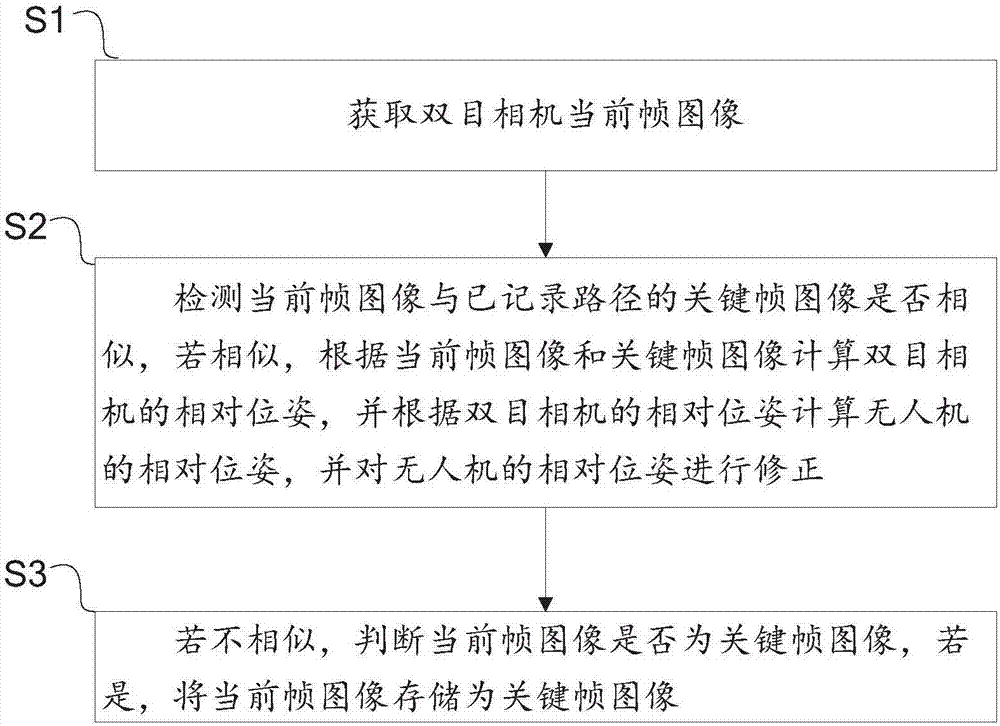
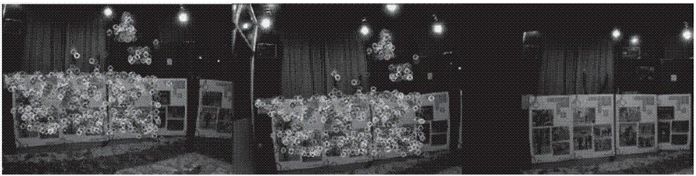
[0040] Aiming at the problem of path recording and playback of UAVs equipped with binocular cameras, this example provides a processing method for UAV flight paths. The flow chart is as follows figure 1 As shown, it specifically includes the following steps.

[0041] S1: Obtain the current frame image of the binocular camera.

[0042] Since the UAV is fixedly equipped with a binocular camera, the binocular camera includes a left camera and a right camera. When the UAV is flying, the current frame image of the binocular camera can be obtained, and the flight path of the UAV can be calculated according to the current frame image. Treat accordingly.

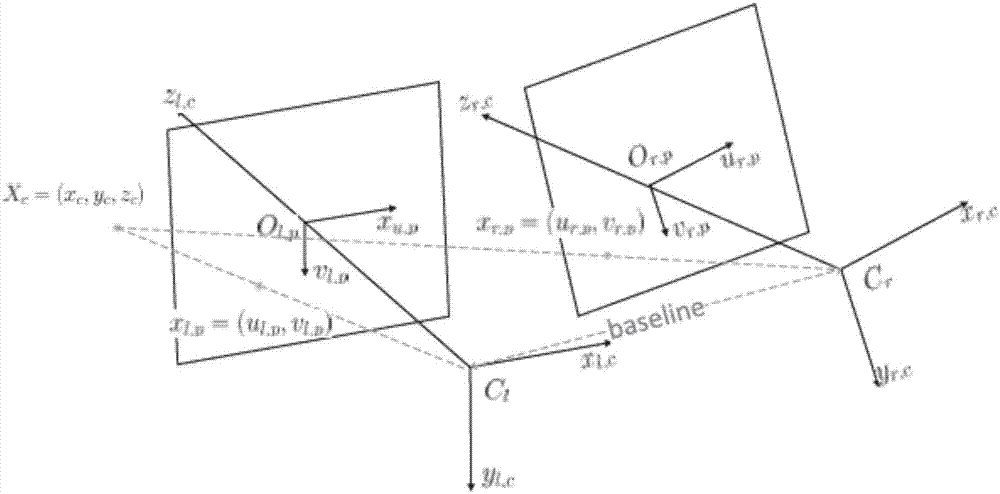
[0043] In this example, it is assumed that the obtained current frame image is already a de-distorted image, and the world coordinate system is set as The camera coordinate system i...


PUM


Abstract

Provided is a method of processing the flight path of an unmanned aerial vehicle. An unmanned aerial vehicle is fixedly equipped with a binocular camera. The binocular camera consists of a left camera and a right camera. The method comprises the following steps: acquiring a current frame image of the binocular camera; detecting whether the current frame image is similar to the key frame image of a recorded path; if the current frame image is similar to the key frame image of the recorded path, calculating the relative pose of the binocular camera according to the current frame image and the key frame image, calculating the relative pose of the unmanned aerial vehicle according to the relative pose of the binocular camera, and correcting the relative pose of the unmanned aerial vehicle; if the current frame image is not similar to the key frame image of the recorded path, judging whether the current frame image is a key frame image; and if the current frame image is a key frame image, and storing the current frame image as a key frame image. As the flight path of the unmanned aerial vehicle is stored according to the key frame image, the amount of computation of a visual localization algorithm is reduced greatly. The recorded path enables the unmanned aerial vehicle or other unmanned aerial vehicles equipped with a camera to fly by path. Moreover, by correcting the position drift of the unmanned aerial vehicle in the process of flight by path, a precise tracking effect can be achieved.

Description

technical field [0001] The invention relates to the technical field of unmanned aerial vehicles, in particular to a method for processing flight paths of unmanned aerial vehicles. Background technique [0002] At present, it is extremely difficult for UAVs to navigate in complex environments (such as indoors, jungles, caves, etc.), especially the realization of functions such as autonomous return and precise path following of UAVs. In this case, it is a feasible way to use the existing accelerometer and optical flow meter as the odometer, and use image matching for real-time path error correction. [0003] However, the current visual positioning algorithms generally have a large amount of calculation. Algorithms such as SLAM are difficult to run in real time on the airborne system. of. Contents of the invention [0004] Aiming at the problem of how to record the flight path of the UAV and realize path tracking, this application provides a method for processing the flight...

Claims


Application Information

Patent Timeline
Patent Type & Authority Applications(China)
IPC IPC(8): G05D1/10G05D1/08
CPCG05D1/0808G05D1/101
Inventor 缪瑞航邹丹平裴凌刘佩林
Owner SHANGHAI JIAO TONG UNIV
Why Eureka
Try Eureka