Laser radar technique-based smart city 3D live map system

A real-world map and lidar technology, which is applied in the processing of 3D images, image data processing, geographic information databases, etc., to achieve the effect of improving efficiency and safety performance, and improving accuracy and reliability.

Inactive Publication Date: 2017-09-15
青岛星邦光电科技有限责任公司
View PDF3 Cites 15 Cited by
  • Summary
  • Abstract
  • Description
  • Claims
  • Application Information

AI Technical Summary

Problems solved by technology

[0004] The present invention provides a smart city 3D real-scene map system based on laser radar technology, which overcomes the problem that the existing three-dimensional map is actually a 2.5D electronic map and cannot be accurately positioned and browsed from multiple angles

Method used


Image

  • Laser radar technique-based smart city 3D live map system
  • Laser radar technique-based smart city 3D live map system
  • Laser radar technique-based smart city 3D live map system

Examples


Embodiment

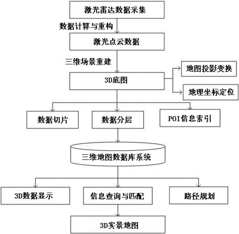
[0028] refer to figure 1 , the smart city 3D real scene map system based on laser radar technology,

[0029] Including a 3D map base map generation system for generating 3D base maps;

[0030] Map data and map projection system, used to store 3D real map data, complete 3D basemap projection and 3D real map projection;

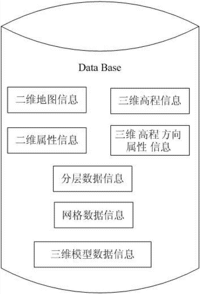
[0031] The 3D map database system is used to store the 3D model data of all 3D objects and the appearance attribute information of 3D objects for users to query and use;

[0032] The 3D map display and browsing system is used for users to call and display 3D real map.

[0033] 3D real scene map data is generated by point cloud data containing geographic coordinates. It contains geographic coordinate data. It not only has accurate and measurable geographic data in the plane direction, but also contains elevation data at any position in the elevation direction. In real scene maps, especially positioning In buildings, there are rich ground features. The 3D bas...


PUM


Abstract

The invention provides a laser radar technique-based smart city 3D live map system. The system comprises a 3D base map generation system, a map data and map projection system, a 3D map database system and a 3D map display and browse system, wherein the 3D base map generation system is used for generating a 3D base map; the map data and map projection system is used for storing 3D live map data and completing 3D base map projection and 3D live map projection; the 3D map database system is used for storing 3D model data of all the 3D surface features and appearance attributes of the 3D surface features to be queried by users; and the 3D map display and browse system is used for calling and displaying a 3D live map by the users. According to the system provided by the invention, more city 3D experience can be brought to the users in the navigation process, the fact that what you see is what you get in the navigation can be realized, and the correctness and reliability of the navigation can be improved, thereby improving the efficiency and safety of the map.

Description

technical field [0001] The invention belongs to the technical field of electronic maps, and in particular relates to a smart city 3D real-scene map system based on laser radar technology. Background technique [0002] The development of electronic maps has provided a lot of convenience for people to travel, but at present we are widely using two-dimensional maps, and more and more people encounter such problems when using two-dimensional maps, when going to a place , it is easy to find the direction through the two-dimensional map, but if you go to an unknown place, it is not easy to locate it accurately even in the surrounding area. The travel of people who need navigation brings troubles. [0003] With the development of 3D technology, 3D map technology has also begun to be studied, but the existing 3D electronic map is precisely a 2.5D electronic map. This kind of map cannot be positioned and browsed from multiple angles. What is more is a 3D-like effect. In practical a...

Claims


Application Information

Patent Timeline
Patent Type & Authority Applications(China)
IPC IPC(8): G06T15/04G06F17/30
CPCG06F16/29G06T15/04
Inventor 纪菲邓宝君孙正欣
Owner 青岛星邦光电科技有限责任公司
Why Eureka
Try Eureka