
Method and system for calculating candidate public transportation stops

A station and bus technology, applied in the traffic control system, road vehicle traffic control system, traffic flow detection, etc., can solve the problems of not considering the division of traffic hotspot areas and not considering the service radius of bus stations, etc.

Inactive Publication Date: 2017-12-15
SHENZHEN INST OF ADVANCED TECH
View PDF5 Cites 17 Cited by
  • Summary
  • Abstract
  • Description
  • Claims
  • Application Information

AI Technical Summary

Problems solved by technology

The location selection method of bus stops based on taxi GPS data overcomes the inaccurate defects of traditional methods to obtain residents' travel needs, and provides a better foundation for the planning of subsequent bus routes. In addition, it also greatly reduces time and manpower to a certain extent. and cost of money, but the existing bus station site selection method based on taxi GPS data does not consider the integrity of the division of traffic hot spots, or does not consider the service radius of the bus station

Method used


Image

  • Method and system for calculating candidate public transportation stops
  • Method and system for calculating candidate public transportation stops
  • Method and system for calculating candidate public transportation stops

Examples


Embodiment Construction

[0064] In order to make the object, technical solution and advantages of the present invention clearer, the present invention will be further described in detail below in conjunction with the accompanying drawings and embodiments. It should be understood that the specific embodiments described here are only used to explain the present invention, not to limit the present invention.

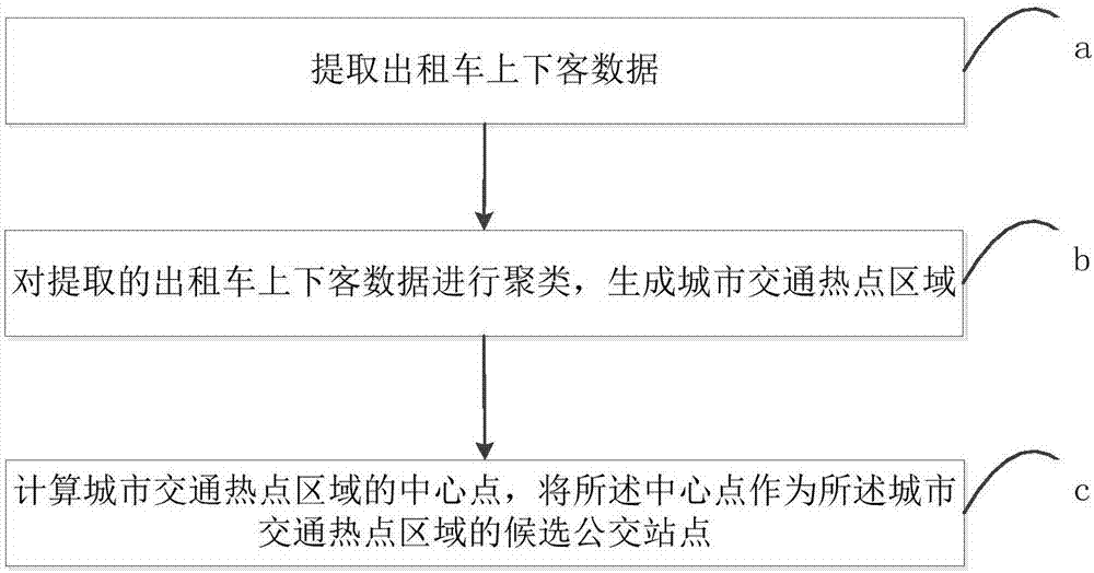
[0065] see figure 1 , is a flow chart of the method for calculating candidate bus stops according to the first embodiment of the present invention. The method for calculating the candidate bus stop of the first embodiment of the present invention comprises the following steps:

[0066] Step a: Extract the data of getting on and off the taxi;

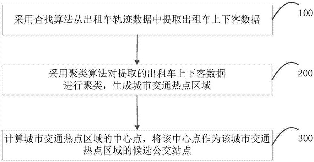
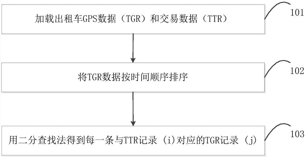
[0067] In step a, the way to extract the taxi pick-up and drop-off data is as follows: extract the taxi pick-up and drop-off data from the taxi track data; the taxi track data includes GPS data and transaction data, and the GPS data includes the license pla...


PUM


Abstract

The invention relates to the technical field of intelligent public transportation, and especially relates to a method and system for calculating the candidate public transportation stops. The excavating method comprises the steps: a, extracting boarding and alighting data of a taxi; b, carrying out the clustering of the extracted boarding and alighting data of the taxi, and generating urban traffic hot spot regions; c, calculating the centers of the urban traffic hot spot regions, and enabling the centers to serve as the candidate public transportation stops of urban traffic hot spot regions. The method achieves the excavation of the candidate public transportation stops through the real large-scale taxi track data, greatly reduces the time, manpower and cost, and is higher in efficiency. Meanwhile, the method gives consideration to the dividing integrity of the urban traffic hot spot regions and the service radius of the urban public transportation stops, and provides valuable reference basis for the addressing of the public transportation stops at a current stage.

Description

technical field [0001] The invention relates to the technical field of intelligent public transport, in particular to a method and system for calculating candidate bus stops. Background technique [0002] With the continuous acceleration of my country's urbanization process, the urban population is expanding day by day, and more and more people need to carry out work or life activities at night, resulting in the severe challenges of rapid increase in demand and serious shortage of resources for urban nighttime public transportation. . Therefore, how to design a night bus line that can not only meet the night travel and activity needs of most people, but also make the bus operation balance by carrying more passengers becomes the key to solving the problem. [0003] Generally speaking, the location determination of bus stops is a prerequisite for urban bus route planning. Existing bus station site selection methods are mainly divided into two categories: one is to use small-s...

Claims


Application Information

Patent Timeline
IPC IPC(8): G08G1/00G08G1/01
CPCG08G1/00G08G1/0112G08G1/0125G08G1/0137
Inventor 肖露艳范小朋须成忠
Owner SHENZHEN INST OF ADVANCED TECH
Learn More