Reservoir area three-dimensional real scene display method based on WEBGIS

A three-dimensional, real-scene technology, applied in the field of three-dimensional real-scene display in the reservoir area, can solve the problems that the scale cannot be infinitely enlarged, automatic update, and can only be set, such as the construction of the reservoir, etc., to achieve convenient access and diversification, and improve navigation functions , the effect of function improvement

Inactive Publication Date: 2018-01-16
SICHUANG TECH CO LTD
View PDF2 Cites 8 Cited by
  • Summary
  • Abstract
  • Description
  • Claims
  • Application Information

AI Technical Summary

Problems solved by technology

This kind of electronic sand table cannot realize the real-time and automatic update of the base map and scene points, and it cannot achieve infinite scaling and drag navigation functions like GIS when sand table navigation for large reservoir areas. The connection needs to set information such as the horizontal azimuth and elevation angle of the associated scene in the current scene in each scene. All hotspots in the existing r

Method used


Image

  • Reservoir area three-dimensional real scene display method based on WEBGIS
  • Reservoir area three-dimensional real scene display method based on WEBGIS

Examples


Embodiment Construction

[0020] The present invention will be further described below in conjunction with the accompanying drawings and embodiments.

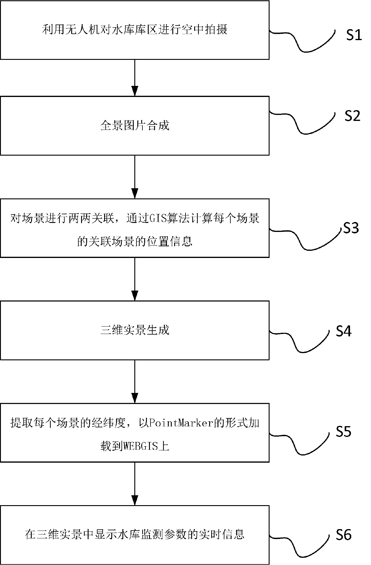
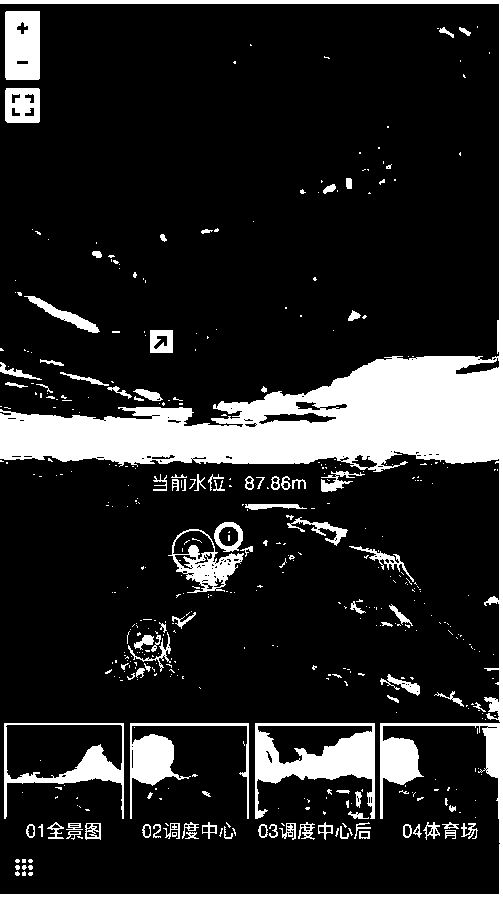
[0021] like figure 1 As shown, the WEBGIS-based reservoir area three-dimensional real-scene display method, the WEBGIS-based reservoir reservoir area three-dimensional real-scene electronic sand table realization method, is characterized in that, comprising the following steps:

[0022] Step S1: UAV shooting: use the UAV to take aerial photos of the reservoir area; turn on the UAV and the control platform, and when the GPS signal is good, let the UAV fly at a fixed height above the reservoir area, and operate the pan / tilt Adjust the angle of the initial shooting so that the initial direction of the UAV is geographically true north and then rotate the shooting. The photos taken have GPS attributes of latitude and longitude, altitude and angle with true north;

[0023] In this embodiment, each planar photo taken by the drone has at least 20% overlap;

...


PUM


Abstract

The present invention discloses a reservoir area three-dimensional real scene display method based on the WEBGIS. The method comprises the following steps: (1) employing an unmanned aerial vehicle toperform aerial shooting of a reservoir area; (2) performing panorama image combination; (3) performing association in pairs of scenes, and calculating position information of an associated scene of each scene through the GIS algorithm; (4) performing three-dimensional real scene generation; (5) extracting longitudes and latitudes of each scene, and loading the longitudes and latitudes on the WEBGIS in a PointMarker mode; and (6) displaying real-time information of reservoir monitoring parameters in the three-dimensional real scene. The reservoir area three-dimensional real scene display methodbased on the WEBGIS realizes scene association automation and employs a WEBGIS electronic sand table to provide a navigation function for the three-dimensional real scene.

Description

technical field [0001] The invention relates to the technical field of three-dimensional real scene display of a reservoir area, in particular to a method for displaying a three-dimensional real scene of a reservoir area based on WEBGIS. Background technique [0002] The existing electronic sand table for 3D real scene applications in the reservoir area uses a fixed-scale background image as the base image. All scene points need to be manually plotted on the background image one by one, and set by each scene The angle value of the relevant perspective is displayed to match the camera field of view inside the scene. This kind of electronic sand table cannot realize the real-time and automatic update of the base map and scene points, and it cannot achieve infinite scaling and drag navigation functions like GIS when sand table navigation for large reservoir areas. The connection needs to set information such as the horizontal azimuth and elevation angle of the associated scene...

Claims


Application Information

Patent Timeline
IPC IPC(8): G06T17/05G06T5/50
Inventor 陈博嘉陈荣汤辉
Owner SICHUANG TECH CO LTD
Why Eureka
Try Eureka